[page 1] [page 2] [page 3] [page 4] [page 5] [page 6] [page 7] [page 8] [page 9] [page 10] [page 11] [page 12] [page 13]
[Next Page >]
Welcome to what I like to call the dolomites "overflow" section. Even though I put a generous helping of images from our dolomites climbing in the main narrative, there are many many additional images that I thought worthy of display. This section includes all those additional images, as well as a full complement of maps, graphs, and locator maps. Be warned! There are well over 250 pictures in this section! (additional pictures not in the main narrative have a thumbnail surrounded by a color)

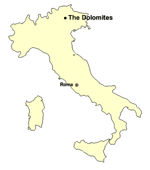
For those of you who do not know, the Dolomites are a sub-range of the alps located in north-eastern Italy. The peaks are composed of the rock 'dolomite' (as you may have guessed). The rock is so named because of its discover: a french geologist named Deodat de Dolomieu.

Dolomite is a form of pseudo-metamorphosed limestone, and is very hard, generally whitish in color, and blocky. The terrain is very dramatic and unique, with very steep-sided jagged towers of rock that rise thousands of feet (or many hundreds of metres) above fairly gentle valleys.

Apart from its dramatic and unique beauty, one of the reasons I like to visit the dolomites is the unique and interesting climbing possibilities offered by the so-called via ferrata (in english: Iron Way) climbing routes. These are essentially fixed-climbing paths, on which one climbs with a special dynamic belay device. The dolomites provide an excellent foundation for these routes, and they often scale bold, exposed routes.

If you want more via ferrata information, please visit my dedicated via ferrata page - it has a complete listing of all of the routes I've done over the years, along with an introduction to vie ferrate, info on guidebooks, locator maps, difficulty grades, and more.

Jenn's Intro Climbs

As you may have read about in the main narrative, this was Jenn's first time to the dolomites and her first exposure to via ferrata climbs. The pictures on this page and on page 2 are from her first two "introductory" climbs: a mid-grade ferrata called the Paolin-Piccolin ferrata, and a shorter but harder higher-grade ferrata called the via ferrata canalone.

Regional Locator Map : Via Ferrata Paolin-Piccolin
This is a locator map showing the location of Cima Auta. The largest center near the climb is a town called Falcade. The via ferrata paolin-piccolin climbs Cima Auta. [enlarge]
Cima Auta
A good view of Cima Auta (the highest peak in this picture, just right of center) from the town of Falcade. The ferrata goes up the big gully to the left of the peak. [enlarge]
Cima Auta Start
This is a shot of our car parked at the trailhead for the start of the hike up to the Paolin-Piccolin Ferrata, which climbs Cima Auta. [enlarge]
Trailhead to Cima Auta
This is the start of trail #689, which takes you to the base of the Ferrata going up Cima Auta. The trailhead is near the little hamlet of Colmean. [enlarge]
Open forest on 689
Trail 689 follows moderately stepply up old farm tracks through open forest. [enlarge]
Open forest on 689
Trail 689 follows moderately steeply up old farm tracks through open forest. [enlarge]
Junction on 689
A junction on the way up 689. Continue following the signs for Cima Auta. (which in this case is straight ahead!) [enlarge]
Winding ever up
The trail/old road continues its moderate but constant rise. The route is marked well with '689' markers. [enlarge]
Bivacco in Clearing
The open clearing setting for Bivacco Giovanni Paolo I (also known as baita Giovanni Paolo I). [enlarge]
Bivacco Giovanni Paolo I
This is Bivacco (Bivouac) Giovanni Paolo I, a very nice little rustic cabin, open and free to all. [enlarge]
Gottfried needs nourishment.
Gottfried is tired from the stiff climb to the Bivacco. Here, Andrew shares a bit of his white choco bar with him. [enlarge]
Interior of Bivacco
This is the rustic interior of the Bivacco Giovanni Paolo I. [enlarge]
Good words to live by
A cute directive on the wall of the Bivacco tells visitors to 'treat this place as if it was your own home'. And in fact the place is remarkably tidy, clean, and free of vandalism or graffiti. [enlarge]
Gottfried Spies the Cima
"Mon dieu!", Gottfried exclaims, upon seeing the foreboding mass of dolomite he must soon climb. [enlarge]
Jenn nearing treeline
Jenn nears the treeline on trail 689, which leads to the start of the Cima Auta Ferrata [enlarge]
Trail 689 above the trees
This is trail 689, now above the trees, and heading for the first major col to the left of the summit of Cima Auta (which is the big high blocky mass you see). [enlarge]
South to the Pale
To the south rises the majestic Pale di San Martino group. [enlarge]
Dolomitic Scree
The trail goes (tiringly) up this steep scree slope. The destination is the deep col in the very center of the picture. [enlarge]
Beautiful open grassy slope
Jenn climbs through open meadows on a wonderful sunny day. [enlarge]
Jenn approaches Ferrata Start
Jenn approaches the start of her first ferrata, on Cima Auta. [enlarge]
Andrew below Cima Auta
Andrew climbs the last bit of scree before the start of the ferrata. [enlarge]
Ferrata Start Gully
The ferrata starts at the base of this gully. You can see the initial ladder. [enlarge]
Ferrata Paolin-Piccolin Start
The ferrata which climbs Cima Auta is called Ferrata Paolin-Piccolin. [enlarge]
Jenn starts first ferrata
This is Jenn at the start of her very first via ferrata. [enlarge]
Gottfried wonders, too
Gottfried and Jenn both wonder... do we really want to be doing this...??? [enlarge]
Climb on!
Jenn completing the first little bit of the Paolin-Piccolin Ferrata. Down in the background is the approach route and valley. [enlarge]
Jenn climbing Cima Auta
Another shot of Jenn climbing the Paolin-Piccolin Ferrata up Cima Auta [enlarge]
Ibex and panorama
Some Ibex provide a nice foreground element to a beautiful view of the southern Dolomites. [enlarge]
Ibex and curiosity
These Ibex examine us curious and clumsy bipeds. [enlarge]
Andrew climbs chimney
Andrew climbs a slightly awkward chimney on the Paolin-Piccolin Ferrata route. [enlarge]
Jenn at the Forcella
This is Jenn at a gap (a pass) at the top of the first section of ferrata. The gap is called the 'Forcella del Medil' [enlarge]
Second half on Slabs
This is a view of the second half of the ferrata, which leads from the Forcella to the summit of Cima Auta. The route goes over a lot of smooth-ish slabs. [enlarge]
Backside of the Marmolada
This is the high and steep south wall of the Marmolada, the highest mountain in the Dolomites. There is a good view of it from Cima Auta. [enlarge]
Jenn on Cima Auta Summit
Jenn has made it to the top of her first Dolomite peak. Yay! [enlarge]
Might he make an appearance?
I think the charismatic Gotty will be coming out soon! [enlarge]
Fancy summit marker
This metal-and-glass summit marker is pretty fancy, even by dolomite standards. [enlarge]
Relaxing at the summit
The two Ferrata virgins relax at the summit. [enlarge]
Andrew at summit
Andrew at the summit of Cima Auta. [enlarge]
Descent route
This is the regular route on Cima Auta, and is the usual descent route. [enlarge]
Descending Normal Route
Jenn descends the normal route on Cima Auta. [enlarge]
[page 1] [page 2] [page 3] [page 4] [page 5] [page 6] [page 7] [page 8] [page 9] [page 10] [page 11] [page 12] [page 13]
[Next Page >]

[ Italy 2005 trip home page | The main trip report | Family | Monte Cervialto | Herculaneum & Vesuvius | Palace of Caserta | Amalfi & Capri | Abruzzo & Monte Amaro | Rome | Tuscany | Venice | The Biennale | Via Ferrata-ing in the dolomites | Climbing in the Ortles | Gottfried's Adventures | Maps, Graphs & GPS Data ]

Send feedback or leave comments (note: comments in message board below are separate from those in above message board)
(23 messages)
(last message posted on Sun. Nov. 20, 16:43 EST 2016 by Britany Wilson)
Web Page & Design Copyright 2001-2024 by Andrew Lavigne. (Privacy Policy)