On previous trips to Italy, I've tended to "visit the family" and then head straight-away up north to the "big" mountains in the Alps. This time, I thought we'd explore mountains in the central and southern part of Italy as well. To that end, I did a little research, and noticed that thre is a high point in the Appenine mountain chain near Avellino. The mountain is called Monte Cervialto, and it is the highest point in the Picentini sub-range. This mountain is quite close to a little mountain town called Bagnoli Irpino, where some relatives-in-laws of mine once owned a grand house (and I even stayed there as a kid for a bit during one of my trips to Italy many years ago). Since this mountain isn't that far from Avellino (perhaps a one hour drive), we decided to flash it in a single afternoon outing.

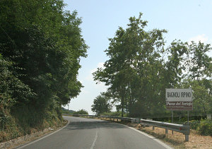
Bagnoli Irpino
The drive eastward from Avellino was scenic, through the wooded hillsides and farmed valleys of the irpinia region. Bagnoli Irpino is still the scenic little town I remember from childhood, although I couldn't put my finger on which big old building near the town piazza was the one I stayed in. Beyond Bagnoli Irpino, a good and very fun twisty road winds its way up into a high plateau called the altopiano laceno (the laceno high plain - altitude 1100m / 3500+ ft). This is apparently a "resort-like" destination for residents of this region. I found it more pastoral and rural than anything, although it is indeed quite scenic. Lots of wandering cattle and such. The Laceno plain is also apparently famous for its Lake (lago Laceno), although it seems more to me like a bit of muddy ground on one end of the plain than a lake. Italy doesn't have many lakes, so perhaps anything will qualify!
Town Square, Bagnoli Irpino
I didn't have a topographic map of this peak (the only time I didn't have a map for a peak on this entire trip), so we had to infer from the highway map as to the start of the trail. We eventually did find it, at the high point of a backroad that connected from the Laceno plain to a valley east (see map and GPS data for more details). We soon found a clear marker on a block of concrete - "Trail 13 - Cervialto" - looked positive!
Trailhead to Monte Cervialto
Andrew on trail to summit
Trail 13 follows an old one-lane gravel track for most of its way. It switchbacks up through dense woods at a very constant grade. This part of the walking is therefore very easy but also somewhat boring. We booted it at a very brisk pace (it was late in the day and we had to get back to Avellino for more family visiting that evening) and made good time, although I didn't really know what the exact kilometrage was to the summit. We saw no other hikers on our hike - strange, considering that this was the highpoint of this entire region. Perhaps Italians around here are not big hikers. At one point, a carabinieri jeep came trundling along the road and stopped, asking us if we were lost. They seemed slightly incredulous when I said that 'no, we aren't lost - we are climbing Monte Cervialto!'
Higher up, the trail became impassable to vehicles and somewhat overgrown. I was getting tired with all of the switchbacking at this point - it was making the hike unnecessarily long. Fortunately, we soon saw the marker which took us off the old road and up steeply into emerging mountain meadows. We were soon climbing into a little mini-world of open alpine amidst the densly wooded mountains of this part of southern Italy. Think of a thickly-haired monk with a tonsure (a perfect little shaved crown) - that's what the peak of this mountain was like.
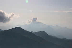
The terrain was grass meadow, studded with fist-sized rocks that made travel only slightly difficult. We soon reached almost to the summit elevation and realized that Cervialto's summit is more like a big open bowl rimmed with multiple rounded grassy knobs. The inside of the bowl was an especially lush and green meadow. We could see that we were on the far side of the bowl from the true summit. Ten minutes or so later, we were at the true summit, at a respectable 1800m / 5900-foot elevation. The view was, of course, expansive.
Andrew on summit, M. Cervialto
Jenn on Summit, M. Cervialto.
Since we were on a tight schedule, we didn't dally long and quickly started our descent. Now that I had an accurate tracklog of the route between summit and trailhead, I could "optimize". There were several obvious shortcuts between excessively long road switchbacks, and taking these reduced our time back to the trailhead by at least 50%. We made it back to the car in just about exactly 1 hour! Avellino soon followed about 50 minutes later.
(If you are
interesting in seeing a more in-depth set of pictures of our climb
of Monte Cervialto,
click
here.)

Towards Avellino
When I visited Italy as a kid, I was closest to my cousin Giovanni. Giovanni is almost 20 years older than me, and I can recall him being very friendly, and always lots of fun. He is now a busy and successful businessman, and when he found out that I was visiting, he invited myself and Jennifer to visit him at his office in Avellino (he was working late). We hadn't seen each other for twenty years, you must remember. We got back a little late from climbing Monte Cervialto, so we were unable to visit him directly at his office, so I was a little disappointed that I'd messed up our meeting.

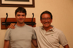
Andrew and Giovanni
He soon showed up at the house, though, not wanting to miss an opportunity to meet. Wow.... What struck me the most was how little he'd changed in 20 years. Giovanni is now in his mid-fifties and he looks at least ten years younger than that. Giovanni is also one of the few relatives I have that speaks english relatively well, and it was nice to be able to chat in English (my Italian is passable but nothing to write home about). All in all, a delightful meeting. I hope that we get to spend a little more time with Giovanni on a future trip.
[ Italy 2005 trip
home page |
The main trip report |
Family |
Monte Cervialto |
Herculaneum & Vesuvius |
Palace of Caserta |
Amalfi & Capri |
Abruzzo & Monte Amaro |
Rome |
Tuscany |
Venice |
The Biennale |
Via Ferrata-ing in the dolomites |
Climbing in the Ortles |
Gottfried's Adventures |
Maps, Graphs & GPS Data ]