It was now time to head west again. We had four days of climbing time left, and we wanted to include at least one 'Glacier' climb. This meant heading to a higher part of the alps.
I'd considered all kinds of different and interesting alpine peaks to climb: Gran Paradiso, Monte Rosa, Piz Bernina. All interesting and very high glaciated peaks. However, a bit of reflection tempered my ambitions. Brian and I hadn't done a lot of high alpine climbing recently, and Jenn had never done any, and had as yet learned little in the way of high alpine mountaineering skills. So, it was safer to try something a bit lower and a bit easier. And as a bonus I wanted it to be relatively close to where we were.
The answer, then, after looking at my maps, was a mountain range called the Ortles. These are a group of glaciated peaks in the province of Lombardia in Italy, not far south of the Swiss Border. The area is a national park called 'Parco nazionale dello stelvio'. The highest mountains in the range are almost 13,000 feet high, and there are several peaks that are very easy glacier climbs. And they were close to our location in the dolomites.
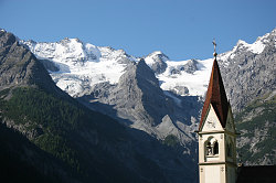
Trafoi Church
We drove from the Corvara area west, past Bolzano, west to Merano, and further west, to a small town on the outskirts of the park called Trafoi. We found a small campground there and called it a night, hoping to obtain information and some food before heading up to climb a peak in this range.
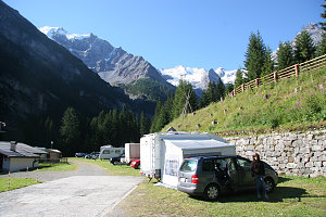
Campsite in Trafoi
Trafoi is a tiny mountain town, and it was hard finding a place in the evening that was open for food. We eventually ended up at the bar of a local hotel, where they served us a plate of cold meats and cheese. Turns out this hotel, called the hotel Bellavista, is owned by a past olympic downhill skiier named Gustav Theoni. And there he was at the bar serving drinks. In the eating area of the hotel were innumerable memorabilia of his past days of glory in the Olympics. Neat.
The next morning, we purchased a 'tabacco' topographic map of the ortles region from the campground host (a strange, rather emotionless sort of guy he was). Initially we had thought to do the highest peak (called Cima Ortles), but I thought it might be a tad much for an intro glacier climb. However, there was another peak in the group called Monte Cevedale, a 12,300 foot peak with a nice gentle glacier leading up one side. The distances looked reasonable, and there were a couple of rifugios on the way up. This became our goal.
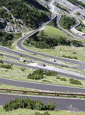
Almost track-like
The route we wanted to climb up was on the other side of the Ortles mountain range from where we were. Getting to the other side required driving up and down one of the most interesting mountain roads ever! The road passed over what is called 'passo dello stelvio', or, in english, the stelvio pass. The road up from Trafoi had over 45 hairpin switchbacks, most of them above treeline; it was endless! Lots of tourist traffic, too. The way down on the other side was almost as twisty, including sections in tunnels that were almost too narrow for 2-way traffic. We got caught behind a situation where two drivers met head-on in one of the tunnels and neither refused to 'back-down' (i.e. back out of the tunnel so the other could advance). Eventually, after much cussing and gesticulating, mirrors were folded and the two cars inched past each other. Once over and down the other side of the pass, we notice that we have crossed back from a germanic area to one that was italian (there are many very distinct regional areas of italian or germanic culture in northern Italy).
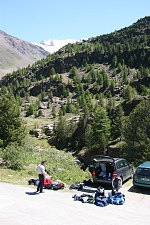
Getting ready for ascent
After a quick grocery stop in the town of Bormio, we head off up the valley that contains our trailhead. Before packing up, we have a tasty lunch at the rifugio that is located right at the trailhead. We then take about a half hour to carefully pack our climbing and overnight gear, and then set off towards our first stop, the rifugio 'pizzini'. We've decided that this is where we will spend the night.
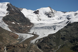
The Glacier of the Ovens
The trail to the hut is almost immediately in the high alpine, above the trees. Around us, we can see higher peaks draped in large glaciers. The mountains are of a noticeably different character here, as they are not composed of the hard, milky white dolomite we've come to be familiar with.
After less than two hours of beautiful, clear, sunny mountain views, we reach the pizzini hut. To call it a hut is a bit of an understatement, as it is a large, modern building with multi-levels. By my guess, it can sleep probably a hundred people. There are even hot showers for those willing to pay a little more for their room.
After donning our 'sandals' (the hut requires that you put your boots away and use one of their non-floor-damaging sandals), we went to the bar, ordered a few drinks, and sat outside on the sunny patio to relax and consult our maps. We could see the summit of Monte Cevedale high above us, with several impressive glaciers cascading down off of it.
Even though it was July, the hut was not that busy (because it was mid-week), and we had a 6-person bunk room for the three of us. Dinner that evening was served at a specific time (Dinner and breakfast were included in our price for the night)., and was quite tasty. There were a few other climbing groups eating with us, none of whom seemed to be heading for our peak the next day. The rifugio staff asked all of us to agree on a breakfast time, which ended up being 4am (I guess they know the schedules of climbers at places like this!)
We retired to bed early, aiming to be up at 4am for our breakfast. We were the first ones down to eat (so much for the requests by other climbers for an early breakfast!). The weather, fortunately, was clear, and we started out under a crisp starry sky. Our first objective was a very steep earthy path to the crest of a ridge far above us.
The way was well-trodden, and an unofficial but clear trail wound its way up a steep dirt-and-rock slope. It was a steep grind, somewhat mitigated by excellent views of the Grand Zebru (second highest peak in the Ortles).
Perched at the top of the slope at over 10,000 feet was an even larger hut - the rifugio Casati. It looked like a hotel! We stopped in here for a quick rest break and to don our glacier climbing gear in comfort - the glacier climbing started right at the foot of this hut. Looking up, we could see a clear boot path up the glacier. There did not seem to be very many open crevasses.
After getting properly roped up for glacier travel, we started our trudge up the glacier towards the summit. The snow was reasonably firm but still had some softness, and the way was clear. We could see several other parties ahead of us on the route.
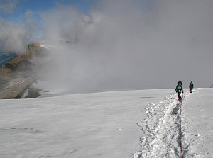
Climbing on Cevedale Glacier
Occasionally we could see where there was a narrow crevasse over which the path crossed. There were only a few spots where it seemed there was a larger crevasse (I say seemed, because the crevasses were mostly snow-covered, and I could only get a sense from a few punch-holes and from the nature of the snow). These larger snow-bridges could potentially be problems on the descent, when the snow had softened.
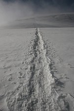
Track to the summit
Even though the grade was slight, Jenn was finding the slog up the snow very tiring. We were above 11,000 feet at this point, and the thin air was making things more strenuous. Some fluffy clouds had started to move in, periodically enveloping us in a sea of white. The view of the higher Ortles summits to the west disappeared.
Eventually we reached what was really the only 'steep-ish' portion of the climb - an angled step over what was probably a bergshrund. Above this, a bit of steep ground led to the narrow summit ridge. Up here, the snow was harder and there were a few patches of icy surface, so I decided to don crampons (and recommended that Brian and Jenn do the same) before tackling this steep stretch. I also gave Jenn a quick bit of instruction on climbing properly and in balance on steep snow.
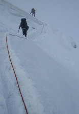
courtesy BConnell
We carefully surmounted the step with no difficulties, and in fact Jenn found the step climbing instruction seemed to ease the difficulty of the ascent. Soon we were on a relatively airy and scenic summit ridge with only a few hundred metres of walking to go.
The summit itself was a jumble of rocks poking out of the snow. There was the ruin of some old summit building off to one side; the collapsed remains of its roof still smelled heavily of tar. There was no one else on the summit at that point, and we struck a few triumphant poses. The sun had come out again and it was actually quite warm up here. After a bit, a couple of Italian guys came up from another route and we got them to snap a few pictures of us.
Mountain Conquerer Connell
The way down went quite quickly. The snow had indeed softened quite a bit, and the few spots that spanned crevasses had to be handled with a bit of care. It took us very little time, however, to get back to the casati hut. In for a quick pee break, de-roping, and a snack.
From here it was a steep but easy descent back to the rifugio Pizzini, where we picked up our overnight gear. The walk back from here down to the car park was a pleasant sunny stroll amongst herds of bell-clanging cows. Congrats to Jenn on her first glacier climb!
(If you are interesting
in seeing a more in-depth set of pictures of our visit to the Ortles and
the climb of Mount Cevedale,
click
here.) Otherwise, to keep reading this narrative, select the 'next
page' button below.
[ Italy 2005 trip
home page |
The main trip report |
Family |
Monte Cervialto |
Herculaneum & Vesuvius |
Palace of Caserta |
Amalfi & Capri |
Abruzzo & Monte Amaro |
Rome |
Tuscany |
Venice |
The Biennale |
Via Ferrata-ing in the dolomites |
Climbing in the Ortles |
Gottfried's Adventures |
Maps, Graphs & GPS Data ]