Akamina Ridge Loop
(Forum Peak, Akamina Ridge, and Wall Lake)
Sunday, August 3
Akamina Ridge is an undulating, rounded series of red argillite humps just north of the U.S. border. The ridge is in fact located within British Columbia, just to the west of the Alberta-BC provincial boundary (which also forms the Continental Divide). The primary access to Akamina Ridge, however, is from a point near the end of the Akamina Parkway in Waterton National Park, and the ridge is most often done from that starting point.
There are several options available when doing Akamina Ridge. One option involves a there-and-back hike up the Bennett Pass trail near Wall Lake; Another more attractive semi-loop option follows an access route up onto the ridge at Forum Lake and a descent down the Bennett Pass trail to Wall Lake.
A third and yet more interesting option is a semi-loop involving a scramble ascent of Forum Peak - a flat-topped mountain connected to the east end of Akamina Ridge. Once on Forum Peak, a simple and beautiful alpine walk leads over the humps of Akamina Ridge, then down the Bennett Pass trail to Wall Lake (and then out on the Akamina Pass trail). This was the variant we'd be following today. A small increment up on the challenge scale from yesterday.
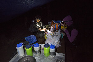
Pre-dawn Prep
The forecast had once again indicated good weather until mid-day, when the chance of intermittent showers or even an isolated thunderstorm became possible. Wanting to ensure that we were down from the open alpine before anything like that came by, we were up super-early, and were away from the campsite by 6 a.m. Once again we drove up the Akamina Parkway, but this time we stopped just short of Cameron Lake (perhaps a kilometre before), at a roadside parking area across from the Akamina Pass trailhead.
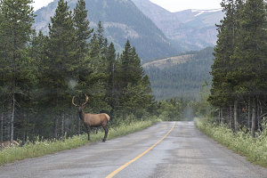
courtesy JInnes
Bull Moose, Akamina Parkway
Akamina Ridge Route, Overview
Off towards Akamina Ridge
The Akamina Pass trail was gravelly and very wide. In fact, you could probably drive a car up it. This isn't allowed, of course, although it is open to foot, mountain bike and horse traffic.
The Akamina Pass trail rises at a fairly easy grade up to (you guessed it) Akamina Pass. The pass is only 400 ft / 125m higher than the trailhead, so this was not a very difficult climb, and we covered the distance to it in about 20 minutes.
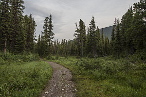
Nearing Akamina Pass
Although Akamina Pass is a fairly nondescript low, broad and forested pass, it is nevertheless noteworthy. Akamina Pass is on the Continental Divide, and the divide forms the provincial boundary between Alberta and British Columbia. We were amused to be treated to a "Welcome to British Columbia" sign.
Waterton National Park's boundary is also reached at the pass, and the terrain ahead in BC was part of Akamina-Kishenina Provincial Park. In fact, we would be spending most of our day hiking in BC.
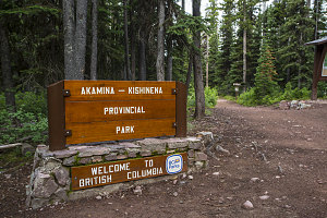
Akamina Pass
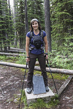
The line of the provincial boundary is periodically cleared out in this area, and to our left and right we could see a straight laneway devoid of trees (but still somewhat brushy at ground level). We amused ourselves for a few minutes at an official provincial boundary survey marker a short ways off to the right - I'm in BC, now I'm in Alberta, now in BC, now in Alberta.
courtesy JInnes
Provincial Boundary Marker
The route we were following (as described in Kane's Scrambles in the Canadian Rockies), leaves the official trail here. A faint herdpath led south along the provincial boundary cut-line. This we followed, quickly getting wet from wading through wet bushes (I'm not sure why we didn't think to put on our rain pants right away).
Although the way was obvious, our pace slowed significantly as we followed the cut-line, stepping over occasional logs and swatting away a fairly annoying cloud of tiny mosquitoes. Liberal applications of bug spray were needed to keep them at bay.
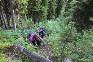
Less than a kilometre of walking (southwards) brought us to the first real elevation gain of the day: a very steep and bushy ascent up the cut-line, as it ascended the first bit of Forum Peak's north ridge. In open terrain this would have been a true scramble, but here in the thick brush of the cut-line, it was more of a haul-yourself-up-through-branches sort of deal.
courtesy JInnes
Above the steep and brushy grade (which gained us about 400ft / 125m of elevation), the slope lessened considerably. Soon thereafter, the thicker brush faded away, and a clear footpath led up through increasingly meadowy terrain. We began to see wildflowers and beargrass, as well as the beginnings of great views to our left, down to Cameron Lake and the mountains at its head.
Flattening out, still brushy
Forum Peak and boundary marker
The day had started out fairly muggy and close, but as we ascended into increasingly open terrain, things cooled off and a slight breeze aired us out. Up ahead, we could now clearly see the remainder of our journey to Forum Peak: a narrowing and sharpening ridgecrest terminated by a cliffy summit block.