Aster Lake Backpack, Day 1
Thursday, August 7
I wanted to go on a couple of backpacks (i.e. overnighters) during our Rockies 2014 trip. Our first attempt at this (back on the Carthew-Alderson trail in Waterton Lakes) didn't work out because the backcountry campsite at Alderson Lake was full. For the second backpack, I wanted to try for something in the large swath of Rockies south of Banff National Park. The twisting paths of the Internet eventually brought me to a handful of pages describing the Aster Lake area of Peter Lougheed Provincial Park, in the heart of Alberta's Kananaskis Country.
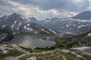
Aster Lake
Aster Lake is a high alpine body of water not far from the BC-Alberta border, in the southwestern corner of the park. Situated where it is and at nearly 7400ft / 2250m, it is a perfect jumping off point for exploration and climbs of many high peaks along and near the continental divide: Mt Northover, Mt Joffre, Mt Mangin, Mt Cordonnier, and Warrior Mountain, among others. Aster Lake is also a point along a circular backcountry route that includes a walk along Northover Ridge.
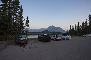
Upper Lake Picnic Area
Backcountry camping at Aster Lake is managed by Alberta Parks, and a permit is required for overnight use. The Alberta Parks website has a very nice backcountry camping vacancy calendar that can be used to see what spots are currently available (
here's the link for the one for Kananaskis Country).
Originally I had wanted to stay two nights at Aster Lake, but by the time I had finalized my plans, one of the nights was unavailable. My plan, which included summitting an easy peak while we were up in the area, could still be managed with 2-day,1-night stay, and I was able to book Thursday night (August 7) at the Aster Lake backcountry campground.
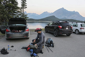
courtesy JInnes
FInal Prep
We were still not entirely sure if we were going to summit a peak on the first day of our backpack, or on the second. For that reason, we started off from the trailhead quite early - at 6:30 a.m.
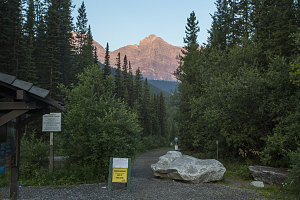
Trailhead
There is no official trail to Aster Lake. To reach it, one follows the Upper Lake trail around the shore of Upper Kananaskis Lake to a point where a non-official path/route leads up through forest and then alpine terrain to Aster Lake. Routefinding-wise, the trickiest part is the area around Hidden Lake. I will attempt to clarify the uncertainty regarding this route in this trip report.
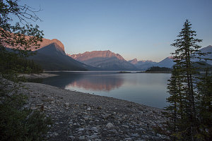
Upper Lake on calm morning
As I mentioned earlier, the starting point for Aster Lake is at the Upper Lakes trailhead on Upper Kananaskis Lake. From the large parking lot, a very wide trail heads off west. When we did this hike, a sign warned of bridge washouts at Sarrail and Rawson Lake creeks, and that hikers would be required to ford up to 60 cm of water (roughly 2 feet). Well, so be it.
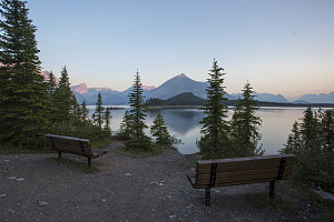
Contemplative Benches
Under calm conditions and clear skies (although once again, a bit hazy), we headed out along the deserted trail, being careful to make noises and to have our bear spray handy.
Seeing as the Upper Lake trail is wide and mostly flat, progress was swift, and we arrived very soon at the crossing of Sarrail Creek. As the sign at the trailhead had promised, the footbridge across Sarrail Creek was gone (although bits of it were visible a short way downstream, near the lake). However, the water was definitely not 60 cm deep, and in fact, it looked like it might be possible to cross without getting our feet wet. A bit more exploring revealed that someone had put together some fallen logs and remnants of the original bridge into a makeshift crossing. We were able to easily cross on this.
The Upper Lake trail become more.... undulating, I guess is this word, after the creek crossing. Lots of little 3 or 4 meter ups and downs and small twists and turns. Most of the time a band of trees obscured the views of the lake, but every so often there would be a nice little opening affording a view (or even a path down to the lakeshore).
The Rawson Creek crossing had also been washed away (by 2013's floods), but here, a new footbridge was already half-finished, and we were able to carefully walk across the large unboarded logs that had been laid into place.
The route to Aster Lake follows a route that runs past Hidden Lake, a smaller body of water just to the southwest of much larger Kananaskis Lake. There's an unofficial semi-maintained footpath that cuts over from the Upper Lake trail to Hidden Lake, and it seems like perhaps the routing of this footpath has changed over the years (I've read a couple of different descriptions). Here's what I've learned after reading these instructions and then attempting to follow them:
After walking just a shade over 5 km from the Upper Lake trailhead, we heard the rushing noise of water, as if from a stream. However, there was no stream to be found emptying into the lake. Instead, we spotted a small mound just off the shore of Upper Kananaskis Lake near to us. Atop this mound - a two-sided stream! Yes, that's right - a stream that headed off in two directions, emptying into Upper Kananaskis Lake. This fascinating and rare feature was a result of the outflow from Hidden Lake, which runs underground between Hidden Lake and Upper Kananaskis Lake, where it rises up to and out of this mound near the shore of the lake. I imagine that if Upper Kananaskis Lake's level is high enough, this mound is covered and you do not get to experience this cool phenomenon. In any case, if it is exposed, this is a good marker - for you should not go any farther along the Upper Lake Trail.
The Amazing two-way river
Right at this point (opposite the mound with the outflow, or about 5.1 km of foot distance from the Upper Lake TH), we encountered a small stone cairn with a piece of flagging on a stick stuck in it. A faint but discernable footpath led uphill into the woods behind the mound. This was the start of the off-trail route to Hidden Lake (and by extension, to Aster Lake beyond). As a side note, we were fairly sure but not 100% sure that this was the way to go, so we explored nearly 400 metres further along the Upper Lake trail to be sure there weren't any better candidates for this cutoff path. If there are any cutoff paths beyond this, I'm not sure their extra distance would make them worth doing.
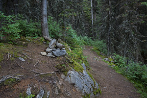
Turnoff to Hidden Lake
So, off we went up the faint herdpath. It wound up through the forest, gaining about 200ft (60m) of elevation as it crossed over a forested ridge. This was more up than I had expected, based on internet descriptions and even the descriptions of the ranger back at the PLPP visitor center. But, it was distinct, didn't have too many fallen logs, and was definitely on track to cut over to Hidden Lake. So, we continued.
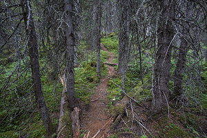
Decent footpath
The unmaintained paths near and around Hidden Lake seem to have a reputation for being horrible and tiring bushwhacks. So far, though, the going was easy, as far as unmaintained trails go. The ranger back at the visitor center had said that a group had recently gone in to cut away the worst of the blowdown, so perhaps that was why we weren't finding it too bad. Either that or our experience with rough eastern mountain trails and bushwhacking had toughened us up.
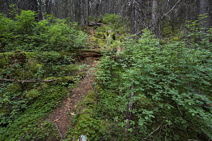
Definitely Followable
We crested the ridge and began descending through the forest on the far side. I could see on my GPS that we were less than a hundred metres from Hidden Lake's shore. At this point, we encountered a junction of sorts: one path leading left, and the other leading more or less straight ahead, down the slope towards the lake.
Based on my readings, I guessed that this was the start of the "bypass" route - a route which runs around the perimeter of Hidden Lake to its south end, but up a ways from the shore. It exists because the water level in Hidden Lake varies dramatically over the course of the season: in late summer, the waters are low enough that an easy walk on a gravel beach is possible, all the way around the lake. However, in early summer the waters are much higher, inundating the trees along the shore, preventing this easy route. At these times, the "bypass" route is the only option.