To Waterton
Friday, August 1
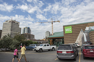
MEC
The first order of business was a quick run to a grocery store to stock up on food for the next few days, followed by a quick run to Calgary's Mountain Equipment Co-op store. There where we purchased a few necessary items, including two essentials we could not bring with us on the plane: stove fuel and bear spray. The northern Rockies are prime black and grizzly bear habitat, and having some sort of deterrent is very prudent policy.
courtesy JInnes
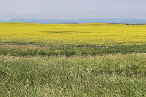
Prairie Expanse
The first park on our agenda - Waterton Lakes National Park - is located about three hours' drive south of Calgary, near the Alberta border. Although we didn't have any hiking or climbing on the agenda for today, we wanted to arrive as early as possible, in order to try and snag a campsite. Most of the campgrounds at Waterton are first-come-first-serve, and on a busy summer weekend like this one (this weekend was in fact a long weekend, making it even busier), it was important to arrive early afternoon at the latest. Even that was probably cutting it close.
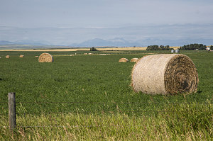
Idyllic Farm Scenes
So, south we drove, along the nice two-lane expressway of provincial route 2. The highway cut through expansive stretches of gently undulating prairie and farmland. Ahead in the distance, only dimly visible at first but becoming ever more distinct as we angled toward them, were the outlines of the foothills of the Rockies.
courtesy JInnes
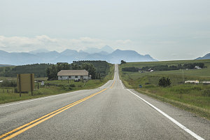
Where the Mountains Meet the Prairies
We departed highway 2 and headed southwest on several secondary roads towards Waterton. The terrain became hillier and the highway twistier until we came to an interpretive lookout overlooking the Waterton Valley, and our first full look at the front ranges of Rockies on this trip.
Distinctively colorful and craggy peaks continued to fill our field of vision as we passed through the Waterton Park gates. We turned off of the main park road and onto the Red Rock parkway, headed for our first choice of campgrounds - Crandall Mountain.
The narrow and twisty Red Rock parkway led across the last bit of prairie and into a large valley (the Blakiston Valley) that emerged from the leading edge of the mountains.
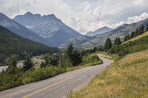
Red Rock Parkway
We arrived at the Crandall Mountain campground right around 1:30pm. Disappointingly, a 'full' sign hung near the campground's entrance station. Nevertheless, we rolled down a window at the entrance station to talk with the park staff.
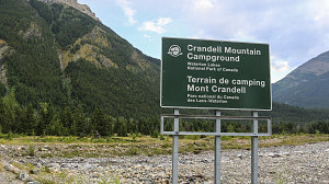
courtesy JInnes
Crandall Mtn Campground
The campground was indeed full, at least technically. Apparently, a handful of campsites would become available as current campers were leaving. The gentleman at the entrance station said that there was a waitlist (in excess of 25, I believe), but this seemed strange to me, since we could only see two or three other people milling about. A bit of further inquiring revealed that many prospective campers had come by early in the morning and put their names on the waitlist and then left (presumably to look for backup locations, I guessed). The silver lining for us in all of this gloomy news? If those who had put their names on the waitlist didn't show up by 2pm, then they'd forfeit their position and we could supplant them. Since it was by now only twenty minutes before 2pm, this seemed like a decent bet. We decided to wait.
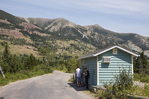
Awaiting a spot
Twenty minutes ticked by very slowly. Fortunately, only one or two other people showed up at the entrance station, and at 2pm, we were able to snag the second of the five or six campsite that became available. We chose to grab the site for three nights - the entire time we'd be in the Waterton area.
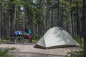
E-loop site
With the logistics of lodging out of the way, we could now relax and explore the area a bit. This was the first time for myself or Jenn in the Waterton area.
We drove back out along the Red Rock parkway to the main park road and then south towards the Waterton townsite (Waterton - like Banff and Jasper national parks - had a pre-existing town located within its boundaries when it was created).
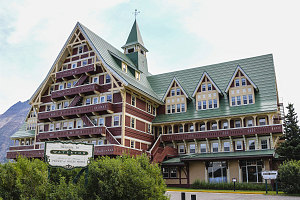
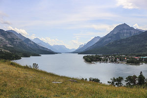
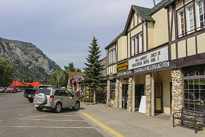
We stopped at several scenic spots along Middle Waterton Lake, the hill atop which the historic Prince of Wales hotel is located, and in the townsite itself - which has a more quaint and homey vibe to it than do other park or near-park mountain towns, like Banff, Canmore, or Jasper. The townsite is built right on the shore of Upper Waterton Lake, and feels very close and integrated with the surrounding mountains.
In the center of town is a very large Parks Canada campground (the "Waterton Townsite Campground"). This campground is organized in a more Euro-style manner, being primarily composed of big open fields with densely-packed campsites. The campground is entirely reservation-based, meaning that if you want a site here, you have to book well in advance, especially for busy summer dates.
courtesy JInnes
courtesy JInnes
View from driftwood shelter
courtesy JInnes
courtesy JInnes
courtesy JInnes
Apart from aimless exploration, we had one more scheduled task to perform - meet up with a hiking-loving friend who was interested in joining us for the weekend. This friend - Cassándra - was currently working in the Lake Louise area of Banff National Park and had to make the multi-hour drive down to Waterton after work. We had been in communication with her and expected her to arrive around 5pm.
Arrive Cassándra did, shortly before 5pm. We guided her back to our scenic little campsite and we spent the rest of the day catching up, having a few sips of wine, making dinner, and planning for the next day - our first big outing of the trip!
courtesy JInnes
Late afternoon relaxation

courtesy JInnes