The Loop - Highline Trail Traverse
Glacier National Park, Montana
Monday, August 4
The third outing on our Rockies 2014 trip saw us shift our focus a little bit southwards, to the other half of the Waterton-Glacier International Peace Park: Glacier National Park in Montana. Similar in character to Waterton National Park, but larger in area and more rugged in topography, Glacier National Park is a wonderful place full of distinctive landforms and excellent hiking trails.
courtesy JInnes
Morning Prairie at Waterton
It just so happened that work colleague Chris Hatko and his immediate family were driving west through the northern Montana area on a cross-country road trip. In the leadup to our respective trips, we had agreed to meet up for a joint day hike in Glacier National Park. We ended up choosing a very scenic and popular stretch of trail in the park known as The Highline Trail. The Highline Trail is a long distance route that generally follows the continental divide, from Upper Waterton Lake near the border with Canada, down to where the park's Going-to-the-sun road crosses the divide at Logan Pass. Often the trail traverses along just below the rugged spine of the divide, in open alpine meadows filled with wildflowers.
courtesy JInnes
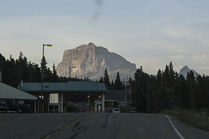
Chief Mountain Crossing
After some last-minute back-and-forth e-mailing and texting, we all agreed to congregate at a spot along Glacier NP's scenic Going-to-the-sun road, a spot known as "The Loop". We'd start off on a trail from this point, and that trail would take us up into the alpine until we intersected with The Highline Trail. We'd then turn south and hike a very scenic 12-ish kilometre stretch of The Highline Trail to Logan Pass.
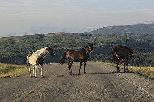
Our agreed-upon meet time was 8 a.m. We started off from our Waterton NP campground shortly after 6 a.m., aiming to reach the border crossing at Chief Mountain into the U.S. at 7 a.m. - when the crossing opens for the day. This all went according to plan, as did the scenic drive south through Montana and into Glacier National Park through the main east entrance.
courtesy JInnes
Next, we had to drive along the park's main scenic byway, the Going-to-the-sun highway, over Logan pass, and down to "The Loop" trailhead. Unfortunately, here is where we hit a snag. There was ongoing construction along a large eastern section of the Going-to-the-sun road. Even at 7:35 a.m., the crews were fully at work. And we were stuck behind a construction worker's "stop" sign.
Our wait stretched past minutes and into the tens of minutes. Car engines were shut off. We blew past our agreed-upon 8 a.m. meet time and still we had not started moving yet - and we still had many tens of kilometres of winding mountain road to cover. I had no cell coverage here with which to send a message to Chris, who was by now surely wondering where we were.
Waiting Patiently
After an interminably long wait, a follow-me car finally showed up and we began a slow procession through the construction area. Once past the construction, we soon arrived at Logan Pass, where - due to a bit of last-minute miscommunication - I had thought Chris and Gillian would be waiting. As a result, I wasted a few more minutes searching the large parking lot.
I was now fairly convinced that Chris and Gillian would assume (wherever they were) we were not going to show up, but nevertheless, I decided to check down at "The Loop" parking area - where we had planned to start the hike - to see if perhaps they were waiting there. Another fifteen minutes of driving down the Going-to-the-sun-road to the west brought us to the hairpin of "The Loop", and - much to my surprise - Chris, Evie and Gillian were indeed waiting. Amazing! (Amazing, but good).
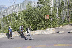
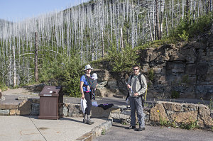
Beginning at "The Loop"
Despite the logistical obstacles, we had managed to all successfully meet up - although an hour later than intended. In the interest of making up a bit of time, we quickly organized gear and made ready to set off.
During the early planning for this hike, the plan had been for Chris alone to join us. As the date drew near, Gillian expressed an interest in the hike - but there was one catch. Recently-born infant Evie - the newest addition to the Hatko household - was still nursing, and it wasn't really possible to separate mother and daughter. In the end, Gillian decided to join us without being separated from Evie. And that meant, of course, that Evie would be coming along with us. An inspired choice - most moms would have simply chosen to stay at home (or camp, in the case of a car-camping trip such as theirs).
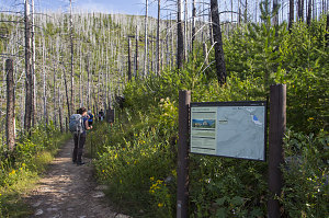
The Loop Trailhead
We were ready to head off by about 9:20 a.m.. Late, but still plenty early for us to cover the 18+ km distance from this trailhead to the south trailhead of the Highline Trail.
It was a warm and clear morning as we set out, hiking along a clear and well-graded path through what was clearly a forest fire burn area. There was lots of green undergrowth and bushes covering the ground between the dead trees, leading one to conclude that the fire was from at least a few years past (as it turns out, the forest fire was from 2003 - which coincided with the last time I visited Glacier. Hmm... I do remember lots of forest fire haze on our climb of
Pollock and Piegan Mtns back in 2003).
Granite Park drainage creek
With the troubles of our meetup now behind us, it was time to enjoy the beautiful scenery of Glacier. Owing to the dead trees, we had a much broader view of the surrounding terrain than normal, and we could see clear across the McDonald Creek valley to attractive Heaven's Peak.
Leading mostly on the level, "The Loop" trail (the trail we were on) soon intersected with the Granite Park Trail. This trail connected up to the Highline Trail at Granite Park, and so was therefore the way in which we were headed.
The Granite Park trail, much like "The Loop" trail before it, was wide, well-graded, and smooth. It climbed at an easy to moderate grade over the broad slopes below Granite Park, zig-zagging back and forth over the terrain in three long traverses. We were still in the burn area of the 2003 Trapper fire, and so we had both excellent views and a full dose of a hot summer sun.
Despite having not done a big hike like this before, both Gillian and Evie did very well. We were moving along at a very decent clip, and baby Evie seemed very content in her swami-like carrying wrap. Very rarely did she make any sort of complaining noises.
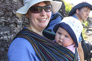
courtesy JInnes
The Divide comes into view