Mount Temple
Climb via the "tourist" route
Saturday, August 9
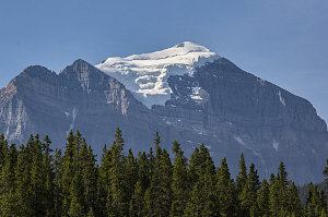
Saturday was the last day of hiking and climbing on our 2014 Rockies trip. We were about to finish off on a high - literally - for today we were going to climb the highest peak of our trip - 3544m / 11,627-ft Mount Temple.
Mount Temple is one of the Rockies' 54 so-called 11,000ers, and by many routes, it is quite a challenging climbing objective. However, there is a moderate scramble route on its south-west aspect that, over the years, has become quite popular. It is referred to somewhat derogatorily as "the tourist route", but even so, it is a true mountain scramble, one that requires a head for a bit of exposure, the ability to use your hands to climb (in a few places), and - near the top - the possibility that you'll need to have an ice ax and crampons.

Mount Temple
Our friend Cassándra was part of a hiking group challenge organized by the staff at the Chateau Lake Louise (where she works), and had been thinking of and planning to do Mt Temple for some time. As a bright and cool Saturday morning dawned, she had lined up a total of seven people for this climb: myself and Jenn, herself, plus four work colleagues: Anthony, Jerome, Courtney, and Amy.
On this trip so far, it had been typical for us to get very early starts, and often we were the first people of the day to arrive at a trailhead. Today, though, was a bit different. It took a while for the entire group to congregate together, such that it was well past 9 a.m. by the time we were ready to head out hiking.
Fortunately, there was still time for us to safely complete the climb of Mt Temple. The weather forecast had turned out as predicted: clear, cool, almost crisp. There was little of the atmospheric haze that had characterized the past week. And most importantly, there was no chance of afternoon thunderstorms. Important for a climb such as this.

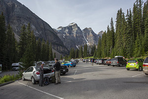
Moraine Lake parking lot
The "tourist route" on Mt Temple (or southwest ridge route, as I'll be calling it from now on) starts off from the trailhead at Moraine Lake, along the lakeshore trail. The Lake sits in the Valley of the Ten Peaks, an iconic spot in the conciousness of Canadians' idea of Canadian mountain wilderness. The lake and its background of mighty peaks adorned the back of the Canadian twenty dollar bill for many years. Definitely worthy of a few carefully framed photos.
Picture-perfect Moraine Lake
Since we had arrived relatively late, many other visitors had already arrived, and the parking lot was half full and the lakeshore trail already crowded with day-hikers. This made the always-travel-in-groups-of-four-or-more sign a little bit redundant, as this first part of the trail was a bit like one big continuous group!
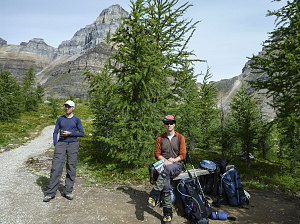
A few metres up the lakeshore trail, we branched right at a junction with the Larch Valley trail. The size and frequency of hiking groups dwindled somewhat as we hiked up the well-engineered switchbacks of this trail, gaining elevation quickly and efficiently. Along this section, we began to learn a bit about our new hiking companions, and they about us. Anthony was relatively new to these peaks but very keen and enthusiastic - in fact, his original proposal for Mt Temple had been to camp overnight on the summit. Jerome had a quick wit and a matter-of-fact manner that was both unexpected and welcome. He'd been working in the Lake Louise area for almost fifteen years now and from all the subtle indications we could see, he was quite an experienced hiker and scrambler. Apart from being really into the beautiful mountains here, both of these guys seemed interested in both video games and strategy board games. We agreed that we'd have to get together for a match someday.
Eiffel Lake Trail junction
With all of the introductory chatter and talk of board games, the hike up to treeline seemed to pass in a few instants. The switchbacks of the Larch Valley trail ended, and the grade flattened out. We began to pass through open meadows surrounded by forest. Above the tops of the forest rose the jagged Wenkchemna Peaks - the same peaks that form the dramatic background at Moraine Lake.

courtesy JInnes
The Larch trees gradually became more scarce and the meadows wider as we ascended. At about 2350 meters (7720 ft), we emerged from the trees entirely. We had come far enough up towards Sentinel Pass by this point that we now had a full-on view of Mt Temple's southwest flanks, and with that view, we could now trace the path of our scramble ascent. It definitely looked formidable and quite steep from this angle. Although we had done lots of reading and researching, you can't help but feel a bit of the unknown as you prepare to ascend something new. Although I felt confident that ultimately I would be able to routefind up the slopes if I had to, it was comforting to have Jerome along. He had already done this route twice before.
Mt Temple, southwest aspect