Iceberg Lake
Glacier National Park, Montana
Tuesday, August 5
We got up bright (or rather, dark, since it was still dark out) and early for our second and final day in Glacier National Park. It was now just Jenn and I, and the plan was to do something little less trail-worn, a little more scrambly than the hyper-popular Highline Trail that we had hiked the day before. For this, I had chosen a relatively easy scrambling objective: Mount Henkel - a 8,770ft (2673m) peak in the Many Glacier area of the park, just east of the Continental Divide. I had partially climbed this peak
back in 2004 with friends Luke and Sophie, reaching a point probably 2/3rds of the way to the top. It had been a relatively straightforward climb (at least up to that point) and I wanted to go back and give it another shot. If things went fast and/or well, there was the option to traverse along an open ridge to nearby Crowfoot Mountain, down to Ptarmigan Lake to the west, and a return on the Ptarmigan Lake trail, forming a loop - but, only if things went swimmingly well.
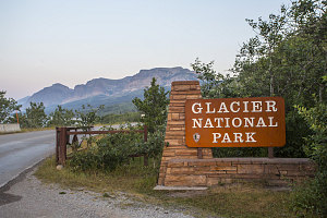
Many Glacier entrance sign
In the end, we decided against attempting a climb of Mount Henkel. Jenn had been suffering a bit from tennis elbow, and her arm was feeling particularly sore today. Not wanting to aggravate it by using it for scrambling, we decided to do something that was foot-powered only. Fortunately, several attractive options were available from the Many Glacier area. We chose Iceberg Lake.
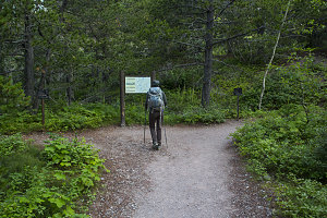
Start of Iceberg Lake Trail
Iceberg Lake is one of many tarns nestled in cirques along the sides of the Continental Divide. All of these tarns are very scenic, but Iceberg Lake is a bit special. Owing to the shading effect of both the steep walls of the Continental Divide and lofty 9300ft neighbour Mount Wilbur, Iceberg Lake is especially hidden from the effects of the sun's rays. This means a deeper snowpack that lasts much longer into the year, and as a result, a large amount of snow and ice remains virtually throughout the summer. Combine the year-round wintryness of Iceberg Lake with an easy and scenic approach, and you have a recipe for a very popular trail.
Early morning on Ptarmigan Trail
Fortunately, the vast majority of humanity seems resistant to early starts. As a result, the Iceberg-Ptarmigan trailhead was deserted when we started off at 7 a.m.
Under clear skies, we walked briefly uphill through forest before arriving a large low-altitude meadow below Mount Henkel. I stopped at a faint footpath that led uphill towards Henkel, and I recalled how this was the approach route that Luke and Sophie and I had taken, ten years before. Once again, the summit of Henkel would have to wait for another time.
Start of Henkel Scramble Route
The altitude gain between the Many Glacier area and Iceberg Lake is only about 1100 feet (350m), and the trail is super smooth and well-graded. Combined with the fact that we were a small group of two, the result was very fast progress up the trail. Fortunately, still no other people (nor bears) in sight. The bear spray was at the ready in a padded container at my hip, though, just in case.
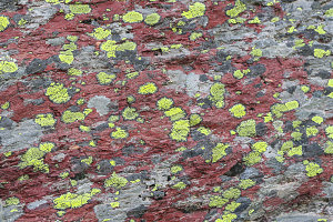
courtesy JInnes
At about the 3km mark, the Ptarmigan trail entered forest. This wasn't a patchy, scrubby forest like on many other trails we'd been on recently, but rather a continuous and dense forest. The trail continued through shady forest all the way to Ptarmigan Falls and junction, with only brief little views to the peaks and crags above.
Glimpses of Ptarmigan Wall
Ptarmigan-Iceberg Junction
Ptarmigan Falls was a pleasant enough spot, with the clear waters of Ptarmigan Creek running over a couple of pretty cascades before tumbling down the 30 or 40-foot high falls. The trail crossed the creek on a sturdy little footbridge, then wound around and up, back into the trees, to arrive at a trail junction. Here, the Iceberg Lake trail split off from the main Ptarmigan Trail.
We stayed left at the junction (i.e. in the direction of Iceberg Lake). Another half hour of hiking gently upward through the trees brought us to an abrupt treeline. Ahead of us was a glorious morning-lit view of the headwall above Iceberg Lake. Our elevation was too low for us to see the lake itself, however.
Iceberg Lake Cirque nears
Back to Swiftcurrent Valley
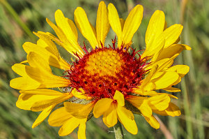
From treeline, the rest of the trail to Iceberg Lake was very scenic. There were many pretty wildflowers in the open meadows that the trail now ran through, and the ever more prominent semi-circle of Iceberg Lake's headwall formed a perfect photographic background.
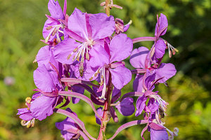
courtesy JInnes
Alpine trail to Iceberg Lake
courtesy JInnes