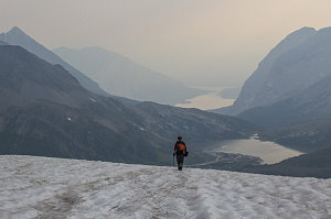
The view was indeed expansive, but it was less impressive than it could have been. All during the morning's climb, we had been smelling what had seemed like campfire smoke. Now atop Warrior Mountain, we could clearly see that, in many directions, a nearly-impenetrable haze hung in the remarkably still air. Immediately to the west, on the BC side, we could barely see the next set of ridges. We surmised that some large forest fire (which we could not see) was the source of at least part of the poor visibility conditions. In combination with the generally humid and cloudy conditions, the whole sense was one of pallid and drab grayness.
Northwest view, Warrior Mtn
Happy to have achieved the summit, but mindful of the time and somewhat disappointed by the hazy scene, we loitered at the summit for only about twenty minutes.
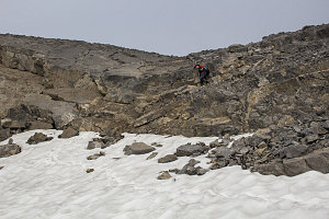
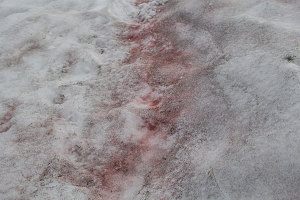
The hike back down the loose scree was also relatively tedious; it wasn't the type that you could just bomb down with abandon. Once at the shallow col below, a short and easy downscramble brought us back to the snow atop the glacier fragment. Now knowing how easy and straightforward the slope was, we didn't even bother to put on the microspikes, and quickly heel plunged back down to below the glacier.

courtesy JInnes

courtesy JInnes

courtesy JInnes
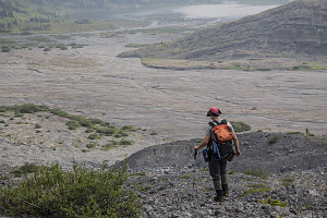
Alternating between stretches of bedrock, fingers and patches of snow, and gravel and boulders, we picked our way back down to the broad outwash plain flowing down from below Mt Joffre. It was nice to be back on flat ground as we hopped the braided streams of the outwash plain. Soon we were back on the footpath leading around Aster Lake, and this time - with daylight - we were able to enjoy the delightful fields of wildflowers through which the footpath led.

courtesy JInnes
Jenn descending steep bit
Down to the outwash plain
Jenn crossing Outwash Plain
Aesthetic little footpath
At about 10:15 a.m., we rounded the eastern end of Aster Lake and arrived back at our tent. Pretty decent time, all in all: we had covered the roughly 9km up to the summit of Warrior and back in not much over five hours.
Interactive trackmap with photo points - Warrior Mtn from Aster Lake - click map to view
Warrior Mtn from Aster Lake - Climb Data
Start Time:
4:57a.m.
End Time:
10:21a.m.
Duration:
5h23m
Distance:
9.14 km
(5.68 mi)
Average Speed:
1.7 km/hr
(1.1 mph)
Start Elevation:
7357ft
(2242m)
*
Max Elevation:
9665ft
(2946m)
*
Min Elevation:
7357ft
(2242m)
*
End Elevation:
7394ft
(2254m)
*
* : +/- 75 feet
Total Elevation Gain:
2276ft
(694m)
*
Total Elevation Loss:
2259ft
(689m)
*
* : +/- 75 feet
Elevation Graph