Aster Lake Backpack, Day 2 - Warrior Mtn
Friday, August 8
In order to achieve a mid-afternoon return to the trailhead, we awoke at 4 a.m., quickly ate, and made ready to leave. There was little to pack since we were leaving our tent set-up until we returned from our climb. Since it was still pre-twilight, we got underway under headlamp, crossing the meadows up to the shore of Aster Lake and then following a distinct footpath leading around south side of the lake (we had partially scouted this path out the day before).
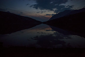
Faint Morning Glow
Apart from a narrow and rough section along the east shore of the lake, the path was very nicely formed and easy to follow. Once we had rounded the lake and had headed a few hundred metres upstream from it, the distinct footpath ended at the edge of a wide outwash plain. This outwash plain was full of braided channels of water, none of which were particularly deep and all were easy to hop across. There was now pre-dawn twilight, and with it we could see the shadowy shape of Warrior Mountain ahead.
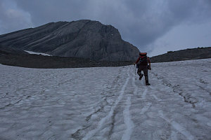
courtesy JInnes
The way seemed straightforward: after crossing the outwash plain, we ascended a shallow drainage alternatively filled with gravel, rubble, and talus. Higher up, before reaching Warrior's flanks, a steeper slope of scoured and bare rock sloping down from the left allowed us to climb up towards the remnant bit of glacier. This slope was quite a bit steeper than the shallow drainage we had climbed, but the glacier-scoured bedrock surface was sound and dry, and the angle of the strata provided nice rounded ridges of grippy rock upon which to walk. Soon we were at the base of the snowfield that surrounded the glacier remnant.
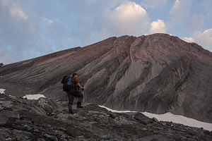
courtesy JInnes
Approaching remnant glacier
Now, the standard practice is to rope up when crossing or setting foot on a glacier. This is primarily due to the danger of falling into a glacial crevasse. However, a bit of experience and knowledge can be used to evaluate the level of this risk. Glacial crevasses are formed due to the stresses in glacial ice that arise from the flow of that ice. However, when a glacier becomes stagnant, its flow ceases and the stresses necessary to form crevasses are rarely present. This certainly seemed to be the case here.
Furthermore, we had not chosen to bring crampons, owing to the fact that only a part of the glacier's ice surface was exposed (the remaining part around the border was covered in snow). Nevertheless, we had brought less agressive traction aids that go by the brand name of microspikes, which we put on if case we somehow found ourselves on an icy surface. We had also brought ice axes (always a good idea when crossing snow of even moderate steepness), and got those out now.
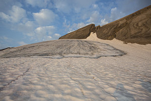
Exposed Glacier Ice
Now up close and personal - next to the snow slope surrounding the glacier - it looked even easier than it had from afar. The snow slope didn't really even reach into the moderately steep category - perhaps a 25% grade at most. It was also firm but not hard, resulting in very positive footing while allowing steps to be kicked.
It was an easy ten to fifteen minutes of kick-stepping up the snow. Near the top, near the boundary with the ridge, there was actually a wide, flattish bench upon which one could simply walk normally. Super easy stuff.
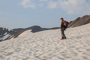
courtesy JInnes
The access point onto the ridge was a shallow low point accessible from along the top edge of the stagnant glacier (when I say glacier, I mean the snowfield along the top edge of it). About 5-10 metres of easy scrambling up some downsloping slabs and we were on the ridge crest, which at this point is about 100 metres wide.

courtesy JInnes
There was still some uncertainty about which peak we'd be climbing, but at this point, now on the ridge, we had to choose: either climb Warrior, now about half a kilometre away and about 600 feet (175m) of climbing, or climb Cordonnier, which was just over a kilometre away and perhaps another 125ft / 30m higher. Or, we could climb both. The calculus hinged upon when we'd get back to the car, and at a current time of 7:30 a.m., we figured it would take another half an hour to get to Warrior's summit, then another two hours back to camp, then another three to four hours back to the trailhead. Already that was looking like a 2pm-ish return time, which we felt was late enough of a time for us to start our drive to the Lake Louise area. After all, we had another big hike planned for the next morning in Lake Louise, and arriving tired and late would not be ideal. The net out of all of that calculating was the decision that climbing the quicker objective - Warrior Mountain - was all we could fit in. If we had been staying for two nights, then we could have easily climbed both peaks.
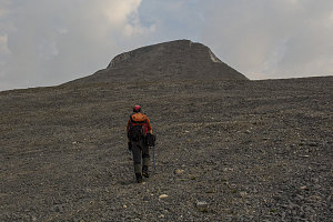
courtesy JInnes
Highway of Scree
So, with the decision made, we started our final ascent to Warrior's summit. Once on the ridgecrest, it is a simple - though somewhat tedious - climb up a large and relatively featureless scree slope. A few faint semi-paths in the scree make things a bit easier in spots, but mostly it is just loose scree. Fortunately there's only about 600ft / 175m of height to gain, so it didn't take all that long, and at 8a.m., we arrived at the summit of Warrior Mountain.
South along Continental Divide
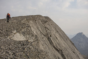
courtesy JInnes
A small cairn crowned the fairly small bump at the top. On all sides but the side we came up, the terrain dropped away precipitously. Once again, we were directly on the continental divide, straddling both the east and western drainages of North America and on the border of Alberta and BC.