Up to this point, there was some question about whether or not to try to do the Sewards and Seymour in a single outing. In the end we decided that a single day for Seymour and a single day for the Sewards would be ok. And, this day was to be for Seymour.
Seymour Mountain
Seymour Mountain, as viewed from the summit of Panther Peak. Seymour Mountain is the 34th highest peak in the Adirondacks. It is what is considered a "trailless" peak, meaning that there is no officially maintained trail to the top. What this usually means is that there is still a beaten path, but that it may be at times difficult to follow and may have lots of blowdown. Seymour's Elevation is 4090 feet.
[enlarge]
|
|
Seymour/Sewards Access Point
The trailhead for this hike is reached by turning off from Highway 3 between Tupper Lake and Saranac Lake, not far to the east of the Highway 30/3 junction. An initially-paved (but later gravel) road winds its way for perhaps 10 km to a trailhead parking area with the sign you see here.
[enlarge]
|
|
Markus Preps for the hike
A little "pit stop" before the start of the hike....
[enlarge]
|
|
Registering
On our way at 7:20 am.
[enlarge]
|
|
AMR-style bridge
This bridge, which crosses one of the many brooks encountered on the hike in to the base of the climb, is reminiscent of the beautiful Lake Road AMR Gate.
[enlarge]
|
|
Pleasant walk
The whole of the first 8+ km is more-or-less flat, with some sections (like this one near Ward Brook) very easy to hike on, being parts of old road systems.
[enlarge]
|
|
Ward Brook Leanto
Not long after crossing Ward Brook, one comes to the cute Ward Brook Leanto.
[enlarge]
|
|
Ward Brook Leanto
Another shot of the Ward Brook Leanto
[enlarge]
|
|
Herd path turnoff
only a few hundred metres beyond the Ward Brook Leanto, one encounters the cairn (see picture, left of Markus) that marks the start of the 'herd path' leading to the top of Seymour. It is quite well-defined, and in fact you can see here that it is more defined than the old road, which is completely grassy with no footpath tread beyond this point. Might be harder to spot this in winter, though. Another clue is that the turnoff is immediately beyond a small brook.
[enlarge]
|
|
Ampersands
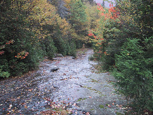
Ampersand Mtn and Lake are brightly light by the early autumn sun. Over our peak, though, low rapidly moving clouds keep things more gloomy. This shot is taken while climbing the narrow slide on Seymour's north/northeast flank. The herd path runs parallel to it, but if desired the slide can be climbed. Warning! when wet the slide is slippery and tricky! The top of the slide and the herd path re-join. In my GPS tracklog, the 'SLIDE' waypoint roughly marks the start (lower part) of the slide.
[enlarge]
|
|
Narrow Slide
This is a view up the narrow slide on Seymour's north/northeast flank. If desired, the slide can be climbed. Warning! when wet the slide is slippery and tricky! The top of the slide and the herd path re-join. In my GPS tracklog, the 'SLIDE' waypoint roughly marks the start (lower part) of the slide.
[enlarge]
|

courtesy Markus
|
Markus at Seymour
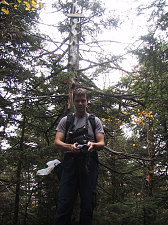
Proof that Markus has indeed bagged his 31st 46er peak. After some toiling up the muddy very steep herd path, we arrive at the pleasant summit.
[enlarge]
|
|
Markus' photographer's pose
[enlarge]
|
|
Andrew on Summit
Photographic proof that I made it to the summit as well.
[enlarge]
|

courtesy Markus
|
Unsettled Day
This is the view from the southern lookout point on Seymour's summit. The Cloud deck is only about a hundred feet above us and racing by, as the wind is very very strong. Still, the mood created by gale-force winds, low clouds and stabs of sunlight is inspiring. The Santanoni range rises to the left in this picture (mostly obscured by clouds, though).
[enlarge]
|
|
