Strathcona Backpack: Castlecrag, Frink and Albert Edward
Sunday, August 17 and Monday, August 18
The Paradise Meadows / Forbidden Plateau area is the most developed part of Strathcona, and so likely to have the
highest amount of people traffic. On the other hand, it offered pretty much the shortest drive access of any part of
Strathcona, it was paved road all the way to the trailhead, and the access into the high country was on marked,
developed trails. These traits fit the bill for our somewhat hasty outing.

Paradise Meadows Trailhead
We left Gabriola late-morning (perhaps too much of a tardy departure, in retrospect) and arrived at the Paradise Meadows trailhead at around 2:30pm. It was a bit late to
be starting out, but the approaching change in weather meant that we wanted to get out on our backpack before the day
was out. That way, we could finish the loop and be back at the car at the end of the next day. I really value my clear, view-filled mountain days!
Although the trails we took across the Forbidden Plateau were for the most part easy and flat, we had started late and
wanted to get to the base of the high country before setting up our camp, requiring a brisk 12km-in-3 hours hike. We
did it, though, arriving at a secluded little spot on the southeast corner of Moat Lake well before sundown. We even
had a neat visit from two boaters who were descendents of the owner of the lake and land surrounding it.
Beautiful Subalpine Terrain
Our campsite at Moat Lake
The next morning we started early, wanting to beat the approaching bad weather. With some dark clouds overhead, but no
rain, we climbed around the backside of Castlecrag mountain, reaching it's summit via the cairned and flagged route by
8am. Spectacular views to the south towards Comox Glacier and north and west towards our next two peaks: Mounts Frink
and Albert Edward.
Moat Lake from Castlecrag
Continuing on, we easily hiked up the flank of Mt Frink to it's summit. It wasn't as pointy or craggy as Castlecrag's
summit, but it offered even betters views across nearly all of Strathcona park. There's a lot of excellent peaks and
alpine terrain to be found on Vancouver Island, that is for sure!
Glorious Morning sunshine
Hope Lake and Mt Albert Edward
We continued on from Frink's summit, making a nice open-alpine traverse over to Mount Albert Edward. We arrived at
Vancouver Island's 6th highest summit shortly after 11am, and enjoyed a completely unobstructed 360-degree view of
basically all of Strathcona Park. And the weather? Well, the bad weather had held off for us, and we had a
completely clear and beautiful sunny day.
Coastal Clouds Creeping in...
The hike back was scenic, especially the first bit down from Albert Edward, but also long and tedious. Until you get down to near Circlet lake, the route is rough [in spots] and quite steep [again, in spots]. Once back on the maintained paths, it's mostly good footing all the way back to the trailhead. We arrived at the car, quite spent, at about 5:30pm. A good solid 12+ hour hiking day!
Snowfield on Albert Edward
Albert Edward's NE Cirque
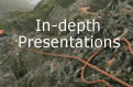
 Warning!
 You've only seen a brief set of images and a short writeup on our backpack.
Click
here to go to a special
"in-depth" page that contains a more complete account, a lot more pictures, elevation graphs, and an interactive track-and-photo map of where we hiked.
Resting and cooling our weary bones in the car, we cruised back south to Nanaimo, where I was salivating at the idea of
a cooool Dairy Queen Skor Blizzard. We were pulling into the parking lot at the Nanaimo Dairy Queen when Jenn's phone
rang. It was Ewart! Our friend Ewart had just finished the West Coast Trail and -- coincidences of coincidences --
happened to be in Nanaimo at that very moment with his sister. Would we like to meet up, he suggested?
Fifteen minutes later we met up at the Bastion in downtown Nanaimo, with my Skor Blizzard now a fading memory.
Although Ewart and Ruth (Ewart's sister, visiting Vancouver Island with him) had settled into the Painted Turtle
Hostel in downtown Nanaimo, a quick call to the Innes residence and a warm invite from Jenn's dad changed that plan: we
were all invited to stay at the Innes residence for a few days.
After very quickly packing their things up, we headed to the Gabriola ferry and Gabriola Island. Another tasty
moose-meat filled meal followed, and then we retired (Ewart to his tent on the front lawn, of course) for a most
restful night's sleep.