Nova Scotia's Highpoint
Sunday, July 13
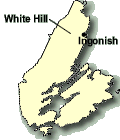
White Hill is the highest point in all of Nova Scotia. Even so, we're not talking about a very high summit -- White Hill's elevation is only 1750 feet (535m). Despite this modest elevation, White Hill is the most difficult peak in the Maritime Provinces to reach. It is located smack in the middle of the 40 kilometer-wide Cape Breton Highlands peninsula, almost equidistant from both shores. To cap it off, there are no maintained paths to reach it. At best, it promised to be a very long and troublesome bushwhack.
Fortunately, a network of fire roads were once built across the highlands, and the faint remnants of those fire roads remain. We chose to attempt the peak via a road such as this that led westward from near Ingonish.
Despite the loud partygoers the night before, I managed a few hours of quality sleep time, even though we got up at 4am. We knew that we had something on the order of at least 35 kilometres of hiking this day, and we didn't know much the orienteering component of our trek might delay us, so we needed to get going as soon as possible.
Under clear and calm pre-dawn skies, we drove the short 5 minute drive to the Freney Mountain trailhead -- the lower starting point we had scouted out the day before. We quickly packed up and started off up the road. Our big day had begun!
Climbing steeply, we quickly covered what turned out to be about 3/4 of a kilometre of gravel road (definitely passable by most 2wd vehicles) to the upper trailhead and parking area, where a national park service barrier and sign marked the boundary of Cape Breton Highlands NP. Continuing on past the barrier, the road became grassy and pathlike. This part was maintained, because this was part of the Freney Mountain trail loop. Soon, though, we'd come to the unmarked spot where a very faint fire road was supposed to branch off to our right.

Start of an Epic
Carefully counting off the distance with my GPS (based on information in my 'not won in a day' guidebook), we started looking closely for a faint, overgrown path leading off to the right. Eventually I spotted something, but to call it a path was being too generous. Rather, it was the absense of trees in a non-random way that caught my attention. There was basically nothing path-like on the ground to otherwise indicate that this was it. Just to be sure, I hiked a little farther up the main trail and back to see if anything else looked more definite.

Highland Ferns
I was pretty sure, though -- this was it. We donned our gaiters and braced ourselves for the potentially arduous journey ahead, and started along the old fire road.
There were some loose brush and ferns, but the going wasn't too bad. By looking far ahead, you could make out the lane formed by the lack of small white birches the comprised most of the forest here. Everything was covered in thick morning dew, though, so our pants soon got thoroughly soaked. The fire road bent gently left and started to level off. The nature of the Cape Breton highlands is that of an almost-flat plateau that steeply drops off right near the sea. We were just finishing our climb onto that plateau.
To our right, we could see a thin area of vegetation on a nearby hillside, and we spotted some big wildlife! No less than five moose were contentendly grazing there, although they vamoosed (ha) as soon as they became aware of us.
Now mostly on the flat, the road continued on in a relatively followable state, with good footing. I thought that this might not be so bad after all, if most of the road is like this. No orienteering our route-finding required so far!

Muddy mess
Our luck soon came to an end. A thicket of bushes blocked the path of the road, and on the other side, I could discern nothing that looked like a road, no matter how much I strained to see some remnant of it. It was supposed to continue ruler-straight here, according to the dotted line on my topo map, but all I saw in front of me was a sea of gentle-looking ferns. Oh well, I thought, we knew this kind of thing was possible, and there was nothing to do but take a reasonable course and try and regain some visible remnant of the road further along.
Plunging through the ferns, which were now more than waist-high (meaning the dew-soaking now reached up to our thighs), we made much slower progress. We couldn't see what our feet, so we had to step more slowly and more carefully. We made our way around thickets and over wet areas, all the while keeping an eye on the topo map and the GPS to keep relatively close to where the fire road was, in the hope of regaining it.
Eventually, after almost an hour of this, we again spotted a ghostly 'laneway through the trees' -- clearly a man-made, unnatural tunnel through the foliage. We had regained the fire road!
Hoping there weren't any more spots like this, we resumed our higher rate of speed and headed northwest along the old fire road. The going was actually pretty good, and in several places along this stretch, there was actually a discernable path to follow. It appeared as if the local wildlife had turned the old road into one of their main herd paths -- all of the footprints along the path were non-human.
With a little care in a few non-obvious areas, we had a pretty straightforward time following the old fire road for the next 4 or 5 kilometres or so. The only two issues that slowed us down were the periodic 'mud holes' -- areas of soupy and potentially quite deep mud. After a while I noticed that even the wildlife avoided these mud holes: before approaching a mud-hole, there would almost always be a faint herdpath that, if followed, led around the mud hole and then rejoined the road. The other obstacle occasionally encountered were nearly impenetrable thickets of an alder-like bush. These would sometime grow up directly in the path of the road. Initially I would try and stay directly on track and push through these, but I soon learned that this was a frustrating waste of time. Again, after a while I noticed that if I looked for it, there was almost always a faint herd-path leading around these annoying obstacles. The wildlife up here was kinda smart!

Pretty Valley View
Our pace picked up as we became more proficient at staying on the road and avoiding the mud holes and thickets. It was becoming an enjoyable walk, actually, with a lot of pretty decent herdpath-on-road leading through a very pretty dwarf-birch and fern forest, something I found quite distinctive from the typical forests of the northeast.

Open Marsh
After much walking and a few ups and downs, we reached the flatter part of the central highlands. Here, at about 1500 feet, we began to encounter the open lands of 'the barrens'. These are large areas of open, low scrub, with almost no trees. Strange for such a low elevation, it must indicate that this area receives some pretty harsh winter weather.
We came to the first of a couple of marshy areas that our guidebook warned us would be an easy place to lose the road. I was worried about the marshes being horribly difficult-to-cross waist-high-in-mud-and-water obstacles, but fortunately, I was wrong. The marshes were open areas with some standing water, but the grassy parts were like walking on water-soaked sponges. They held our weight well and there was little mud, and although it did eventually make our boots pretty damp, the marshes were easy to cross. And the guidebook was right -- one had to scout very carefully for where the road continued on after the marshy area, because in the marshy areas themselves there's very little to no indication of the road.

After a couple of these marshy areas, the road crosses a large barren, staying pretty much ruler-straight and easily-followable for a long time. We had come nearly 14 kilometres so far, and we still hadn't reached the summit. This was going to be one looong day! Still, the going was pretty fast now, and I was confident that we would make the summit (whereas I wasn't completely sure of this at the start). With the exception of one final small marshy area, we reached a junction of four fire roads shortly after 11am, about six hours after we started hiking.
The criss-crossing of the fire roads is an important orienteering landmark for this journey. From here, the guidebook advised going straight for another few kilometres until we were at the closest possible point to White Hill. Then, we would strike out cross-country, bushwhacking directly for the summit.

Highland Barrens and White Hill
I thought that we had pretty clear sailing from here to the summit. But no, White Hill had a few more stings-in-it's-tail waiting for us. One was the final bit of fire road. Although it was easy to follow, there is one low point nearing White Hill where there is a very extensive and yucky stretch of mud-hole like ground. While carefully attempting to navigate around the worst of the mud, I accidentally stepped on an area that was much less solid than I had anticipated. I immediately plunged one leg up to the waist in dark brown soupy mud. My topo map went smack against the mud, and I very nearly dropped my camera, too. Quickly rescuing my map, I pulled out my leg with a sucking sound and with a great whiff of putrid-smelling swamp gas. Ugh! Now I know why the wildlife makes tracks around these obstacles rather than going through them. Such deep mud might immobilize even a full-grown moose!

Thick and troublesome
With the mud encounter behind us, we reached a point close to White Hill (which we could now see as a very low rise above the nearly flat barrens), and we picked what we thought was the shorted and least brushy route to the summit. It doesn't look too bad, but there was about 100 meters' worth of very dense, 8-foot high vegetation. Slow and annoying to bushwhack through, and just the kind of thing that Jenn hates! Fortunately, it was only about 100 metres deep, and afterwards the terrain returned to a sea of 1 foot-high springy thickets, relatively easy to walk on.
Soon we were on the broad flat top of White Hill. I knew from reading internet reports and reading my guidebook that there was an old fallen radio tower and a marker of some sort. We spent some time wandering about, eventually finding it on the far side of the broad flat top that we had come up on. We had reached the summit at last -- seven and a half hours and about 18.5 kilometres after our trailhead start at 5:15am.

White Mountain Summit
The summit itself looked like a little rock submarine emerging from the ground: a little sliver of bedrock with a small concrete marker on it's highest point. A few metres off to the northeast was a fallen red-and-white striped tower. There was no guidebook, but upon closer inspection of the summit rock and marker, there was a nice clear survey mark. That it was the summit was no longer in doubt!

Proof positive
We were truly in a wild place. In all directions for as far as the eye could stretched the endless barrens of the Cape Breton Highlands, occasionally punctuated by a small lake or two. Way, way off to the northeast, we could see a tiny sliver of ocean. There was no indication of human habitation or activity anywhere in our view.

Summit Survey Marker
After a good snack, we prepared ourselves mentally for the very long journey back. This trip was on track to become the longest day-hike that I had ever done. And although the terrain was not super-difficult, it was still going to be a long and tiring day. We were making good time, though, and I was pretty sure we'd be back well before dark.
As we stood on the summit, thinking about the dense thicket and horrible mudhole on the last leg of our climb up, I thought that perhaps it might be more efficient and less troublesome to bushwack down the other side of the hill, angling for a spot that intercepted a fire road not far from the junction we had encountered on the way up. This would potentially be shorter and hopefully would avoid the nasty bushwacking and mudhole sections. After a bit more thought, I called Jenn over and we decided to go for it.
It was a good call. There was only open barrenlands on this side of the peak down to where a regular bit of more open forest started, and from there, we encountered a decent wildlife herdpath that led us back to a fire road. Faster, less hassle, and more enjoyable. From the fire road, we quickly hiked back to the junction, completing an irregular loop of the mountain. I'd say this way up to White Hill from the fire road junction should be considered as an alternative to anyone climbing the Nova Scotia highpoint.

Heading back
With all of the mysteries and uncertainties now out of the way, it was simply a matter of retracing our steps and following our GPS tracklog back. The day's weather continued to be beautiful, with a nice breeze now cooling us off and keeping the annoying horseflies at bay. We had a slightly better time staying on the old fire road back near the start where we had lost it in the morning, but there was still one stretch were the road just was not followable, and we again had a short stretch of bushwhacking before we regained the road again. Overall, I'd say that this first section of hard-to-follow road is the hardest (orienteering-wise) part of the entire hike.

Some new jewellery?
With much gratefulness, we reached the end of the fire road and intersected the maintained Freney Mountain Trail. Although we could have taken the shortest-route 2km back to the car, I managed to convince Jenn to hike over to the Freney Mountain Lookout, which involved an extra km or so of hiking. I was hungry for a nice lookout view, though, something that the hike to White Hill did not provide. Jenn was nice enough to accommodate, even though she had already hiked over 33 km so far this day.
Reaching the end of the Barrens
The hike over to the Freney Mountain Lookout was an easy jaunt, made only difficult by our fatigue. The Freney Mountain Lookout indeed give us a superb late-day sunlit view of the Clyburn Valley and the ocean and headlands near Ingonish. It was nice to see some vertical relief after a full day of nearly flat terrain!
From the lookout, we hiked down the other side of the Freney Mountain Loop, finally reaching the car at the lower trailhead at about 8:10pm. Just under 15 hours to cover almost 38 km of terrain. Definitely my longest day hike ever. Even though Jenn was up for it, I didn't feel like camping, so we checked into a quaint seaside cottage in Ingonish, had much-needed showers, a burger and fries at a local pub, and then crashed on a nice, comfy bed. The satisfying end to a challenging day!
Interactive Trackmap & Photo Points - White Hill Climb - Click map to expand
Note: For a more detailed account of our climb of White Hill, please visit the
in-depth report, with many more pictures and detailed hike maps, graphs, distances, waypoints and other data.

 Introduction
New England Shortcut
The Evangeline Trail
Cape Split and Cape Breton
Nova Scotia's Highpoint
The Cabot Trail
Prince Edward Island
A Tale of Two Visits
Family Business
Introduction
New England Shortcut
The Evangeline Trail
Cape Split and Cape Breton
Nova Scotia's Highpoint
The Cabot Trail
Prince Edward Island
A Tale of Two Visits
Family Business
 In-depth: The Hancocks Hike
In-depth: The Cape Split Hike
In-depth: White Hill Climb (NS Highpoint)
In-depth: The PEI Highpoint
In-depth: The Hancocks Hike
In-depth: The Cape Split Hike
In-depth: White Hill Climb (NS Highpoint)
In-depth: The PEI Highpoint