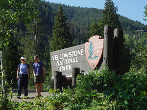
East entrance, Yellowstone NP
All fueled up (both vehicles and people), we head west towards the Yellowstone East Gate. We are soon in cool high Yellowstone (a welcome change from the hot arid basin we just drove out of), and we stop at the Bridge Bay ranger station for our backcountry permit.
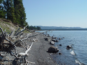
Yellowstone Lake
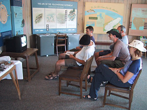
As it turns out, we also have to watch an educational video on the dangers and regulations of the Yellowstone Backcountry. As dutiful leader, I gather all of the children round the little TV they have and we watch carefully as we are told how to conduct ourselves in the backcountry. The big thing in Yellowstone is proper handling of the bear situation (both Black and Grizzly), since in the past that has been a big problem in Yellowstone. Since many of us are sufficiently paranoid about bears anyway, I'm pretty sure we are going to be ok.
courtesy Markus
Gather round...
We get a [free] backcountry permit for a campsite along the north shore of Shoshone Lake (campsite 8R3), which is pretty much what I wanted. The plan is to hike in from the Delacy Creek trailhead down to Shoshone Lake, and from there along the north shore of the lake to the campsite. Then, the next day, hike to the Shoshone Lake geyser basin and then out on a trail that ends up near the Kepler Cascades, further down the road. (thus taking advantage of our two-vehicle situation).
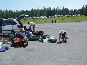
Backpack Preparation
After an hour of pack packing we are all ready to go. I had set a mental goal of getting started by 2pm and we pretty much hit that by the time we get started on the trail.
The trail from the Delacy Creek trailhead to Shoshone Lake is in excellent shape - a nice gentle well-formed path through open forest and wonderful open meadows. Quite a difference from the typical Eastern trail. Definitely good terrain for a heavy backpack. Less good was the discovery of not-so-small number of Mosquitos....
Trail through open meadows
It takes us about an hour to get to the shore of Shoshone Lake, a wonderful large high-altitude lake, completely undeveloped. The trail follows the shoreline for quite a few kilometres, and views to some of Yellowstone's high country (specifically the Mt. Sheridan area) are abundant. We make excellent time and arrive at our camp (8R3) late afternoon/early evening (around 6 or 7-ish). Total distance is about 13 km.
Ewart's Lakeside trailhiking
The campsite is excellent: right on the shore of the lake, with no other campsites nearby. We have it all to ourselves. Being all hot and sweaty from the hike in, we all go for a quick dip in the lake, and then set to making our dinners. The only probem with this campsite: mosquitoes... and LOTS of them. We take various measures to avoid them: covering all exposed skin with clothing, hiding in the lake (Ewart and Peter ate their dinner out in the water to get away from them), and staying in our tents.
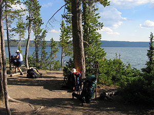
courtesy Peter
Food storage at backcountry campsites in Yellowstone is taken very seriously. This is Grizzly country, and the park tries hard to make sure that encounters between people and bears are kept to a minimum. Proper food storage is one of the biggest ways to
ensure this. The backcountry campsites at Yellowstone have a food storage strategy of some sort: at our site, a cross-beam had been installed high up between two tall trees. We are to hang our food from this cross-beam. With the help of some nylon twine and the combined intelligence of 6 humans, we are able to secure all of our food and garbage high up above the forest floor. We can't help but notice the long claw marks on the trees supporting the food pole... yikes!
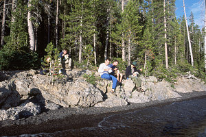
courtesy Ewart
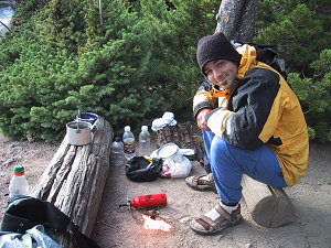
courtesy Markus
Getting away from the bugs
After securing our food, we still have an hour or so of light to fritter away. We aren't about to offer more of our precious blood to the little flying vampires, so five of us gradually congregate to our [my and Markus'] tent (yes, you can fit 5 people into a 3-person tarn tent). Ewart opts to remain, gore-tex clad, in the lake. A nice evening chat by the lake in the tent is a great way to wind down our first "real" day of the trip.
Keeping the grub from the bears
With all this talk of bears I am feeling the need for a little security, so I carefully position my bear spray so that I can get to it quickly if need be during the night. Fortunately, the night is peaceful and undisturbed by any critters.
Interactive trackmap with photo points - Soshone Lake Backpack Day 1 - click map to view
Hike Data - Yellowstone Backpack, Day 1
Start Time:
1:46p.m.
End Time:
5:50p.m.
Duration:
4h4m
Distance:
12.89 km
(8.01 mi)
Average Speed:
3.2 km/hr
(2.0 mph)
Start Elevation:
8021ft
(2445m)
*
Max Elevation:
8054ft
(2455m)
*
Min Elevation:
7840ft
(2389m)
*
End Elevation:
7840ft
(2389m)
*
* : +/- 75 feet
Total Elevation Gain:
286ft
(87m)
*
Total Elevation Loss:
431ft
(131m)
*
* : +/- 75 feet
Elevation Graph
The next day we are off to the Shoshone Geyser Basin. This geyser basin is the largest backcountry geyser basin in the park. I like the idea of being able to explore these neat features in their natural state, with no boardwalks, tons of tourists, etc. After an hour and a bit of hiking we arrive at the basin and explore some of the neat geothermal features. One geyser in particular (the Minute Man Geyser) gives us some neat but short eruption events. Lots of other fumaroles, pools, and pots also capture our attention. The mosquitoes, unfortunately, are also still present.
Nearing the Shoshone Geyser basin
The Shoshone Geyser Basin
Intricate Thermal formations
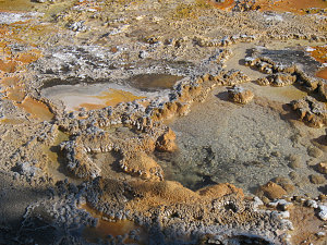
courtesy Peter
Hole into the netherworld
From the geyser basin we start our hike out over the continental divide to our exit trailhead. I miscalculate a bit on the second day's trail distance (more like 21+ km vs. 13-14 km), much to the consternation of some of our group (Markus in particular is complaining of low energy). It wasn't so much that the terrain is very difficult (overall the hike is pretty flat), it is just the idea of hiking 20+km with heavy backpacks.
On the other hand, the trail itself from the Geyser basin to the Continental Divide is very very nice. It follows the banks of Shoshone creek and winds its way through beautiful meadows in and around the creek. From the pass the trail descends down to the valley of the Firehole river. The Firehole river runs through the valley system where most of Yellowstone's geyser basins and geothermal areas are located.
Shoshone Creek and Geyser basin
Beautiful Shoshone Creek Meadow
Trail through more meadows
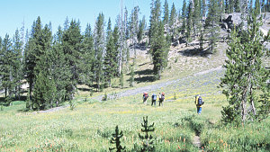
courtesy Ewart
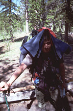
courtesy Luc
Trail through more Meadows, II
At this point we've covered about 15km and we are all tired and dusty. Markus has managed to get through his low-point and has recovered both mentally and physically somewhat. We soon arrive at the strange bulbous mass of the Lone Star Geyser, but it turns out we are nowhere near the eruption time so we move on. From the Lone Star Geyser to the trailhead the route is a paved/gravel bike path. Luc and I decide to go ahead more quickly so that we can fetch the van from the other trailhead and be ready to be off when the rest of the group arrives.
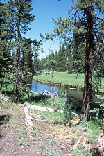
courtesy Ewart
When Luc and I return with the Van, everybody has just arrived. Markus looks haggardly tired again but as usual he has survived. Thankfully Markus' A/C is still working 'cause we are all hot and sweaty... and no one wants to be in a vehicle without A/C right now. Everyone seems to be in one piece and in relatively good spirits though, and that's what counts. Hmmm... turns out I've managed to get a few blisters on my feet from this backpack (which is unusal for me).
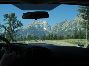
courtesy Peter
Heading for the Tetons
Next on the agenda is Grand Teton national park and the jagged prominence of Teewinot mountain - something I've been wanting to re-do since Luke and Andree and I had to give up only a few hundred feet from the summit due to a Thunderstorm (
click here to go to read about that outing).
We make the scenic 1 hour drive from Yellowstone to Grand Teton NP and set up camp at the Colter Bay campground. I'm humming and hawing about whether we should try for Teewinot the next day or not. I'm leaning towards no because it is late in the day and we haven't organized any of our mountaineering gear and because I want to get started really early to ensure success. Plus everybody is wiped from the longer-than-expected backpack of today. Also Markus is getting a bit frantic and down about the whole Teewinot thing because the difficulty of today's backpack has really worn him down, and he isn't sure that he can do Teewinot tomorrow. I guess he is acting as the warning canary for all of us.... so, the call is obvious: tomorrow we'll get ready and the next day we will tackle Teewinot.
In Their Own Words...
Peter: "Into yellowstone. The shot of the sign is blurry as there were too many people standing in front of it to get a clean shot. There is a shot of Andrews favorite hiking treat: Dare Cinnamon Danish cookies. We plan a backpack into Yellowstone, but before we can get started we have to watch the bear video. Bears are a serious issue in yellowstone. So are mosquitos we soon discover. The trail in is smooth and picturesque, but the mosquitos are unrelenting. Many pictures will show people in Gortex jackets, even though it is warm and dry.
After about a 13km backpack we arrive at our lakeside camp site where the breeze is mercifully keeping the mosquitos at bay. We waste no time jumping in for a dip.
We eat our meals and set up camp for the night. Somewhere during the night I discover my food had too much lactose in it. So I creep into the night lit by my bluish LED headlamp in a very "blair witch" like setting. My imagination is running wild with all the bear info that we had recently, as I creep around looking for the pit toilet. I was WIDE awake with adrenaline, but saw no bears, just more damn mosquitos as I wandered about in my search.
The next morning we hike out through the other worldly scenery of the thermal features in the park. Many geysers, vents and thermal pools that we get to enjoy far from the the tourist crowds.
Later as we are driving past yellowstone after climbing Teewinot, (included here for geographic synch) we stop in to see the spectacle of old faithful. A mass tourist spectacle it is indeed, complete with long rows of bench seating for the crowds to watch. I will take a small out of the way Geyser any day, over the mass tourist event.
"
Caroline: "On Yellowstone: Now I feel we have finally arrived. A trail that goes to and then follows Shoshone Lake is proposed. This looks so much like a new forest in the sense that it's "clean". It's airy and you can see far ahead. The mosquitoes are not bothering me too much but some of us don't fare as well... I gladly share my "deet" with the group. Death to the bugs!!! Flowers and cool flora everywhere.This is great ! We make camp by the lake. I'm happy to take off my heavy backpack and to go for a swim. Aaah ! Very refreshing ! After a good meal and an impromptu pow-wow in Andrew's and Markus' tent, I turn in for the night. Sleep tight! Tomorrow will bring on a challenging hike!
[the next morning]
The sun is getting up, and Andrew wakes Luc and I up (I ended up harbouring a refugee from mosquito hell). A warm breakfast and we're on our way. The trails takes us to a very cool geyser basin. Every "hole" is different, some bubble, some don't. wow. It's fascinating to think of all the energy just beneath our feet. This hike will prove to be longer than expected but in the end I think it was well worth it.
As we drive south to Grand Teton Nat. P., we stop to take a picture of the breathtaking view of the Teton range from Lake Jackson (?). Andrew points out the peak we will climb... wow ! I can hardly wait!"
Ewart: "Ewart jokingly suggests to Andrew that he document his proposed design in a DD
(Detailed Design) document, and have it reviewed prior to implementation. Andrew decides to over-ride due process. [not sure what it was I was supposed to document... strange... JAL]"
Interactive trackmap with photo points - Soshone Lake Backpack Day 2 - click map to view
Hike Data - Yellowstone Backpack, Day 2
Start Time:
7:46a.m.
End Time:
2:45p.m.
Duration:
6h59m
Distance:
21.03 km
(13.06 mi)
Average Speed:
3.0 km/hr
(1.9 mph)
Start Elevation:
7698ft
(2346m)
*
Max Elevation:
8075ft
(2461m)
*
Min Elevation:
7639ft
(2328m)
*
End Elevation:
7642ft
(2329m)
*
* : +/- 75 feet
Total Elevation Gain:
527ft
(161m)
*
Total Elevation Loss:
660ft
(201m)
*
* : +/- 75 feet
Elevation Graph
For Maps and Graphs of this backpack, click
here.
For the GPS tracklogs from this backpack, click
here)