When we get up in the morning, we are greeted with an amazing sight - it isn't blue and sunny and hot. Its actually cloudy with the threat of some showers. Which is good for the local fires but not so good for a hike. Peter has decided that he feels too under-the-weather to join us, and decides to sit the day out (as does Luc, who also feels a bit ill). So it is down to myself, Caroline, and Markus. And although the weather is questionable, it is still quite reasonable, so Markus, Caroline and I get ready, then make our way in Markus' Acura to the pass.
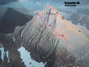
Mount Reynolds (annotated)
At the pass, we discover we are missing some of Caroline's wet weather gear, so we have to return to the
In Their Own Words...
Peter: "We had heard that much of GNP was closed due to forest
fires and this did turn out to be the case. The
many glacier area was closed to us and the areas
we had access to were pretty hazy. The first hike
was Mt. Reynolds. Which I did get ready for, but
when at the store to get food, I realized how
crappy I felt and decided the day would be better
spent near a bathroom (beer or illness?). Luc
was in the same situation and Ewart was not yet
ready for any serious hike, so this day only Andrew,
Caroline and Markus went for a hike, while the
rest of took it easy. "
campground and fetch that. We leave Markus at the pass to take a few more pictures of his favourite visitor center. By the time we are back up at the pass and ready to go, it is after 10am. Fortunately the hike to the base of Reynolds is not long.
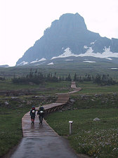
courtesy Markus
Start of Reynolds climb
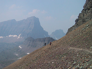
And, actually, the weather is kind of nice... cool, a bit of a rainshower here and there, and interesting vistas through breaks in the clouds. The hike up to the pass to hidden lake is over easy boardwalk trail, and then from there the route to Reynolds heads south. We lose the crowds at this point and are by ourselves.
The weather improves from this point onwards and we traverse across meadow, talus, snowfields, and by some regal-looking rams to the saddle just below the northwest ridge of Reynolds mountain. From here there is a superb view looking down onto Hidden Lake and Bearhat mountain. At this point the air is relatively smoke-free in this locale and the true beauty of Glacier NP is visible.
Boardwalk to Hidden Lake Pass
A stop for a decent lunch break and to sit and soak in the views is absolutely required. From here it is a 15 minute walk over to the start of the climb of mount Reynolds, which looms high above us.
courtesy Markus
Grand Tour Climbing Route
The route we've chosen is called 'the great tour route', and is a kind of spiral route that winds around and around the mountain until the top is reached. It includes the infamous north face goat trail, which traverses the sheer, steep north face of the mountain.
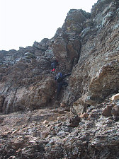
We locate the couloir that leads up to the bench on the lower northwest side of Reynolds. The climbing here is in blocky loose sedimentary rock. Care is required to avoid dislodging rocks onto others, and I make sure that I drill that idea into all of us.
Mountaineering Gear at Glacier
Approach to start of Climb
Markus wants to be extra careful not to be involved in any rock incidents, so he insists on taking up the rearmost position so that he can't possibly drop rocks on anyone. The rock is fascinating, with many interesting colors and lots of depositional marks, like ripple marks and mud cracks. Soon we're at the top of the couloir, and from here it is a short scree climb to the start of the north face goat trail.
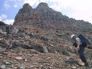
courtesy Markus
Getting close to north face
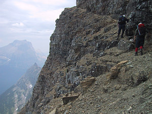
We approach (or at least I) the north face goat trail with a bit of trepidation. From below, it looks like an impossibly narrow route across a sheer face of rock. When we finally get to the start of the route (on the western side of it), it turns out to be a bit different than I
In Their Own Words...
Caroline: "Mount Reynolds: Wow, this is really different. The scree makes me nervous at first but I soon realise that it's safe enough. I really enjoyed the thrilling "goat path" on the North (?) face. It was very exciting but I was glad when it was over. As I look at the pictures, I can hardly believe I was there... It was really too bad there was so much smoke, though."
had expected, but no less scary. instead of a well-defined cut, the route is more of a slanty less-steep part of the cliff. Below the path the north face of the mountain is not actually vertical, but rather it falls away in very steep mounds of loose scree and short cliffs. Still would not be survivable if you fell down it, and still provides the feeling of lots of "air". Above the path the cliff is almost vertical, all the way to the summit.
We're determined to do it, and with sweaty palms and very careful footsteps we make our way across the north face. We are all extremely slow, deliberate, and careful. Not one of us puts a foot wrong or even slips in the slightest. In any other location walking on this path would be no big deal at all. Given where it is, traversing so high up right across the middle of a huge face of the mountain, makes it a much more mentally taxing ordeal.
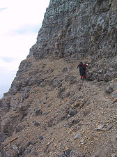
courtesy Markus
courtesy Markus
Start of north face traverse
More exposed traversing (inset annotate!)
After many long minutes (probably only about 20) we reach, with relief, the small platform partway up the northeast ridge of the mountain. We pause for a quick break and I assure Markus and Caroline that that is the worst of it, from here on it is easier and less scary. The next section traverses across the, let me see, the east face, and is actually pretty steep terrain as well, but not as bad as the traverse across the north face.
Yes, there is a traverse route
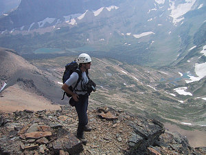
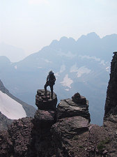
When we reach the southeast ridge of the mountain we are definitely past the worst. The south face of Reynolds is a large scree slope, not nearly as steep as the north side. Markus and Caroline draw some 'scratch graffiti' in some of the rocks here. And then we are off, trudging up the centre of the great scree slope right up to the final cliffs of the summit area. Being newbies to Glacier's peaks, we flounder a bit trying to find a scramble route up the cliffs, but with the help of occasional cairns and a bit of common sense we finally find ourselves on the very topmost summit ridge, which is not more than 10 feet wide. From here it is an easy 1 minute walk over to the high point. Success!
courtesy Markus
Dragon's Tail and Gunsight Peak
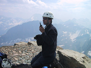
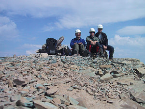
There is a large summit cairn and GMS register on the summit, which Caroline fills out for us. On the FRS radios we hear some chatter from what sounds like other hikers. After some searching for the correct FRS subcodes, we manage to contact them. Turns out they are many many kilometres (10+) away at Siyeh Pass! (another location in the park). Pretty impressive range for units that are supposed to only manage 3. We have a short conversation, exchanging info about each other and about the climb up Reynolds. It is then time for my cookie shot and a group photo. The visibility has deteriorated somewhat due to the forest fire smoke, but is still spectacular, especially to the south, with all kinds of interesting peaks, some with reasonably large glaciers on them.
courtesy Markus
courtesy Markus
Chatting with school group
On the way down Markus gets his 'straddling the continental divide' shot (the continental divide goes up and over the western ridges of Reynolds Mountain). We retrace our steps through the upper cliffs and upper scree slope, and then turn west, down the scree slope and an easy couloir back down to the path on the western side of Reynolds. Our loop (more of a spiral loop) is complete, and we've seen all sides of this very interesting peak. On the way back down to Hidden Lake Pass, we encounter many mountain goats feeding and shedding their coats on brambly bushes (I was wondering what that cottony stuff on branches was...), and from there we intercept the throngs of tourists and before we know it we are back at the car. OK. A mountain, good weather, good views, fun, and NO accidents. no slip-ups. no rockfall. That's the way it should be.
courtesy Markus
courtesy Markus
courtesy Markus
Whew... gotta get this sweater off!
Back down at the campground, Ewart and Luc and Peter have had a relaxing day... they've slept and gone out to the retail outlets just outside the park and have gotten showers and done laundry. Luc and Peter are still feeling under the weather, but are hopeful about joining us on a peak tomorrow. Ewart's butt is still sore but his spirits are good. A relaxing supper followed by a Ranger program about 'Glacier's Ranger's wives in the old days' follows.
Dinnertime at the campsite.
Interactive trackmap with photo points - Reynolds Mtn Circular Route - click map to view
Hike Data - Mt Reynolds Climb
Start Time:
10:11a.m.
End Time:
5:47p.m.
Duration:
7h35m
Distance:
10.73 km
(6.67 mi)
Average Speed:
1.4 km/hr
(0.9 mph)
Start Elevation:
6595ft
(2010m)
*
Max Elevation:
9171ft
(2795m)
*
Min Elevation:
6595ft
(2010m)
*
End Elevation:
6723ft
(2049m)
*
* : +/- 75 feet
Total Elevation Gain:
2660ft
(811m)
*
Total Elevation Loss:
2568ft
(783m)
*
* : +/- 75 feet
Elevation Graph
(For Maps and Graphs of the Reynolds Mtn climb, click
here.
For the GPS tracklogs from this climb, click
here)