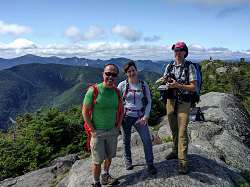
We talked a lot about Pough (pronounced "Puff"), the informally-named little subsummit of Hough, but there isn't much to Pough, and we were up and over it quite quickly. Then down and up steeply to Hough - a much more substantial 4400-foot peak that has some really nice little crags and lookouts on the southern approach to its summit.
We reached the top of Hough at about 12:45pm. The third 46R for Alana today and a perfect time for a well-earned lunch. We were making notable progress towards the pointy peak of the Beckhorn (The Beckhorn is essentially a pointy subsummit on Dix's summit crest).
By now, we'd noticed that that big group we'd seen back on the summit of East Dix -- it wasn't a random aberration. No, there were a lot of people out hiking today -- even in these supposedly remote, less-travelled herd path routes. The Adirondacks are indeed becoming quite crowded (and again, I realize that our own presence counts towards that).
Very nice herdpath at times
East Dix Slide, Annotated
The final bit of herdpath hiking to the Beckhorn was quite pleasant (as I said, much of the herdpath along the Dix Range's bumps and peaks is in quite nice shape). The only real difficulty was a very awkward V-shaped crack that had to be surmounted, just a few minutes before reaching the Beckhorn. There really is no way around it, but with enough foot and body-jamming, you eventually wriggle your way up it. As a reward, there's a nice panorama from the top of it.
Surveying completed terrain
Soon after the awkward ramp/chimney, we reached the crest of Dix's summit ridge. We were standing on a small bump along that ridge -- the bump that hosts that prominent clean-edge shelf we'd been seeing from many viewpoints along our approach. I'm not sure if it is the bump or the shelf that is labelled the Beckhorn, but in any case, we were here. This is also where, for the first time today, we intersected and start travelling on an actual official trail.
The Beckhorn shelf interests us, and we drop our packs and hike a few tens of yards downhill along the trail (away from the summit) to visit it. It's glorious little spot, almost entirely clean-faced granite. One slab relatively horizontal, and the other overhangingly vertical. We take a few gag shots and then return back up to our packs.
Despite it being over 4800 feet in elevation and the sixth-highest peak in New York State, Dix mountain's summit crest isn't completely alpine. There are many outcops of bare rock and short bushes, but there are enough low trees around for it to just fall below that mark. Having said that, the walk to the summit is still quite scenic and pleasant. We arrive to a large group of teenagers blaring out music and enjoying some summit photography. We wait for them to move on and then take a few shots of our own.

courtesy AWilcox
After recording Alana's fourth 46R summit, we move a tad north of the summit to one of the best, most open ledges, where we have our afternoon break and lunch. The day is truly glorious now - cool, sunny, mostly devoid of clouds. And the Great Range is nicely lit and arrayed out in front of us, now not all that far away to the north.
We relax and munch for a decent amount of time. However, we're aware that we are quite a long way from the trailhead (the Round Pond trailhead along route 73). And even though it is just 3pm, and we've made pretty good time to get here, it was important to maintain that pace and continue on, lest we be caught by sunset.
I'd only ever done the Dix trail from route 73 once, in winter, so this was my first time seeing the actual tread of the trail. At first it wasn't too bad, as it followed the gently sloping northwest shoulder of the mountain. But, at about 4100 feet, after passing the junction with the trail to Elk Lake, it drops off into a steep-sided basin that forms the north face of the mountain. This is the same face that sports a large set of bare open slides, and which clearly identifies Dix Mountain when it is viewed from the north.
The trail down this slope is "traditional" Adirondack rough. That means big boulders, awkard steps, and a very steep grade. This stretch descended for about 800 feet, down to about the 3300-foot level, where it emerged into the wide path of one of those slides. Beyond the slide, the trail's grade moderates considerably, and the quality of the tread improves, eventually becoming a very pleasant and smooth forest path. In fact, when you consider the entire 10-11 kilometer (6.5 ish mile) length of the Dix Trail from route 73, there is not all that much of it that is truly rough.

courtesy JInnes
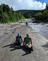
After a quick break at the very pleasant slide (nice views and very smooth bedrock), we continued on. We were basically just slogging along now, trying to cover the many forested miles to the trailhead in as little time as possible. There aren't many attractions to look at until you get to the shores of Round Pond, which is very close to route 73.