Hike to Motel 66
Day 3 - Tuesday, July 11
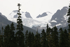
The Joffre Range
Day 3 (Tuesday, July 11) dawned gray but essentially dry, with only a few smatterings of drizzle. Still, not good! We headed out of the campground at about 7:30am, and managed good time along highway 99, reaching the gas station in Pemberton about 10 minutes ahead of schedule. Chris and Kirk met up with us shortly thereafter, and soon we were ready to continue on to the trailhead.
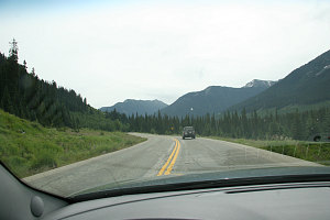
Following Chris
The weather continued its unsettled pattern as we drove up on Highway 99 from Pemberton, drizzling occasionally, and with a few lighter patches here and there (by the way, this is a nice highway through excellent scenery, and it is a fun and twisty road!!). We stopped momentarily at the parking lot for Joffre Lakes. Here, we got our first view up into the Joffre range. We could see the very large matier glacier, along with a few of the peaks in the range. Which peak would we end up climbing? And, would we be able to see anything at all when we did, given the weather? time would tell...
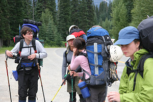
Outlining our route
A few minutes further up highway 99, we parked at the Cerise creek trailhead. Well... to call it a trailhead is a bit generous, because it isn't really an official trail. Over the years, though, a quite serviceable herd path trail has formed. If one has a vehicle that one is willing to get a little scratched, there is a logging road that leads to a higher point on the herdpath, saving perhaps an hour or so of hiking time.
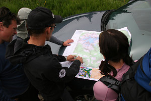
Outlining our route
Everyone got on their big, full packs. Our instructors' packs seemed tiny in comparison. Either they were skimping somewhere or their wealth of experience allowed them to pare things down to the bare minimum. Hey, maybe Pu's small pack was smarter than we knew!
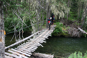
The easy crossing
The guides spread out various bits of group gear for us to carry (ropes, etc), and we were off. The path immediately descended into the cayoosh creek drainage and crossed cayoosh creek on a fairly nice wooden suspension bridge. The path head off along the flats for a short bit and then crossed cerise creek itself. Here there was no bridge - only a narrow, wet, de-barked log, and the level of flow of water was fairly high. Looked a bit treacherous!
Chris and Kirk realized that our group might have a hard time getting across this without falling into the water, so they expertly scampered across and set up one of our ropes as a fixed hand-rail. They also recommended we put on our crampons to help grip the slippery log (of course they had no trouble going across themselves sans crampons).
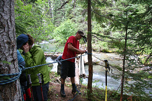
The harder crossing
While everybody started to carefully make their way across, Kirk started to ferry peoples' packs over. When it was my turn, I decided (perhaps foolishly) to try with my pack. The combination of a heavy pack and crampons on a narrow beam of wood made me pretty wobbly, and there were a couple of times where I wavered and nearly fell in, slightly bending my brand-new hiking pole in the process. Maybe I shoulda just let Kirk take my pack.
On the far side of the stream crossing, we gathered everything up again, and made ready to hike on. Turning my attention to my bent hiking pole, I applied a careful bit of force to try and straighten it out. It snapped in two. Not wanting to carry two now-useless pieces of aluminum, I left it near a tree near the stream crossing, intending to reclaim it on the return trip (in restrospect, this wasn't a smart move - when I returned 7 days later, the pole was gone).
Soon the herd path left the flat, sometimes swampy bottom of the drainage. It climbed up into an area of recent logging, where we got some nice views down towards duffey lake. the weather looks, actually, to be getting better. The sun has come out through some hazy sky and it is getting quite warm. Are we in luck? Is the weather going to change for the better?
Soon we reach a logging road (the same road that you can drive up on if you so choose). We follow this for a short while, perhaps 20 minutes, before plunging back into the woods at the edge of a clearcut. Above us we can see the snowy peaks of the Joffre range getting closer!
Once in the forest, the path becomes a bit rooty; the walk through the nice mature forest is nice, though. As we head up the cerise creek drainage, we cross a few easy side streams and one nasty bit of avalanche blowdown (through which the path will probably be re-cleared soon). Views up towards Joffre Peak are great, with excellent views of steep snow, craggy ridges and a couple of small glaciers.
Staying out of the bottom of the cerise creek drainage, we headed off to the right, to the ridge on the west side of the creek. The path through the forest became quite steep, and we made good progress elevation-wise, soon reaching over 5000 feet, where the ridge flattened out for a bit. This is the location of Keith's hut, a memorial built for Keith Flavelle, a climber who died on Mount Logan in the Yukon some time ago. The hut is quite nice, and is available on a first-come first-serve basis for $20 a night. We stopped for a nice break here, glad to know that the majority of our distance and elevation were done for today. From the hut, there is an excellent view up to the Anniversary Glacier, Joffre Peak and Mount Matier.
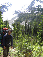
courtesy Brian
Andrew nearing Keith's hut
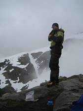
Our objective for the day was an alpine spot higher up on the ridge called "motel 66" by our instructors (so-called because it was roughly at an elevation of 6600 feet). We again resumed our hike up from the hut, and it wasn't long before we reached treeline. From here on up our walk was up a beautiful open ridge, crossing a few easy snow slopes along the way. Five hours after we started from route 99, we reached the rocky flat area of the ridge known as "motel 66".
There weren't a lot of good campsites here, and most of our tents ended up being squeezed next to one another, modern-suburban housing style. Peter and Pu were forced to pitch their tent a short ways down the ridge due to lack of space. It was a pretty nice campsite, though, with a panoramic view up into the high terrain and down into the valleys below.
Chris gave us the rundown on our facilities, showing us the trickle of snowmelt water where we could get water, and the rough ring of stones below camp that was designated our latrine. Under non-raining but mostly cloudy skies, we had a nice, relaxed, dry dinner. The fun stuff would start the next day!
Interactive Trackmap - Hike to Motel 66 - Click map to Expand
Climb to 'Motel 66' - Hike Data
Start Time:
10:57a.m.
End Time:
4:49p.m.
Duration:
5h52m
Distance:
6.48 km
(4.03 mi)
Average Speed:
1.1 km/hr
(0.7 mph)
Start Elevation:
4012ft
(1223m)
*
Max Elevation:
6567ft
(2002m)
*
Min Elevation:
3959ft
(1207m)
*
End Elevation:
6567ft
(2002m)
*
* : +/- 75 feet
Total Elevation Gain:
2588ft
(789m)
*
Total Elevation Loss:
34ft
(10m)
*
* : +/- 75 feet
Elevation Graph
courtesy Brian
Elevation profile over Distance
Elevation profile over time