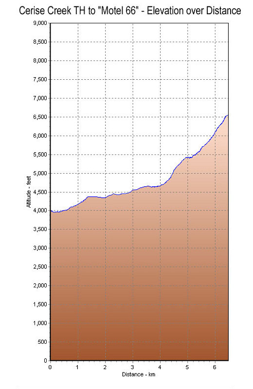
This is a GPS-derived elevation profile of our hike from the Cerise Creek trailhead to "Motel 66", graphed over distance.
This image is from the presentation "Complete Mountaineering with the Canada West Mountain School".
 Go to presentation where this image occurs.
Go to location in presentation where this image occurs.
Go to presentation where this image occurs.
Go to location in presentation where this image occurs.
Copyright 2001-2016 alavigne.net.