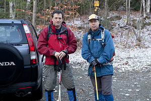
October 23, 2010 was a day all about Brian Connell and Harold Piel. It was the day that they both achieved their goal, after many years, of completing their quests to climb the 46 designated 4000-footer peaks in the Adirondacks.
This trip report documents their day.

Ready for the final journey
Brian and I had both started hiking in the Adirondacks on the same day: May 10, 1994, on the day that a total annular eclipse of the sun passed over the central high peaks. Brian was my manager at the time, and I managed to somehow convince him to authorize a day off of work for the entire team to drive down to the Adirondacks, climb a mountain directly under the eclipse's path, and watch the celestial events unfold. It was somewhat of a misadventure, with our hopelessly ambitious plans to climb Mount Marcy quickly scaled back to Algonquin and finally to Wright Peak, and with most of the group woefully unprepared for cold, late winter conditions. But we made it, and a love of the Adirondacks began (You can read all about that original misadventure
here).
So, here we were, sixteen years later. Brian and I had done many peaks together since, but he'd fallen behind a little in making it to the outings, and by the fall of 2004,
I had finished my own ADK 46. During the years since, Brian had paired up with his friend Harold Piel (who also had managed to catch 46R-fever), and now they were ready for their final outing that would cross the last of the peaks off of their lists. In a closing-the-circle sort of gesture, I offered to come along and stand on Brian and Harold's final 46R summits with them.
The remaining peaks for Brian were all of the so-called Dixes, minus Dix itself: East Dix, South Dix, Hough, and Macomb; Harold only had East Dix and Macomb to finish. They had originally planned an outing entirely from Elk Lake, but I managed to convince them of the attractiveness of a traverse from Elk Lake, over the peaks, and down the Boquet River Valley to route 73. I would meet them part way up on the peaks, and hike with them to their final summits and back down to route 73 to my vehicle. This turned out to be a better idea than they could have known: when they drove up the Elk Lake road on the morning of October 23, they found it closed and off-limits to hikers due to the start of hunting season. They then somewhat desperately drove all the way around to the Boquet River start point on Route 73, where I had fortunately not yet started off. We'd be doing the entire hike from this side.

Starts off nice...
By 7:30 am, we had started off on the herd path that leads away from Route 73. The herd path follows the course of the North Fork of the Boquet River for a bit, then crosses the river about 600 metres / yards in. It had been slightly below freezing the night before, and some of the key boulders used in the crossing still had a glaze of ice, making it a little bit dicey to cross. I didn't particularly relish an accidental morning dip into near-freezing water, so we decided to play it safe and take the alternate, more bushwhack-y route that stayed on the south side of the river.
We stopped for a short break at the crest of a wooded ridge above the river. The crest provides a nice view up the Boquet River valleys (both South and North), as well as all of the mountains in the Dix range, minus Macomb. Above the last of the colored foliage of autumn, we could see the broad bulk of Dix Mountain, pointy Hough, indistinct South Dix and a little tip of East Dix.
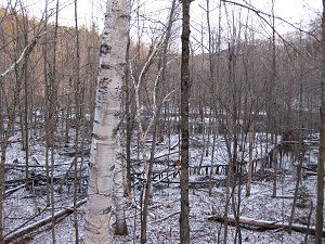
Also of note was the North Fork itself. There had been a large amount of beaver work since I was last through here, and a large area of the lowlands surrounding the river had been flooded into a sizeable lake. This meant we'd have to skirt a little further afield along our bushwhack route.

courtesy BConnell
Valley of the Boquet R, South Fk
Extensive Beaver 'Dam'-age
We spent the next thirty minutes or so making our way west along the edge of the flooded area, stopping periodically to examine the beavers' work. There was countless signs of their activity about. Busy, indeed.
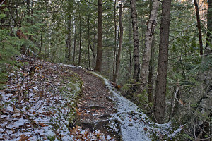
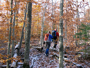
We intersected with the herd-path at the point where it re-crosses the North Fork of the Boquet River, glad to have completed the somewhat tiresome trail-less trudge. Our speed increased as we walked along the delightfully easy herdpath, enjoying the late fall colors and bright but cool morning. A thin dusting of snow had fallen the night before, and as we gradually gained altitude, it became more pronounced. One of our ascent options was to climb up the fantastic slide on East Dix. Would this dusting of snow, we wondered, put a kaibosh on that?

courtesy BConnell
Crossing to the other Boquet
After crossing through yet another area of extensive beaver dam-erage (which actually forces the route to change from its original course and skirt around it), the herdpath arrived alongside the South Fork of the Boquet River. From here, we'd be heading up-drainage into the increasingly narrow valley that drained large parts of East Dix, South Dix, Hough, and Dix. Then, at a point up-valley at about 3,000 feet, we'd decide which way we were to go: left, up the slide on East Dix, or right, bushwhacking up a drainage to the Hough-Dix col. From either of those ascents, we would start our bagging of the four peaks we had planned for the day.
We waffled back and forth between our two options: if we went up the slide at this early hour, the previous night's snow dusting would probably not yet have melted, especially given the north-west facing aspect of the slide. On the other hand, if we went up the other way, then we would be descending the slide, and if the snow had not completely gone by then, we'd have a treacherous descent (and an ascent of a slippery surface is generally perferred to a descent of one). I also hadn't been up the bushwhack route to the Hough-Dix col in non-winter conditions, so I did not know how brushy it might be down at ground level. As a result, it was preferable to me to tackle that in the descending mode.
In the end, we decided to go for the slide ascent up East Dix and the bushwhack descent down from Hough. The slide was indeed still covered in a fresh layer of snow throughout its entire length, and our brief attempts at exploring the possibility of climbing it this way revealed that it was just not prudent: apart from a general loss of traction, you couldn't see where there were sections of ice under the snow; they were perfectly masked, making for a pretty sketchy situation. We resigned ourselves to climbing up in the trees to the right of the slide, as tedious and un-scenic as that was.
We climbed up a faint herdpath that paralleled the slide for a ways. I figured that this was an intermittent thing that would soon peter out and lead us back to the slide, where we'd have to carefully pick our way up the edge. Instead, the herdpath continued to diverge away from the slide, angling towards the East Dix-South Dix col. It even appeared in places that some trail maintainance had been done. Soon it became apparent that we had stumbled onto a planned and semi-maintained alternate route up to East Dix from the Boquet River valley. I had no idea that this path existed. Normally I wouldn't take it (since the slide is much more enjoyable), but when the conditions on the slide aren't good, this is an excellent alternative.