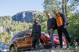
A fine early autumn 2022 Saturday was the backdrop for an introductory hike for three new Adirondack-ers: Brittan, David, and Nick. They had heard about the great hiking but had never managed to make the 3-hour drive from Ottawa to the nearby peaks of the Adirondacks. Today would remedy that.
Initially I had tentatively pencilled in Wright Peak - a fine alpine-summitted objective with a medium level of difficulty. However, as we approached the Heart Lake area at about 8:30 a.m., we soon realized that things were different in the popular areas of the Adirondacks, post-pandemic restrictions: parked cars started lining the side of the approach road more than a mile away from the main parking area near the High Peaks visitor center. It was no surprise, therefore, that the "full" sign was hung at the payment kiosk when we arrived.

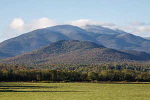
Snow on the MacIntyres
I have never seen the Heart Lake area this busy, ever. And we did not really want to add an extra 2 kilometres each way from a distant roadside parking spot. So, we decided to pick an alternate nice peak, and.... we chose Noonmark. After driving through scenic Cascade Pass and Keene Valley, we pulled into the generously-sized parking area along Route 73 near the AMR land. A new gate and a gatehouse were now present, and a large sign stated that only reservation-holders could park. The stern-ish kiosk attended confirmed this, and there was no option to reserve in real time. So... Noonmark off the table, too.
My third fallback was the Giant Ridge trail, something I knew would go because the parking for that is along the side of route 73, just a short ways south of the Noonmark parking area. Five minutes later, we arrived, looking for a [parking] spot along another immensely long line of parked cars. We did soon find an empty spot on the side of the road, and I was grateful for it. Finally, a place we could actually hike. All I can say is this: visitation to the Adirondacks now seems double what it was pre-2020. Quite eye-opening.

Below the Cliffs
Despite the abundance of visitors, we were still keen and looking forward to our hike. Giant's Ridge trail is nothing to be sniffed at: it is scenic and fun -- if a bit steep -- and not too long. It would serve as a very good medium-difficulty intro to the Adirondacks.
We started off at about 9:30 am. The trail very quickly starts a steep ascent up through the forest, frequently over rough boulder sections. There did seem to be some new rerouting and switchbacking since i was last here a few years ago. Gradually, switchbacking is [rightfully] remaking the trails of the Adirondacks.
Roughly twenty minutes of ascending brings us to the first good lookout ledges on the edge of the shelf that holds the Giant's Washbowl. From here, our new Adirondack hikers got their first good view of the wilderness of the High Peaks. And a great view it is, of the Chapel Pond Pass area, its prominent open slabs directly across from us, as well as a glimpse over to the Great Range of the Central high Peaks. Very, very nice.
Moving on from the initial lookout ledges, we soon crossed the little mountain pond known as the Giant's Washbowl, nestled beneath rocky cliffs and ringed by coniferous trees. The level of the water was quite low right now, and the log footbridge at the mouth of the pond spanned dry ground today.
Beyond the Giant's Washbowl, the Ridge trail passed some nice forest campsites, then resumed its ascent. After staying right at a junction, things soon became quite steep and very rough - the kind of bouldery roughness that sometimes gives the trails of the Adirondacks a bad name. Mostly I do the Giant Ridge trail when there's enough snow to completely cover this sort of stuff, but today, early in the fall, it was laid out before us in all of its uneven glory. Brittan commented that this might present some difficulty for her later, since she was prone to knee soreness on rough descents.
Continuing up the Ridge Trail
Twenty minutes of steep and rough trail ascent, along with some some possibly new switchbacks (can't tell for sure, but they could be new), we reached the first of the open slabs: areas where the trail climbs or scrambles up on the bare unbroken surface of the mountain itself.
Nick, Brittan and David were quite impressed with the views afforded by these slabs, off to the hazy ridges of the Southern Adirondacks, and also to the nearby higher peaks of the Dix Range. Seeping ground water glistened in the sun on the rock slabs of nearby Rocky Peak, making us briefly think that we were seeing early snow.
The next hour and a bit were highlighted by us enjoying the many excellent views as we emerged onto many different beautiful open areas, some facing south, some facing east, and some looking upwards to our ascent ridgeline. The weather was perfect - cool and slightly breezy, but bright and sunny. And although there was an incredible concentration of cars at the pass, it did not feel overly crowded up here on the ridgeline. To be sure, there were other hikers around, but it wasn't anything overly ... bothersome.
We continued to climb up the endlessly fun series of low ledges and open bits, only briefly going into the trees before coming back out into more open hiking. This is the really outstanding feature of the Giant Ridge trail: this long section of frequent open hiking is a fairly uncommong thing on the ascents of the larger peaks, which have ascents that are mostly in the trees until you get near the top.
Somewhere just below 4000 feet, the beautiful open ridgeline sections of the trail come to an end. The route now follows closely to Giant's southwestern ridgecrest, but now it is almost entirely in the trees, save for one or two limited views into Giant's big western basin.
Giant mountain is about 4600 feet high, so there's only about 500-600 feet of ascending this forested ridge - and near the top, there are some steeper sections that provide some scrambling and some decent (if limited) views back to the southwest. At these brief glimpses back to the west, we really noticed how much higher we had climbed.
Skirting the Western Basin
With a final bit of steep scrambling, we arrived on Giant's summit crest. The crest is unfortunately forested, but after hiking a short way north along it, one arrives at the broad summit ledge - completely open to the west, and at the top of the mountain's steep western basin. Although the view is only about 180-degrees, there is a very fine panorama of the Central High Peaks from here - possibly one of the best all-encompassing views of the Central High Peaks. I imagine that 80-90% of all of the 4000-footers are visible from here.
With the altitude and exposure to wind, the top of Giant was a lot less warm and comfy than had been the ridgeline ascent. Up here, the wind was cold and biting, and we elected to find a spot to hide in the low conifers just beyond the summit to have our lunch. For all the cars below at the trailhead, there weren't too many people loitering around at the summit. Not surprising, given the cool conditions.
Brittan, Nick and David were pretty happy with their accomplishment: becoming Adirondack "1ers", and with seeing this area from a mountaintop viewpoint for the first time. We staged some dynamic and sporty-looking summit photos, and then packed our stuff back into our packs and started our descent. The conditions today did not encourage lounging around.
David's Stylish Summit Shot
Brittan and Nick's Stylish Summit Shot
Nick's Stylish Summit Shot
