Fundy Footpath Day 1
Big Salmon River to Seely Beach - Sunday, August 21
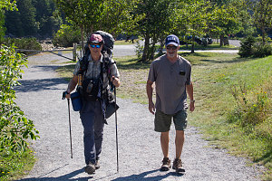
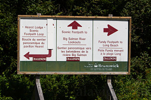
All righty, now... We are situated at the mouth of the Big Salmon River on the southern coastline of the province of New Brunswick. Months of planning and organization have now come to a head: We were now all in place at the start of the western end of the Fundy Footpath and a glorious, if a little too humid... sunny summer morning. Carl had remained to take some obligatory starting off pictures as we shouldered our packs, and then we were off. Just to the north of the parking lot is a bright greenish sign (labelled "Big Salmon River') that drew us. It talked about both the Fundy Footpath and the brand new bridges -- one for vehicles and one for hiker traffic -- across the Big Salmon River. And thusly, our adventure began...
courtesy JInnes
First ever Carl-Andrew hike
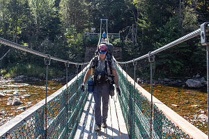
The first bit of path led north along the western banks of the Big Salmon River. In less than a minute we were walking underneath the Parkway's vehicle bridge and the delicate span of the foot suspension bridge came into view. Carl walked with us along this bit of flat, wide gravel path up to the start of the bridge. I scrambled up onto the vehicle bridge to get a nice bird's eye view of our group hiking across the long footbridge.
courtesy JInnes
courtesy JInnes
Across the suspension bridge
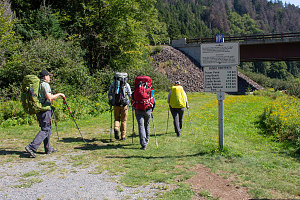
Scrambling back down from taking pictures of the footbridge, I said thank-you and good-bye to my brother Carl, and then scooted along over the footbridge to catch up with the rest of the group, who were waiting on the far (eastern) side. There were a bunch of signs here that made it seem like this point was the actual official start of the Fundy Footpath. I'm guessing perhaps these were put in place before the suspension footbridge had been finished.
In any case, the detailed signs showed the major destinations along the Footpath up until it reached the boundary of Fundy National Park, 41 kilometres away. For today, our objective was Seely Beach, indicated as 8.2 km away.
courtesy JInnes
Now that we were on the east side of the Big Salmon River, it was time to start making real (i.e. eastward) progress. A bit of grassy path, very lawn-like, led us back underneath the parkway's vehicle bridge (but now on the opposite bank of the river). Once past the bridge, the trail narrowed into a more typical hiking path.
Very shortly we entered into a thickly-treed section along the banks of the Big Salmon River. The trail was not more than a few metres above the water, but there was now a thin band of tree trunks between us and the actual shoreline. The Gorge of the Big Salmon river is fairly deep, so the ground to our left rose steeply upwards.
Unlike our previous two year's backpacks on Lake Superior, we can smell salt water and low tide aromas, which is pretty cool. A genuine maritime coastal trail!
This trail section felt pretty.... new. As in, it had the feel of being relatively recently blazed, both in the cut of the trees and vegetation, the erosion control measures, and the feel of the footbed. I imagine that over time this will settle in to something that feels a little more worn. For now, though, this bit felt fresh.
About a half a kilometre after following above the banks of the Big Salmon River, and after passing a side trail leading up to the parkway, the trail abruptly made a 90-degree turn left and went straight up the steep slope, away from the river and the coastline. Assisting us in our climb was the first of the many cable stairs that have been employed in the construction of the Fundy Footpath. These are metre-wide sections of wood 4x4s strung together along two long cables and draped down the slope. A third cable holds up a series of 4x4s that are upright, and serves as a handrail. The whole affair is a little loose, but definitely helps with the ascent of the steep slope while minimizing erosion and the chance of slipping.
Above the cable stairs, the trail and the terrain changed abrubtly again: the trail flattened out almost completely, and began a horizontal traverse below the tablelands edge above and the (presumably cliffy) final drop into the sea below. We couldn't see any of the waters of the Bay of Fundy here - we were completely in forest.
The trail was uneroded and free of obstacles along the stretch - quite pleasant. Also pleasant -- actually more than pleasant -- was a beautiful floor of thick, leafy ferns in a semi-open forest. That meant it was quite bright and sunny in spots. Very magical along this little bit. A very wonderful intro to hiking along the Fundy Footpath.
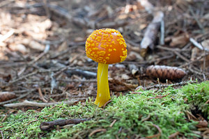
A little further along this beautiful ferny section and we came to the two kilometre mark (eastbound) along the Fundy Footpath. There was a marker and a sign on a tree at this point. The marker was a traditional round-style trail marker, but with a fancy logo of the Fundy Footpath on it. The sign was big, made of metal, finished in color, and with large clear lettering. And a very large number "2". Signifying two kilometres traveled thus far eastbound on the Fundy Footpath. We had already seen the 1 kilometre marker, but seeing this second one, it was fairly clear to us that we were going to get a big celebratory sign like this for each kilometre of our journey. Cool.
courtesy JInnes
More pleasant traversing path brought us to the first true coastal view on the Fundy Footpath so far - a limited view looking back west along the coastline. The tide was out, so the rocky margin of the Bay of Fundy's floor could be seen. There was a nice bench here and thus this was a good spot for our first break. I figure we were at about 2.5km distance from the Big Salmon River trailhead at this point.
Not ten minutes later, we crossed a tiny forest brook and arrived at a flattish area in the forest. There were a lot of signs here, too, including signs and blazes for a camping area known as the Big Salmon River Campsites. Now, all literature I had recently seen on the Fundy Footpath had indicated that these campsites were now closed - however, there was no indication of this at all anywhere, and the campsites themselves looked perfectly viable. To me, these spots looked completely usable (as of summer 2022, anyway).
Another interesting (and a touch ridiculous) sign in this area warned backpackers to boil water for 10 minutes (presumably before using to drink or cook). I'll state right here that that is much longer than necessary. Lots of studies have been done and it is extremely unlikely that anything more than a minute or two of boiling is required. The general feeling, in fact, is that even just reaching a boil is likely good enough. Ten minutes = big wastage of camping fuel and time.
Big Salmon River Campsites
East of the Big Salmon River backcountry camping area, the trail returned to steep bay-slope traversing, still in forest, and often still through pleasant areas of ferns and moss. We were starting to approach the next major point of interest along the coastline - the Long Beach area - and the trail started to edge back towards the coastal cliffs. As a result, we soon started to get fairly frequent and very pretty views east to the wide flat sands of Long Beach (especially since it was still low tide).
First Glimpse of Long Beach
Looking Down Landslide Scar
Return to Ferns and Mosses
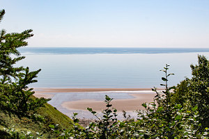
Nearing Long Beach, the trail finished its traversal of side-sloping forest and arrived at a lower, flatter area near the mouth of Long Beach Brook. There were a few areas of open grassy bluffs along this section, with much more expansive views of the bay. This section was more what I had imagined the Fundy Footpath would be like, and it was nice to finally encounter a bit of that.
courtesy JInnes
A distance sign marked our arrival at the banks of Long Beach Brook, which we had to ford. On this warm, humid day on a fairly dry summer, the waters of the brook were a trickle, and it was a simple matter of a few rock hops to cross it. Immediately beyond the brook, we re-joined civilization: a wide lawn, a parking lot full of cars and a tidy little interpretive center building and picnic tables. We had arrived at the Long Beach stop along the Fundy Trail parkway.
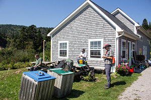
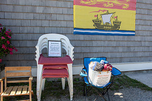
We stopped at the Long Beach interpretive center for our second break of the day. There were bathrooms here and picnic tables to sit on. Just outside the interpretive center, the parkway's staff had arranged toys and chairs and games and other items that tourists might want to use on a warm and sunny day like this. We took advantage of the bowl of soapy suds and the bubble maker. The whole arrangement at this Long Beach stop along the Fundy Footpath was surprisingly comprehensive, complete, and friendly.
courtesy JInnes
courtesy JInnes
Break at the Interpretive Center
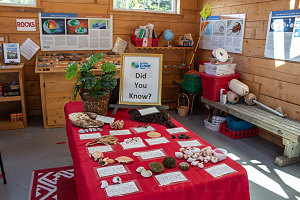
Interpretive Center Interior
courtesy JInnes
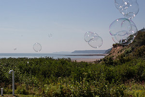
courtesy JInnes
After a long and lazy break in the hot sun (there are no trees or shade here), we decided to continue our journey eastward towards Seely Beach. Across the parking lot from where we were seated we could see a long flight of wooden stairs and the now-familiar small insignia of the Fundy Footpath on a nearby tree, marking the continuation of the Footpath eastbound from the Long Beach area.
courtesy JInnes
Fundy Footpath Continues...
At the top of the long flight of stairs, easy, wide and mostly flat trail led eastward. The cliffs above the Bay of Fundy were lower here, and again the trail frequently poked out along grassy bluffs with views out over the water. We were also very close to the Fundy Trail Parkway itself here, and in a few spots we could turn our heads inland and see -- between tree trunks -- cars driving on the parkway.
Eastern end of Long Beach
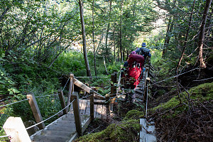
About twenty-five minutes after the end of our break at Long Beach, we came to a descending set of cable-stairs to a small brook. Beyond this point, the trail became more.... remote, I suppose, once again. We were farther away and out of earshot of the parkway, and the trail was a little rougher - although still quite pleasant and in some places nicely constructed. A long section of sideslope traversing was also quite interesting and pleasant, with a steep slope leading up on our left and a steep slope on our right down to the waters of the bay, which once again was at times visible through the forest trunks. Like many sections of the Fundy coastline where there is a steep slope, the forest here was mostly tall coniferous trees, and there was often a nice preponderance of moss. On a hot and sunny day like today, the shady and cooler hiking along these bits was appreciated.
courtesy JInnes
Down to a stream crossing
Well-constructed trail segment
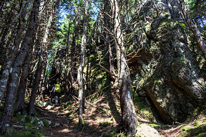
The secluded trail continued eastward, continuing to traverse along a steep forested side slope for about an hour in total. In places, the trail wound up and down steep gullies. In other places, it was quite "root-y" (tree trunk roots, I mean). I had seen several videos and descriptions of the extreme roughness of the Fundy Footpath and imagined endless kilometres of this - but so far, we had only encountered this sort of thing in a few places.
courtesy JInnes