Backpack Day 6: Hook Falls to Hattie Cove
Saturday, July 31
It rained pretty decently during the night - in several long periods. By the morning, however, the precipitation had stopped, although a solid overcast remained. As did the humidity.
Today was our final backpacking day. We had somewhere on the order of ten to twelve kilometres left to go, give or take, and then we'd be done. In all, we'd enjoyed ourselves. But thoughts began to turn to bathrooms and showers and especially burgers. The usual "end-of-trip/return-to-civilization" hankering was upon us.
After packing up and heading out, we immediately (within a minute or two) turned in to take in Hook Falls for one last time. In the higher relative humidity of morning, the weird warm-water sauna effect of the falls was even more pronounced: clouds of steam and mist rose off of the water.
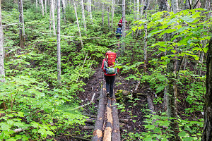
courtesy JInnes
The first part of our morning is spent following the trail as it parallels the southern banks of the White River. I had expected, given our relative proximity to the park headquarters, that the trail would have started to get wider, smoother, and with more infrastructure. While the last item was starting to be true (there were definitely many more sturdy wooden bridges and such), the trail itself was still rather rough and rooty. And there were a lot of tiring little steep ascents and descents, as the trail crossed over all of the little ravines draining down into the White River.
Infrastructure Getting Better
After about forty-five minutes of this type of trail, we arrived at another modern suspension bridge. This one was the doozy of the trip. A long and very high crossing of the gorge of the White River.
This was definitely a scenic highlight. One crosses probably 75 or so feet above the angry, frothing water, which is rushing down a sort of natural sluiceway in the granite. This long and intense area of whitewhater is known as Chigamiwinigum Falls, although once again it has more the feel of rapids than an up-down falls. The gorge is quite deep and long here. It would take some serious whitewater skills to run this section of river.
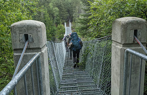
courtesy BConnell
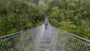
courtesy JInnes
Arriving at Big Suspension Bridge
White River Suspension Bridge
Brian and Alana over the White River
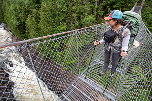
courtesy JInnes
Jenn, White River Suspension Bridge
We take our time snapping shots and marvelling at both the river gorge and at the construction of the suspension bridge, before continuing on our way.
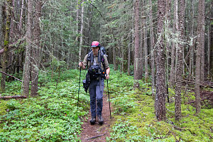
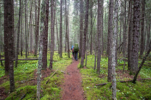
Immediately on the far side of the bridge, a transformation: where we had spent the last hour toiling up and down a sometimes muddy and rough sideslope, the character of the trail now changed. It was now wide, nearly completely flat and smooth, and it was a welcome relief. Our hiking speed probably doubled or tripled.
courtesy JInnes
courtesy JInnes
For about a kilometre, the trail continues flat and wide and smooth. As the trail begins to curve away from the floodplain of the White River, it starts to undulate over some more uneven terrain, but still, the going is pretty good. Certainly it is clear that there is more foot traffic here, given the width and wear on the trail. Certainly much more so than the faint almost non-path we had started out on five days prior at North Swallow Harbour.
We arrive at a trail junction with the Mdaabii Miikna loop trail, but we realize that it is the western junction. We seem to have hiked right past the eastern junction without noticing any marker or sign. Another example of poor park trail marking?
Crossing a Playter Harbour Creek
Arriving at the eastern Mdaabii Miikna means that we are also soon to be arriving back at the Lake Superior shoreline, and sure enough, it isn't long before we see a sign for the PH1 backcountry campsite at Playter Harbour. Weirdly, the sign says "PH1, 1km" which makes no sense to me, as my GPS shows clearly that we're only a few metres from the lakeshore. A few of our group are like "nah, we don't want to walk 1km off the trail for a lakeside rest break". I tell them to hold on for a sec - I'll go look. And yeah, the backcountry campsite is maybe 40 metres down the side path. What is the park thinking here, letting such a big and obvious error remain on a sign?
The Playter Harbour campsite is quite nice - not a ton of tent space, but situated on an intricate bit of bedrock shoreline that has tiny micro-inlets and rock ribs. We have our morning break on one of these rock ribs, looking out over the water of the Harbour. A small boat powered by an outboard comes slowly motoring into the Harbour as we eat. There's a strange howling emanating from the boat, which we soon can see is the soulful mourning of a large hound perched on the boat's bow. A desperate desire to be off of the water? Maybe a canine foghorn?