Halls Creek Narrows Day 2 - The Narrows
Capitol Reef NP - April 2
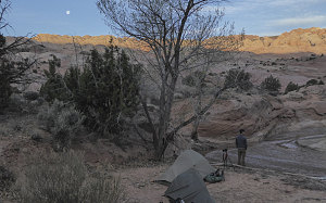
We awoke as morning twilight brightened the skies. It was calm and mostly clear out - something I was glad to see, since I was tiring of this drab high cloud cover we had been experiencing the past few days. Today was going to be the most interesting part of the backpack - the day we'd get to see the beautiful narrows of Halls Creek.
courtesy BConnell
Sunrise at Halls Creek
Our plan was to do the narrows as a loop; there's a low pass adjacent to the stretch of narrows that can be easily hiked, and using that either before or after doing the narrows, an easy loop of 11 kilometers (7 miles) can be done. We had positioned our camping location for maximum convenience, right on the edge of this loop (regardless of which direction we chose).
After breakfast (and taking some cool zoomed shots of the waning gibbous moon against a horizon of slickrock), we tidied up camp, securing the tents against possible wind or inclement weather. We had decided to do the loop by first hiking over the low pass (known as the Hall Divide) down to Halls creek on the downstream side of the narrows. Then, we'd turn upstream and hike through them, finally arriving back at our campsite to complete the loop. The low sun was casting some nice light and the wider-scale scenery (visible over the low pass and not visible while in the narrows) were best seen now, early in the morning. Also.... doing the narrows as the second part of the hike was a bit like saving the best part for last.
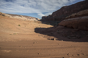
Up a Slickrock Bowl
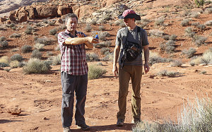
There's a defined herdpath that leads from Halls Creek (above the narrows) to Halls Creek (below the narrows). We started out south directly from our campsite, and so the first few hundred yards were not technically on this herdpath, but eventually we meandered over to where we figured it would be. Like the main herdpath down from the Halls Creek Overlook, it was quite a nice little footpath, clear and free of any troublesome obstacles. In the early morning light, we had some grand views back north, looking obliquely across the slopes of the Waterpocket Fold.
courtesy JInnes
Fabulous Capitol Reef Scenery
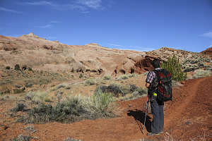
Hall Divide - the pass separating the upper part of Grand Gulch and Halls Creek from the lower part - is not much of a feature. It's perhaps only 150 feet in elevation, very gently sloped and not much of an obstacle. But it was apparently enough to divert the course of Halls Creek to the west and over the Navajo Slickrock (which was presumably much flatter at the time), allowing it to slowly carve the gorge of the Halls Creek narrows over eons, even as tectonic forces tilted up the Waterpocket Fold.
courtesy JInnes
Descending to Halls Creek
An easy and leisurely hour of hiking brought us from our campsite, up and over Hall Divide, and back down to Halls Creek. It was flowing with a fair bit more water here than it had been back up at the start of the narrows. Still, it was [at the moment] a placid little clear-watered creek.
We stopped for a short break and switched into water shoes. From here we turned right, heading upstream, and basically walking directly in the bed of the creek. The water was not cold and was only a few inches deep in most places.
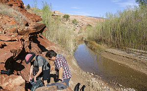
courtesy JInnes
We splashed up this open part of Halls Creek. Reeds and other riparian vegetation lined the banks, and the walls had not yet closed in. It was pleasant, sunny, comfortable, quiet and peaceful here.
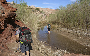
courtesy JInnes
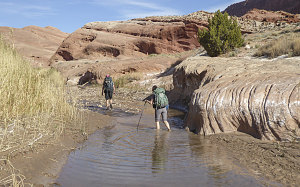
courtesy BConnell
courtesy JInnes
Beginning the upstream walk
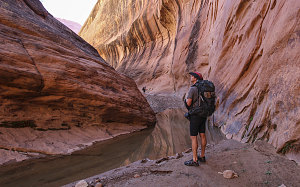
About ten minutes of upstream wading and the white walls of Navajo Sandstone started to slope up and up, and soon, we were in a fairly narrow V-shaped canyon, still for the moment fully open to the sun. Seeps of groundwater wetted the walls near us, with bits of vegetation making a home directly in the rock.
courtesy JInnes
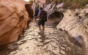
The walls continued to climb higher as we walked upstream. A slight bend in the watercourse and we were in the shade and out of view of the open lands behind. Ahead we could see yet higher walls, now vertical enough to be streaked with the blackened marks of desert varnish. Another bend ahead and the view disappeared around a corner.
courtesy JInnes
A few corners later we came to a constriction and slight dip in the bottom of the canyon, and here we encountered a stretch of water that we could tell was more serious (i.e. deeper). I took the lead, carefully prodding my way along, happy to discover that it only went up to mid-thigh at its deepest (guidebooks say that at times there can be sections requiring wading in these narrows).
Streaks of Desert Varnish
Streaks of Desert Varnish
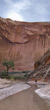
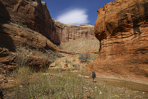
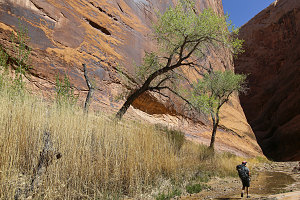
Beyond the deep stretch, we were treated to a couple of beautiful huge bends, slightly more open and allowing some vegetation to grow, including a few beautiful solitary cottonwoods placed in very attractive locations relative to the orange and yellowish walls of sandstone. Down here in the warmer southern end of Capitol Reef National Park, these cottonwoods had started to bud, giving the canyon a few beautiful touches of bright spring green.
After an hour or so walking up Halls Creek, one thing was clear: these narrows definitely belong in the top list of excellent canyon narrows of the Colorado Plateau: huge sheer walls, a beautiful flowing creek, lots of desert varnish, sunny bends and shady passages. It ranks right up there with the likes of Coyote Gulch, Escalante River, Paria Canyon, the Narrows of Zion, and several other of the greats. And arguably more secluded than all of them.
courtesy BConnell
courtesy JInnes
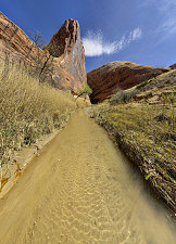
After Brian and Jenn got up close and personal with some cattails, we turned an especially beautiful corner with some soaring buttresses of sandstone. After walking around them a bit, they seemed to be the remnants of previous (and now abandoned) bends the river had cut. This section was probably the most visually interesting of the entire stretch of narrows.
courtesy JInnes
courtesy BConnell
The Beauty of Halls Creek
Criss-crossing watercourses