Intercanyonnect
Introduction
I was fortunate enough to attend IBM's huge annual spring conference - Interconnect, they call it - in Las Vegas this year. And while the conference is an interesting expose of tech industry trends and all of that, many long-time readers of my website will know that my deeper "connect" is to the beautiful sandstone canyons of the nearby Colorado Plateau. So, as the conference approached, I spent some time seeing if I could convince any of my work colleagues - both near and far - if they'd like an intro to these canyons. I dubbed the discussion channel for this endeavor "Intercanyonnect", and that quickly became this presentation's title.
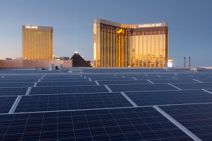
Convention Center Roof
I proposed two separate outings from Las Vegas - one on the weekend before the conference, and one after. In both cases, I based the outings out of Zion National Park, the closest of the big southern Utah national parks (to Vegas). The relatively short distance (a two and a half hour drive) meant that we could fairly comfortably plan and execute a day trip from Las Vegas.
Angel's Landing
Pre-conference, Sunday, March 19
For the Sunday before the conference, I managed to snag Janhavi and Blake, two friendly work colleagues. They had respectively travelled from Texas and California to attend Interconnect and had arranged to be free on the Sunday before the conference started. I introduced them to the harsh world of Lavigne hiking protocol by forcing them to meet me in New York-New York hotel lobby at 6 a.m. sharp. I knew Blake was taking this seriously when he mentioned that he had had to curtail his partying the night before - although the dribbles of egg over his clothes were somewhat concerning.
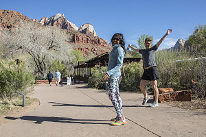
Yay Zion
We had a fun drive to Zion on a cool but sunny Sunday morning. We tempted Blake with the delicate fragrance of salt and vinegar chips until he could no longer contain himself, and he was saved only by our arrival in the little resort-like town of Springdale, just outside of the main entrance to Zion National Park. Around us, the soaring pink and white walls of Zion canyon were already capturing our attention.
Also capturing my attention was the traffic. As in, there was a lot of it. Although it was only around 10 a.m. in the morning, a long car lineup had already formed for the main entrance gate. Knowing the layout and operation of the park fairly well, I made a decision to snag a nearby street parking spot, and we walked through the park's nearby pedestrian entrance.
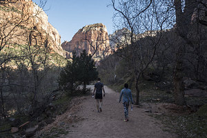
Angel's Landing Ahead
For our day's outing, I had chosen fabulous Angels Landing as our hiking destination. A short hike highlighted by an amazing final half-mile exposed scramble, it is immensely popular. And neither Janhavi nor Blake had ever done it.
During the spring, summer and fall, all non-overnight visitation to the main part of Zion canyon is by park shuttle, so having left our car outside the park was of little consequence. We strolled through the grounds of the visitor center and lined up for the regular no-fee shuttle (well, there is a fee, I guess, in the form of the park's entrance fee).
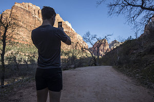
Angel's Landing Ahead
I've done Angel's Landing many times, and I know how busy it can be. I decided to offer Blake and Janhavi a few moments of hiking peace by getting off at the Zion Lodge stop and walking the short half-mile along the floor of Zion canyon to the Grotto stop, where the regular hiking route to Angels Landing begins. In the cool morning shade, we got some nice introductory views of the surrounding 2000-foot high canyon walls, and of the triangular wedge of Angels Landing itself, already visible ahead through budding cottonwood trees.
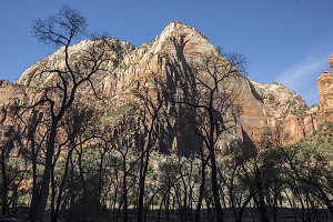
The Mighty Lady
In a few minutes we arrived at the Grotto junction, and joined the large stream of hikers using a sturdy footbridge to cross over the Virgin River (the watercourse that is carving Zion Canyon). Beyond, we turned right and started along the West Rim trail, on the first leg of our journey up to the top. From here, Angel's Landing appears as a massive salmon-colored desert mountain, rising over 1,500 feet above us.
Must... Capture... Photo!
The first few minutes of the West Rim trail are flat and easy, paralleling the Virgin River. Soon, however, the well-surfaced, wide path begins to angle up towards the canyon walls, switchbacking ever more steeply and cutting ever more deeply into the increasing gradient. Both Blake and Janhavi marvelled at the engineering skill that went into the trail and at the astoundingly beautiful views down Zion Canyon that unfolded as we climbed.
The steep grade of the trail and the direct sunlight soon had us sweating pretty decently - the chill of the cool morning shade long gone. We stopped briefly at the highlight of this section - the long overhanging rock cut across a sheer section of cliff - and then followed the trail as it turned a corner and entered the shady depths of Refrigerator Canyon (aka Telephone Canyon). The trail is relatively flat in here for a bit, as we traverse underneath the bulk of Angels Landing, which now towered directly overhead and was essentially invisible for the moment.
Towards the upper end of Refrigerator Canyon, the West Rim trail began to ascend again, culminating in a neat section of very tight steep switchbacks known as Walter's Wiggles, named after one of the planners of the West Rim trail. Blake was especially fascinated and invigorated by this section of trail, and he rapidly wiggled his way up to the top of them, taking a time-lapse movie sequence with his iPhone.
At the top of the lung-busting steepness of Walter's Wiggles, we arrived at Scout Lookout. The lookout is positioned on a sharp-edged ledge that provides one of the first of the fabulous and dizzying views directly down into Zion Canyon. Already, the shuttle buses along the park road looked like little toys.
From Scout Lookout, the West Rim trail bends to the west and continues climbing. But this we did not follow, for the side route to Angels Landing branches east here. Beyond a small brown metal sign (warning of danger), the trail ends and the route becomes more of a rock scramble, aided by a sturdy metal chain-rail that is present along most sections. I confirmed with Janhavi and Blake - ready to proceed?
The biggest challenge along this final stretch to the top of Angel's Landing is not physical, for the actual scrambling is always easy and the chain is never far away if you need it. The biggest challenge is mental, for there are many places were you feel the "exposure" of the immense dropoffs. A steady, calm frame of mind goes a long way to helping you along.
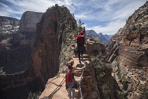
The narrowest part
Blake and Janhavi were both a bit freaked by the exhilarating trail, but wore their fear in a cheerful sort of way. When we reached 'the section', however - a spot where the trail is perhaps three feet wide and with steep dropoffs on *both* sides - Blake had had enough. He sprawled out on the wider sandstone just beyond and confessed that he wouldn't be able to continue (despite my assurances that that had been the scariest part).
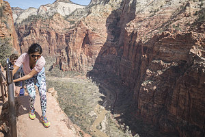
Focus replaces smiles
As Blake slowly and carefully crawled back towards the safety of Scout Lookout, Janhavi and I continued on. The biggest battle involved the crowds of people - the Angels Landing trail is so popular and the narrowness of the route so confining that foot traffic congestion is a real problem. Sometimes we had to wait minutes in order to take even a single step forward. This is the biggest drawback to this trail, which is excellent in all other respects. If you can do this trail before or after regular hiking hours, do it. It'll be a much better experience.
About thirty minutes after Blake turned around, we topped out on Angels Landing's summit ridgeline. We took a few celebratory photos of Janhavi's summit success and had a quick snack break.
A Truly Airplane-like view
We battled the hiker traffic on the way back down (I'd say it probably takes twice as long to hike the ridgeline when there is hiker traffic versus when it's empty), finally arriving back at Scout Lookout and re-connecting with Blake, who appeared to have perhaps bathed in the sun waiting for us for a bit too long. The walk back down was brisk at first and then degenerated into a full run on the lower section, as Blake once again developed an excess of energy. This extra speed was all good, since we had an evening work function to attend and getting back to Vegas not too late was a useful thing.
Angels Landing - Hike Data
Start Time:
10:59a.m.
End Time:
2:29p.m.
Duration:
3h29m
Distance:
8.1 km
(5.04 mi)
Average Speed:
2.3 km/hr
(1.4 mph)
Start Elevation:
4258ft
(1298m)
*
Max Elevation:
5784ft
(1763m)
*
Min Elevation:
4258ft
(1298m)
*
End Elevation:
4338ft
(1322m)
*
* : +/- 75 feet
Total Elevation Gain:
1545ft
(471m)
*
Total Elevation Loss:
1476ft
(450m)
*
* : +/- 75 feet
Elevation Graph