Rained Out!
Day 5 - Thursday, July 13
A second night of wind and rain further moved our tent along the path to being fully wet. The particular patch of ground upon which our tents rested was a slight hollow (unlike the instructors' tent, which was fortunately on a well-drained convex piece of ground). I could feel the gooey mud building up under the tent floor.
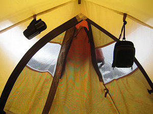
courtesy Brian
Brian's World
In the morning, outside, it was more of the same - in the clouds, on-and-off rain, and no visibility. We dutifully had our breakfasts and got ready. Chris and Kirk were trying to decide what to do today. They were thinking, I am fairly sure, about how much more of this bad weather to tolerate before switching gears. We had a fair bit that we had not yet covered - ice stuff, glacier stuff, and the week was running out.
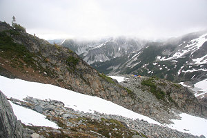
A look back at Motel 66
We eventually did decide to head over to the glacier for some coursework, but with the proviso that if the weather deteriorated further, we'd "re-evaluate" (this became a favourite term of Chris' on this trip).
Peter had had a bad night's sleep, and to top it off, was feeling a bit sick. He decided that it might be best if he skipped today's lesson and stay in his tent, resting. As it turned out, this was the right decision for more than one reason!
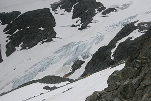
The Anniversary Glacier
We trudged over in the rain to the edge of the [Anniversary] glacier and roped up. We then proceeded over to a section of the glacier that was partially exposed (by exposed I mean that the underlying body of ice of the glacier itself was visible at the surface and not covered by snow). In ever increasing rain, we stood around and watched as Chris and Kirk demonstrated how to place ice screws in glacier ice. The standing around and watching, with water streaming and dripping everywhere, was cold and demoralizing. We proceeded to get out our crampons, and started a bit of roped travel up a steep section of glacier ice, with Chris and/or Kirk placing ice screws for protection. This ended up being a slow and tedious process, and Chris and Kirk were noticing that the interest and focus of the class was waning. No one complained when Chris announced that maybe we should cut the class short and head back to camp. From there, we'd "re-evaluate" and decide whether or not we would continue to stay up at our camp in the rain. I think most of us were wondering what needed re-evaluating.... (not that it wasn't sensible to continually re-evaluate - it was just that it seemed there was extremely little hope of any weather change anytime soon!)
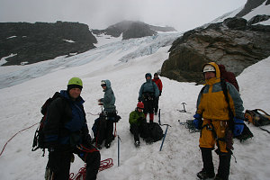
Drenched, cold, and tired
We skedaddled off the ice, back onto the snow, and back to our campsite. The wind gusts had taken the air vent of my tent and pushed it inside out, as I'd feared it might, and my side of the inside of the tent was now at the end of what was effectively a drain pipe. Needless to say, my sleeping bag had received a lot of water.
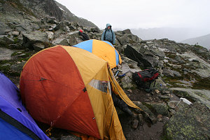
A soggy mess
The weather was still just as unpleasant as it was 30 minutes ago on the glacier, and so we decided to bug out, and head down to the warmth and dryness of Keith's hut, 1000 feet lower down. No one complained about this decision.
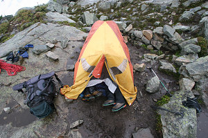
The guides retreat
Knowing they'd be able to pack themselves up 3 times faster than us, Chris and Kirk retreated to the dryness of their tent and chatted. Just about everything we had was fairly wet now, but I didn't care - just pack it in the pack, and get it down to the hut, where we'd lay everything out to dry. Jenn and I were ready to go first, and I desperately wanted to ask Chris if we could just start down ahead to the hut, but I restrained myself, thinking that they probably didn't want unknown-quantity-students off on their own and potentially getting lost (not that I had any doubt about my ability in getting down to the hut by myself, but of course Chris couldn't know if that was so or not...) So... we waited around, absorbing a few more millimetres of cold rain. Oh well, at least my synthetic clothing was working well!
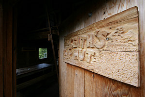
An inviting sign
Eventually we were all packed and ready to go, and we trudged down the ridge, into the forest, and to the hut. Along the way, I struck up some conversations with Chris, asking him about what other things he did besides instructing, learned a bit about his views on various subjects, and what he thought about this or that. A nice conversation. Chris is very experienced, very knowledgeable about the things in his domain.
Out of the rain
Finally, we reached the hut - and no one is in it. Excellent. We have lots of space to lay out our stuff. Every hook, knob, hanger, pole, and rod is pressed into service for hanging some piece of gear or other. It is wonderfully dry and warm in the hut - Kirk was sent ahead to the hut to start a fire in the stove, and it is toasty warm.
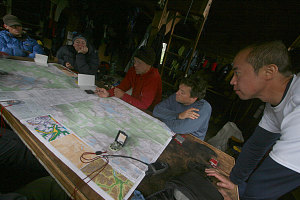
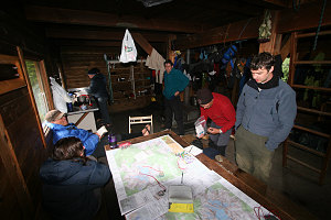
A dry place to talk maps
After organizing ourselves, Chris gives some map-and-compass instruction to try and make something out of the remainder of the day. We then talk about what we are going to do the next day (or 6th day). Chris suggests that we try for our 'summit' if the weather doesn't look too bad. Outside the hut, up in the sky, we actually see a few bright patches and even a bit of blue sky. This will be our last chance, because after the next day we'll have to head back down to the car.
The 'course' part of the day now officially over, we read or play some of the games that are stashed in the hut for (what else) a rainy day. Catherine and I have a long game of chess, which Pu watches with some curiosity (he's never played 'western' chess).
Whole lotta dryin' goin' on
Dinner comes, then goes, and then we retreat upstairs to mostly dry sleeping bags for a night of sleep, listening, rather than feeling, the steady drumbeat of the rain (which has returned with a vengeance) on the roof of the hut. I'm quite glad that we're not staying in a room at motel 66 tonight.
Interactive Trackmap - Ice Skills and Retreat to Hut - Click map to Expand
Start Time:
9:04a.m.
End Time:
11:39a.m.
Duration:
2h35m
Distance:
1.71 km
(1.06 mi)
Average Speed:
0.7 km/hr
(0.4 mph)
Start Elevation:
6501ft
(1981m)
*
Max Elevation:
6569ft
(2002m)
*
Min Elevation:
6230ft
(1899m)
*
End Elevation:
6562ft
(2000m)
*
* : +/- 75 feet
Total Elevation Gain:
429ft
(131m)
*
Total Elevation Loss:
424ft
(129m)
*
* : +/- 75 feet
Elevation Graph
Descent to Hut - Hike Data
Start Time:
12:21p.m.
End Time:
1:27p.m.
Duration:
1h5m
Distance:
1.37 km
(0.85 mi)
Average Speed:
1.3 km/hr
(0.8 mph)
Start Elevation:
6553ft
(1997m)
*
Max Elevation:
6559ft
(1999m)
*
Min Elevation:
5406ft
(1648m)
*
End Elevation:
5424ft
(1653m)
*
* : +/- 75 feet
Total Elevation Gain:
2ft
(1m)
*
Total Elevation Loss:
1099ft
(335m)
*
* : +/- 75 feet
Elevation Graph