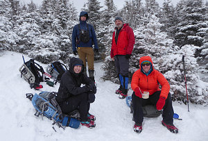
My good buddy Brian is working (slowly) on his Winter 46. He was away on vacation in warm sunny climes for much of the winter 2019 climbing season, and the end of official winter 46R summit season (i.e. the start of spring) was rapidly approaching. He wanted something medium-length and straightforward, and looking at Brian's current W46R list (he is at 18, currently), I thought about what we might do. Phelps was on his to-do list, and fit the bill as something more than reasonable - not too long, and a straightforward climb. And although it didn't have a fully open top, its summit ledge offered a commanding close-up view of the central High Peaks.

courtesy CDoucet
What is this!?
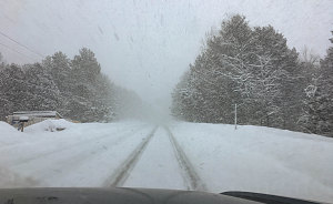
The weather forecast wasn't ideal for our chosen day -- Saint Patrick's day -- but spring was only a few days away and it was go, or else miss this as a winter peak. And as we were driving down, heavy snow squalls and cloudy skies made us think we might have a boring in-the-white trudge today. However, as we approached the ADK high peaks visitor center parking lot, patches of blue appeared between puffy clouds. However, snow showers and mist wreathed the higher peaks. Still, promising.
The trail conditions were solid and consistent hard-pack with a dusting of snow over a slightly icy base. We therefore opted for barebooting with microspikes, and made good time to Marcy Dam. A fair number of backcountry skiiers were out today, perhaps hoping for a winter ascent of Marcy or a nice ski through beautiful Avalanche Pass.
Trail conditions remained easy and excellent all the way up the Van Hoevenberg trail to the Phelps junction. Although the trail from here was a bit less travelled and steeper, it was still hard and appropriate for continued bare-booting. It was a slow but straightforward walk all the way up to the 3600-foot level, where we encountered a few steep ice bulges that required some careful footwork and the use of our ice axes.
Above this icy step, the trail steepened and climbed up to Phelps' summit ridgeline. Although it never truly emerges into alpine, there are some very nice short-tree sections of steep trail that offer excellent views south and west towards Mt Colden, which looks nice and pointy from this angle. There was a substantial snowpack in most places, and this elevated us up above many of the treetops for even better views. The last little stretch to the top benefitted especially from this elevated snowpack, giving us continuous views to the surrounding landscape.
Speaking of that landscape, it was unexpectedly visible. Although the forecast had called for "cloudy", there had been in fact quite a lot of sunshine - more than 50% of the time. And the earlier mists and snow showers that lingered around the highest peaks began to dissipate as we reached the top. Much better than I had hoped for!
Phelps' actual summit is in the trees just beyond a prominent southeast-facing ledge, and we took a few minutes for Brian to visit it for his official 19th winter 46R summit. The real attraction of the summit, though, is that ledge. It opens towards a grand view of Mt Marcy and a few of the higher peaks of the Great Range.
Although a chilly wind sometimes blew, the late winter sun often shone on us and noticeably warmed us up, making our lunch stop reasonably tolerable.

courtesy BConnell
We started down at roughly 1pm, and with the solid and smooth trail conditions, made very good time back down to the junction with the Van Hoevenberg trail. From there, it was an easy and straightforward stroll back down to Marcy Dam, and following that, the mildly tedious walk back to the visitor center parking lot.
Nature's Champagne Glasses
We arrived back at around 2:50pm, finishing the 8.5mi (13.8km) hike in a very respectible five hours and five minutes - a higher average speed compared to most of our hikes. On the whole, the hike had gone better than expected - nicer weather, better trail conditions, and better views than I had hoped for. And congrats, Brian, on your 19th Winter 46R!
Interactive trackmap with photo points - Phelps Mountain - click map to view
Phelps Mountain - Hike Data
Start Time:
9:39a.m.
End Time:
2:48p.m.
Duration:
5h8m
Distance:
13.78 km
(8.56 mi)
Average Speed:
2.7 km/hr
(1.7 mph)
Start Elevation:
2122ft
(647m)
*
Max Elevation:
4164ft
(1269m)
*
Min Elevation:
2028ft
(618m)
*
End Elevation:
2193ft
(668m)
*
* : +/- 75 feet
Total Elevation Gain:
2229ft
(679m)
*
Total Elevation Loss:
2162ft
(659m)
*
* : +/- 75 feet
Elevation Graph
