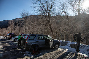
Today was another attempt at an outing with work folks. While we weren't completely successful (in getting everyone out en-masse), we did manage to up our count from the
Hurricane Mountain hike two weeks ago, for today there were four of us instead of three: Myself, Gino, and Chris (Hatko), as before, and one new participant: Mouhcine. Like Gino from two weeks before, this was Mouhcine's first ever Adirondack hike.
I believe any good Adirondacks intro should be up something nice, and today, Cascade Mountain was that something. Short and with a beautiful summit, it is a perfect intro - if a bit busy at times.

Cascade Trailhead
The forecast had been nice and sunny, and indeed it was quite sunny on the drive down. But the forecast had once again (like so many times this winter) deteriorated, and it was now predicting mostly cloudy skies by noon. Hopefully not....
The weather over the previous two weeks in the Adirondacks had seen a number of thaw-rain-freeze cycles, and it was apparent from a quick glance that the snowpack had reduced and hardened considerably from before. There was really no point in putting on snowshoes, other than for perhaps a bit of traction, and as a result we elected to bareboot it.
The first half-mile/kilometer or so wasn't too bad. Mostly the trail was just hard-packed snow, and barebooting without any traction aids wasn't too bad. Then, however, we got to the beginning of the steeper climbing sections, the part that climbs diagonally up to Cascade's southwestern ridgeline. The exposure of this slope is to the south, and the extra steepness combined with that sun-facing exposure meant that there was now a lot of ice; bulges and steep slopey bits, often thinly covered with a tiny bit of snow. I elected to put on my microspikes, which helped immensely. Although I didn't have microspikes to go around for everyone, I did have full-on crampons to offer to everyone else (which are even better on ice than the microspikes). They didn't really feel like going through the trouble of putting on unwieldy crampons, and chose to instead to try to use fancy maneuvering and footwork to thread their way up along the icy trail.
More comfortable Ridgeline
With some difficulty, Gino, Mouhcine and Chris managed to get up to the southwest ridgecrest on Cascade without a major wipeout. From here the trail was much better, primarily just hardpacked snow, and was no longer treacherous to navigate. We stopped only briefly and made excellent time up to a point just below the first good lookout along the ridgeline. A very chill breeze had gradually been increasing in intensity as we climbed, which to me signalled that the open terrain at the top was going to be very windy. I recommended that we stop before getting above the trees, and put on all of our warm and windwear.
Happily Climbing the Ridgeline
Although the skies had indeed mostly clouded over, the base was up around 5000 feet, so the terrain around was still visible. This was good, as the first lookout on Cascade is a great one, with a sweeping view west and south. Mouhcine was suitably impressed with his first Adirondack Mountains panorama.
We ducked back into the thick coniferous forest near Cascade's summit, hiking the last easy bit of trail to treeline. We could see as we approached that above treeline, the open bedrock was bare and dry (rendering the final climb non-technical).
Cascade is one of those somewhat uncommon lower 4000-footers that has an extensive area of open bare bedrock near and on its summit. It's one of the reasons why it is one of (if not the most) popular of the Adirondack 46. You get the experience of a much higher peak for much less effort (both height and distance).
Cascade Mountain Junction
I slipped my microspikes off on the bare rock above treeline, and climbed up into the open. The wind hit us as soon as we were clear of the trees. It was quite strong up here - not White Mountains-class by any means, but still quite stiff and quite chilly. The call to cover all of our bare skin had been a wise one.
The windy walk to the summit of Cascade was - as always - very nice, very scenic. The best views today were back towards the Great Range, where the ice-plastered faces of the highest peaks could be seen fading in and out of high cloud, mist, and blowing snow. We took the obligatory selfies and such on the top and headed down fairly quickly. It really wasn't the day for a lazy lunch break on the summit.
The way down was quick - except for the mid-elevation icy section, which Chris, Gino and Mouhcine again handled without traction aids - carefully and slowly, but ultimately, successfully. Overall we ended up making pretty decent time, finishing up in under three hours and thirty minutes. An excellent introduction to Mouhcine and in general a good day out in the mountains for the rest of us. Here's to maybe doing something a bit longer and higher next time....
Central High Peaks in distance
Interactive trackmap with photo points - Cascade Mountain - click map to view
Cascade Mountain - Hike Data
Start Time:
9:38a.m.
End Time:
1:03p.m.
Duration:
3h25m
Distance:
7.02 km
(4.36 mi)
Average Speed:
2.1 km/hr
(1.3 mph)
Start Elevation:
2182ft
(665m)
*
Max Elevation:
4185ft
(1275m)
*
Min Elevation:
2104ft
(641m)
*
End Elevation:
2132ft
(650m)
*
* : +/- 75 feet
Total Elevation Gain:
2012ft
(613m)
*
Total Elevation Loss:
2060ft
(628m)
*
* : +/- 75 feet
Elevation Graph
