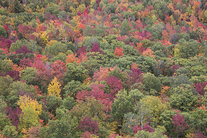
We admired some astonishingly colorful hillsides as we drove down various backroads to the town of Keene, about a 25 minute drive south and east from Silver Lake. I had partially chosen these next two hikes because they were in the Keene / Keene Valley area, east of the High Peaks and generally drier than the rest of the region, owing to (I believe) a rain shadow effect. At least that has been my general observation over the years.
I had chosen for our second hike a little-used route over a couple of low peaks known as "The Crows" - Big Crow and Little Crow. They are situated east of Keene and immediately to the west of a series of low hills known as the Soda Range. I've hiked in the Soda Range several times before, along the so-called Nun-da-ga-o Ridge loop - itself a very rewarding short hiking outing.

In Search of Lower TH
The trail leading over the Crows starts at a point along Hurricane Road uphill and east of the town of Keene. Starting at a point known as Crow's Clearing, it winds up over the ledges of Little Crow, then down briefly and up over the top of Big Crow, before finally descending and arriving at the main Soda Range trailhead. In order to avoid a long road walk, we had brought along Jenn's mountain bike, which we shuttled up to the Soda Range trailhead and locked to a tree.
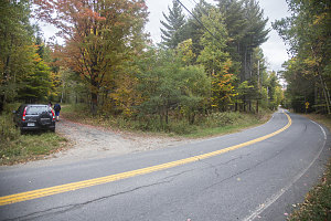
We returned back down to Hurricane Road to locate the Crows Clearing trailhead - but try as I might, I couldn't quite locate it. Or at the very least, I couldn't locate the sign. I had obtained GPS coordinates from the NYSDEC website, but even so, I could find nothing that looked like a specifically like a parking lot or a trailhead.

Is this Crow's Clearing?
We took our best guess, parking near the entrance to a road leading to some sort of clearing, above which the form of Little Crow could clearly be seen. Even if it wasn't the correct starting point, we reasoned, eventually we should intersect some sort of trail.
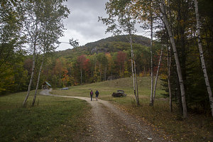
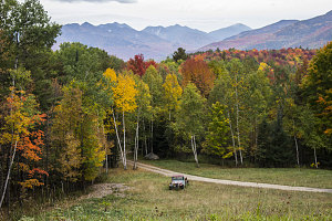
We carefully walked up through the clearing, past an old abandoned Jeep. Off to the far left was a car and a sort of encampment, indicating perhaps that this wasn't the public access we were looking for. We stayed as far to the right as possible, and quietly climbed along the right hand side of the clearing to its top edge. Looking back provided an excellent view back down the clearing and to the High Peaks beyond.
Some faint paths leading from the top edge of the clearing kept alive the possibility that this was the right way, although we had still seen no signs or trail markers. We followed the most prominent of these faint paths, and soon arrived at the intersection of another faint path and a nearby open area. We investigated and found a grassy old roadway that led down towards Hurricane Road. More importantly, there was a sign on a nearby tree that read "Franco-American Trail".

courtesy JInnes
Aha - so, something relatively official. If there was a trail sign here, then that probably meant that this grassy roadway may be the official right-of-way to the trail. But still, we weren't sure; the sign wasn't NYSDEC standard, and there were no other trail markers. Still, it probably went somewhere we wanted to go.
Approaching Crags and Slabs
So, up we went along the "Franco-American" trail. It turned out to be a wonderful little path, clearly rarely used, and passing through pretty deciduous forest. After about ten minutes of uphill climbing, we first came upon an impressive protrusion of jointed bedrock (clearly used for climbing) and then arrived at an amazing little spot - a sudden 180-degree western viewpoint with a breathtaking view of the luminescent fall colors of the Adirondacks.
Spread out in front of us was a broad swath of the Central High Peaks, all the way from the Dixes in the south to the Cascade Pass area in the north. Near and far were amazing displays of reds and yellows, carpeting the lower flanks of the various mountainsides. On the crest of the High Peaks themselves, we could see tendrils of the more inclement weather attempting to find a way over the higher terrain. Our terrain barrier appeared to be working!
The Adirondack High Peaks
Fabulous, Fiery Adirondacks
The Franco-American trail seemed to end at this lookout, although we did spot what looked like a faint path leading upwards. We followed this, soon doing some minor scrambling to stay upon what was the crest of the ridgeline leading up to Little Crow. Seeing that was where we wanted to go, and seeing no other better options, we continued climbing.
We chose the most prominent of a few faint paths that generally led uphill, and were rewarded in a few minutes when we intersected a much more obvious path and an NYSDEC marker - the first so far on this outing. We were clearly therefore now on the right route, and it was now only a matter of followiing the markers uphill, towards the top of Little Crow. I was curious, however, as to where the trail led in the lower direction. Someday I'll follow it to see where the trailhead for this trail is.
The hike up the final several hundred feet of elevation to the top of Little Crow was fun - bits of easy scrambling, several nice ledge sections, and at the top - good lookouts over the broader terrain, although none quite as good as the one at the end of the Franco-American trail.

courtesy JInnes
The Great Range from LC Peak
The trail over the top of Little Crow was a mix of slabs, lichens, moss, and patches of trees. It had a dry feel, something I've found quite frequently on all of the peaks to the east of Keene Valley. It felt a lot like Rocky Peak Ridge, or Jay Peak, or nearby Nun-da-gao.