Fall Fiesta Trio
Silver Lake Mtn, The Crows, Baxter Mtn
October 8, 2016
Fall of 2016 came late this year. After a primarily green September, fiery foliage finally started to appear as October rolled onto the scene. A quick glance at one of the popular northeast foliage reports showed that the higher elevations of the Adirondacks were at "High Color" - one short of the top "Peak Color" category. We of course wanted to witness this spectacle of nature, but timing a visit to the best of fall color is tricky at best, requiring a careful juggling of weather, weekend days, and peoples' availability.
Despite our best efforts, we were only able to secure three of us for this hike - myself, Jenn and Sophie. The rest of our usual crowd were either busy, out of town, or scared away by the prospect of bad weather. And, in fact, the weather forecast for our designated day was depressingly marginal - ranging from mostly cloudy with showers to outright solid rain. We came very close to cancelling entirely, but at the last minute, the forecast improved somewhat, calling for cloudy but dry conditions up until 2pm. "I can work with that", I thought to myself, and quickly put together an itinerary that I felt would maximize color foliage viewing and minimize the chance of encountering rain.
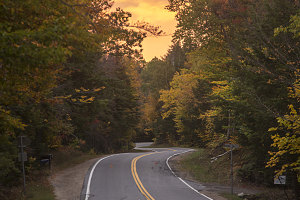
Golden ADK Backway
The plan was this: (a) leave really early from Ottawa, allowing us to get a head start on the rainy weather; (b) break the itinerary up into several short hikes, allowing us to easily bail if the weather turned; (c) arrange the hikes so that we ended up in the drier, rain-shadowed Keene Valley area as the afternoon approached; and as a final bonus. (d) choose hikes that none of us had ever done before.
A tall order, indeed, but it turned out to be achievable. I selected three hikes: Silver Lake Mountain, in the northern reaches of the Adirondacks; The Crows, in the vicinity of Nun-da-ga-o Ridge near Keene; and Baxter Mountain, just to the northeast of Keene Valley. Each hike was short - in the 3 to 5 kilometre range - meaning they were eminently completable in a short day.
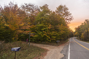
Nondescript Parking Lot
Outing #1 - Silver Lake Mountain
The weather was unsettled, dark, and at times rainy as we drove through the northern fringes of the Adirondacks, past Lyon Mountain - the highest peak in the northern part of the park. Off to the east, we could see a line of blood red where the approaching overcast had not yet completely covered the sky. Shortly after sunrise, we drove through the tiny lakeside community of Silver Lake, and soon located the small and poorly marked trailhead parking lot on the northern side of the road that led east out of town.
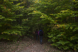
Into Shady Forest
First success achieved: it was still dry here at the Silver Lake Mtn trailhead, and it didn't appear as if rain was imminent. This hike was short - less than a mile each way, so if there was rain coming soon, we had a chance to beat it.
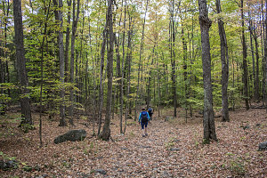
Down here at the starting elevation of 1500 feet, the foliage was still mostly a dark green. An obvious trail plunged through a tunnel of foliage, soon opening up into an airy forest of maples and other deciduous trees. After signing the NYSDEC register, we motored on up.
The Silver Lake Trail was reasonably steep right away, and soon our rapid pace and the grade had us in a good sweat. Although the path was wide, the tread of the trail was not especially eroded. After about 200 feet of elevation gain, we began to hike through patches of open slab with some minor views. We could already tell that the broader area had sections of superb fall foliage colors.
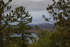
courtesy JInnes
The Silver Lake Mountain Trail soon started to follow the ridgecrest of Silver Lake Mountain itself. Here the trail lead upward primarily through a terrain of dry, well-drained fir and pine trees, with innumerable needles scattered over the ground. The footing was good, though steep at times.
courtesy JInnes
Sun on the left, Rain on the right
The slabby lookouts and viewpoints improved dramatically as we neared the summit. Mostly the views were to the south and east, with only minor glimpses west to the town of Silver Lake itself. The view east was especially good, because the far eastern horizon was still clear, and everything else west of that under solid overcast. The morning sunlight along the eastern horizon against the darker conditions immediately overhead created some extremely nice color and contrast combinations.
Brilliance in the Distance
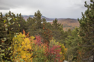
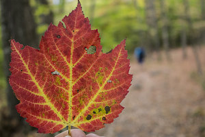
The eastern and southern facing summit ledges provided broad and beautiful views over the north country of the Adirondacks. The colors were indeed at "high", with extensive areas of bright orange, ruddy reds, and golden yellow carpeting the nearby peaks. We had a clear view of nearby Taylor Pond and a half-view of Silver Lake itself.
Also clearly visible from our viewpoint was an approaching line of mist and opaque gray from the southwest. The bad weather! We could see it slowly moving towards us even over the course of a few minutes. Although scenic in its own way, the approaching rain flipped us around and had us heading back down in short order. It had only taken us 30 minutes to hike up to the summit, and we figured that it might only be that long before the rain arrived.
Gravity and a sense of purpose hastened our return back down to the trailhead, and we arrived back at the parking lot a short twenty minutes later. It had been a whirlwind visit to Silver Lake Mountain, but very worth it. A pretty and very accessible little outing; quiet, scenic, and short. Very suitable even as one is driving through the Adirondacks on other business.
courtesy JInnes
courtesy JInnes
So, phase one of our three-phase "Fall Foliage Trio" was done - and we had not yet encountered a drop of rain. So far, so good. Onwards to The Crows!
Interactive trackmap with photo points - Silver Lake Mountain - click map to view
Silver Lake Mountain - Hike Data
Start Time:
7:09a.m.
End Time:
8:10a.m.
Duration:
1h0m
Distance:
2.73 km
(1.7 mi)
Average Speed:
2.7 km/hr
(1.7 mph)
Start Elevation:
1522ft
(464m)
*
Max Elevation:
2381ft
(726m)
*
Min Elevation:
1477ft
(450m)
*
End Elevation:
1477ft
(450m)
*
* : +/- 75 feet
Total Elevation Gain:
840ft
(256m)
*
Total Elevation Loss:
884ft
(269m)
*
* : +/- 75 feet
Elevation Graph