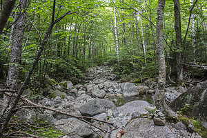
I first used this herdpath back in 2010, while helping friends Brian and Harold finish their Adirondack 46. I'm not sure when it got put in, but it is a very beaten-out route, and super easy to follow. Down it went, always in forest and with decent enough footing, until it interects the lower reaches of the Grace Slide (in fact, I could look out through the trees from the path at one point and see the slabs we had just ascended an hour or two before only a few feet away). Below this point, the footpath parallels the slide, allowing it to be avoided entirely. Rather than step back out onto the wet slabs, we continued on the herdpath, and quickly descended down to the base of the initial stretch of slab, where we rejoined our ascent route.
courtesy JInnes
courtesy JInnes
Parallelling ascent route
Boulders, boulders, and more boulders
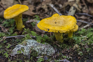
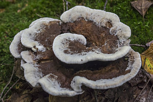
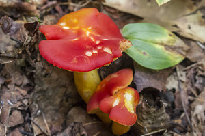
Jenn's Forest Mushroom Shot #1
There's not a whole lot to say about the next section of our day; the section from the bottom of the slide to the upper tentsites on the South Boquet River was a bit less enjoyable, owing to its roughness, and once past the upper tentsites, more enjoyable (owing to a nearly perfect trail and gentle grades). The day overall had turned out to be less sunny than I had expected, with more cloud than blue sky. This was especially apparent during much of our hike back, where the clouds and the thick canopy resulted in very dim lighting conditions.
courtesy JInnes
courtesy JInnes
Ethereal South Fork Waterfall
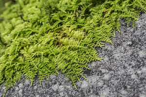
Jenn's Forest Mushroom Shot #2
courtesy JInnes
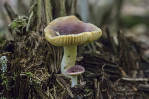
Jenn's Forest Mushroom Shot #3
courtesy JInnes
Jenn's Forest Mushroom Shot #4
Flat and smooth generally equals fast hiking. As a result, even though we'd had some traffic and slow going earlier while we were climbing, we still managed to complete the nearly 11 mile (17+km) journey in just over seven hours.
Compared to our morning start, I think there were probably double the number of cars at the start point when we arrived back. I think, however, that a large number of these vehicles were not hikers destined for Grace, but instead campers and families taking advantage of the numerous nearby tentsites (the ones near the highway) and swimming holes.
Grace Peak Slide Climb - Hike Data
Start Time:
8:10a.m.
End Time:
3:24p.m.
Duration:
7h13m
Distance:
17.24 km
(10.71 mi)
Average Speed:
2.4 km/hr
(1.5 mph)
Start Elevation:
1347ft
(411m)
*
Max Elevation:
4019ft
(1225m)
*
Min Elevation:
1347ft
(411m)
*
End Elevation:
1365ft
(416m)
*
* : +/- 75 feet
Total Elevation Gain:
2773ft
(845m)
*
Total Elevation Loss:
2762ft
(842m)
*
* : +/- 75 feet
Elevation Graph