In June of 2014, the United States Board of Geographic Names approved a petition to rename the Adirondack 46R peak known as East Dix to Grace Peak, in honor of one of the most notable early climbers in the Adirondacks, Grace Hudowalski. Grace was a long-time historian for the 46R organization and was the first woman to climb all of the Adirondack 46. She is a very well-known and regarded figure in the lore of the 46Rs and the Adirondacks, and this was a well-deserved honor.
In its former guise as East Dix, I came to know and enjoy its many positive attributes - a beautiful, open summit, relative solitude, and a very enjoyable slide climb via an approach from the east known as the Boquet River approach. It had been quite a number of years since I'd done the slide climb on this peak, and the news of the renaming reminded me that we should do it again.
Originally I had planned to do this outing in mid-July, but inclement weather scuttled that. So, one month later, on a weekend with a pleasant weather forecast, we set out again. We were a small group today - only myself, Jenn and Pu.
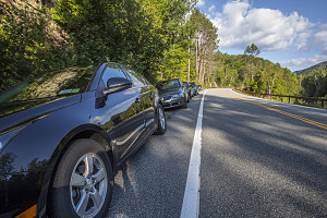
Busy Morning
The east approach to Grace involves hiking along well-developed herdpaths from Route 73, along various bits of the two branches of the Boquet River, and then up the north-west slide face to the summit. This is not an official route, and one of the reasons I like it is the relative solitude such unofficial routes often experience. However, upon arrival just before 8am on this Saturday morning, there were already many cars lined up alongside the highway (there is a small parking lot, but to reach this lot requires a high-clearance vehicle).
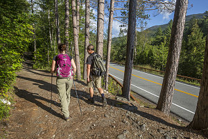
Morning Glory
We set off under crisp and sunny conditions. A minute of walking brought us to the parking lot, where we could see a large congregation of tents and camp gear in the nearby tentsites (some of the vehicles on the highway must have been associated with that). We continued on, starting along the small but fairly obvious herdpath that led west from the parking lot. The obvious and somewhat rough path led along a bank some distance above the North Fork of the Boquet River. There are a few more tentsites along here, and one or more were set up with very un-backcountry-looking tents.
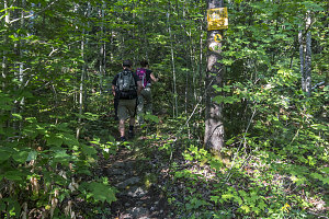
Start of Herdpath
Within ten or fifteen minutes, we arrived at a crossing of the North Fork of the Boquet River; I'll mention right now that the herdpath route to Grace involves many such crossings. Also of note is that here there is an obvious footpath leading left, not crossing the river. This footpath can also be used to access Grace, and in fact it eventually meets up with what I consider to be the "main" route. However, having explored this left-hand route a few times, I consider it inferior, thrashier, more undeveloped, and generally to be avoided. My recommendation: cross here. Of course, during certain river flow conditions, this might not always be a safe or feasible thing to do, in which case falling back on the left-hand footpath is necessary. See my other trip reports for the Boquet River approach for details.
Immediately after crossing the Boquet River, the footpath becomes much nicer. Virtually all roughness is gone, and a soft little path leads northwest, roughly parallelling the river course. After crossing a side-creek (that drains nearby Round Pond), we arrived at a nice slideslope section of trail above Shoebox Falls, a scenic spot that is also an excellent swimming hole. We stopped for a brief look, again remarking on the very low water flow. The box-shaped swimming pool spot looked clear and deep, however.
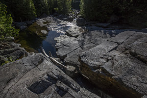
Shoebox Falls
Moving on from Shoebox falls, we continued along the well-defined herdpath, which had by now curved from northwest to mostly south. There is one spot where a side herdpath leads off west - this we avoided, and continued left (south), descending down a small hill.
Next were two further crossings of various branches of the North Fork Boquet River - again all very easy with the current low water conditions. Continuing now in a general south-westward direction, the super nice and very obvious herdpath continued. This is one of the nice things about the Boquet River approach - the quality of the herdpath is generally better than many trails in the area, and the surrounding open forest is very pleasant.
The easy trail and gentle grade (after 4km / 2.5 miles, the trail has only gained about 400 feet from the trailhead) made for rapid progress. After the final crossing of the North Fork Boquet River, the herdpath makes its way across a nearly-imperceptable height-of-land, and switches drainages, crossing from the drainage of the North Fork Boquet River to the South Fork Boquet River. Upon reaching the general vicinity of the South Fork Boquet River, one encounters the first of several nice backcountry tentsites.
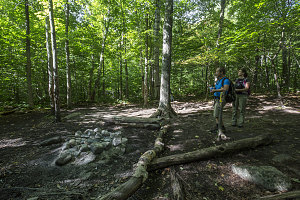
Large campsite
We could hear the rushing waters of the South Fork Boquet River as we made our way up the increasingly narrow valley of the South Fork Boquet River. The trail was still smooth and nice along this stretch, but the grade had increased slightly, and by the time we reached another nice cluster of tentsites, we had climbed up to about 2,150 feet of elevation - about 750 feet above the start point.
A faint white pall and the distinctive aroma of campfire smoke greeted us at the largest of the upper tentsites, although the residents must have recently departed, for no one was around. We took our first break here.
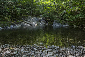
Secluded Pool
Above the cluster of tentsites, the herdpath quality changed - squeezed ever more tightly by the narrowing valley of the South Fork Boquet River, the herdpath became noticeably rougher, and frequently we had to cross and re-cross the bouldery river itself. These days there seem to be a fair number of little cairns to help guide you along the right route. Generally speaking, one stays in close proximity to the streambed, although in a couple of minor cases the herdpath climbs (in a rough and messy manner) a little ways up the steep bank, and then back down again. On the positive side, the deep and shady valley bottom has its own charms. Strewn with innumerable rounded borders, little pools and rushes of water, it has its own nice aesthetic.
Upper Part is rarely this smooth
After about forty minutes of clambering upstream, the herdpath began to climb up the steep southern banks, and soon drew away from the valley bottom entirely. I knew from memory that we were starting the ascent up to the base of the northwest slide - the really fun part of the day!
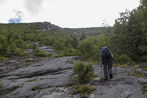
We reached the first bit of slide fragment - nothing more than a strip of sloping slab surrounded by a thick forest. Here, there are two main options: climb the slab, as part of the slide-climb option, or turn right and hike along a well-defined herdpath that completely bypasses the slide, connecting to the ridgeline between Grace and Carson. This alternate route can be invaluable in situations where the conditions on the slide are too treacherous, but can also be handy for those who are uncomfortable with these sorts of routes. We were here to do some slide climbing, so up we went on the slab.
The lower slabs had many wetted-out sections, stretching down the face of the rock in long streaks. We soon discovered that we had to be very careful to stay off of these, for they were especially slippery. In a few spots, it was tricky to sequence together a series of dry patches to allow passage.
courtesy JInnes