A glorious walk up the snows on Cascade's open upper slopes brought us to the summit. Looking around at the 360-degree panorama, we noticed that the puffy low clouds had aggregated and coalesced even further. Far off to the west, solitary Ampersand Mountain poked a domed head up above a solid layer of wispy cloud. Normally, Ampersand wouldn't stand out at all from such a distance, but with the elevation-accentuating effect of the cloud layer, it was very prominent.
Snowy ridgeline and Great Range
The MacIntyres and Colden
After enjoying the scenery to the west, I turned my attention to the south and east, where excellent views of the Great Range and of the distant peaks in Vermont presented themselves.
We caught up to fellow hikers Todd and Jonathan (whom we'd met 40 minutes or so before on the summit of Porter) on the summit of Cascade. We engaged them a little further, and it turned out they were relatively new to Adirondack 4000-footer hiking. In fact, they had used my website to get info on this and other peaks they were planning to hike this weekend.
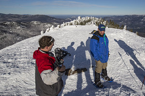
Jon and Todd, Once Again
The talk quickly turned to matters of the website and they gave me some useful feedback on how my Adirondacks page wasn't rendering properly on small-width mobile devices (and then proceeded to show me on their phones). I duly noted the issue, and promised to implement a fix when I got home. update: I can now confirm that in fact the rendering issue is now fixed on narrow mobile devices; thanks once again.
The views today from Cascade were as perfect as - no, better than - any previous time I'd been on the summit of Cascade. The calm, clear weather, the layer of snow on the summit, the still-forming undercast - it all combined to form an exceptionally scenic summit experience.
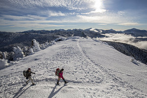
Beginning a fine downhill walk
I was half-tempted to suggest that we stay on the summit and watch as the clouds formed and the early winter solstice sunset approached. Surely the two would combine into some particularly awesome views. However, we were also mindful of the fact that we were hiking a traverse and we had only one car - a car parked way back at the start. We needed to get down in daylight and when the majority of hikers would be milling around at the trailhead. That would give us the highest likelihood of snagging a ride from a fellow hiker.
And so, with some reluctance, we began our the hike down from Cascade. Again, it was a glorious above-the-clouds walk until we plunged back into the forest not far from the Porter-Cascade trail junction.
We quickly descended the busy highway of a trail down towards the Cascade Pass Trailhead, passing quite a large number of hikers still heading in the uphill direction. This standard route to Cascade is quite short, and it took us exactly one short hour to hike from the summit to the trailhead along route 73.
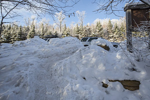
Arriving Route 73
The final (and fairly important) task on our journey was to secure a ride, back down along Route 73 to our start point back at Marcy Field in Keene Valley. I eyed one potential hiker as he got into his car, but then discounted him as he made to turn his car around towards Lake Placid - the opposite of our desired direction.
It was at that point that a solo hiker arrived back at the trailhead. We'd seen him a couple of times up on the trail, and he recognized us. We asked him if by chance he was heading east towards Keene Valley, and he said "no" - but then quickly asked us if we needed a lift. We told him that we could wait for the next person to come along, but he was insistent (in a friendly manner). So, there it was - we'd secured our ride back within five minutes of finishing our hike.
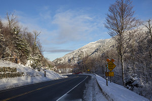
Route 73
Jenn and I got into our generous felllow hiker's car, and Caroline opted to stay back and walk along route 73 through Cascade Pass. She had an ulterior motive - to check out the condition of the many ice climbing routes in the pass. We'd pick her up on the way back after picking up the CRV.
We got to know a bit about our "taxi driver" - named Noah, as it turned out - during our drive back down into Keene Valley. He was an off-the-beaten path sort of adventurer. We ended up discussing several interesting locations that he'd either been to or wanted to visit. Interestingly enough, many of them were places we'd already been (Labrador and Iceland were a couple of examples).
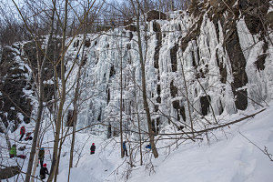
Pitchoff Quarry Ice Climbing Area
After thanking and saying goodbye to Noah at the Marcy Field trailhead, we headed back north along Route 73 to Cascade Pass. We encountered Caroline, still scouting out the ice climbing scene. I joined her in a quick reconnaissance of a climbing location known as the Pitchoff Quarry - a shallow amphitheatre of ice columns. Conditions still looked a bit thin, but a large group of ice climbers were busy toiling on the routes.
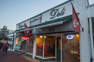
Big Mountain Deli
We topped the day off by visiting Lake Placid's EMS store, then having a surprisingly tasty sandwich dinner at the nearby Big Mountain Deli. As well as an extensive crepe selection, they have a 46R-themed sandwich lineup: one sandwich for each of the Adirondack 46. Although it would have been appropriate, I wasn't interested in either The Porter or The Cascade sandwiches. I opted for something with fish; I think it was "The Seymour". Excellent gourmet sandwich.
So, in all, a very optimal winter hiking day: perfect snowshoeing conditions, clear views, interesting atmospheric effects, friendly hikers and a finish with some excellent food.
Interactive trackmap with photo points - Porter-Cascade Traverse - click map to view
Porter-Cascade Traverse - Hike Data
Start Time:
8:30a.m.
End Time:
2:48p.m.
Duration:
6h17m
Distance:
11.44 km
(7.11 mi)
Average Speed:
1.8 km/hr
(1.1 mph)
Start Elevation:
994ft
(303m)
*
Max Elevation:
4101ft
(1250m)
*
Min Elevation:
994ft
(303m)
*
End Elevation:
2137ft
(651m)
*
* : +/- 75 feet
Total Elevation Gain:
3563ft
(1086m)
*
Total Elevation Loss:
2437ft
(743m)
*
* : +/- 75 feet
Elevation Graph