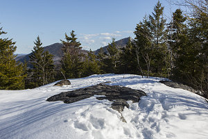
We paused only briefly at the junction, and started off on the final leg to Snow's summit. Here we encountered the only real steepness on the route - one or two sections of minor ledges and slabs. It wasn't long before the grade eased off, and we got to the first of a few nice lookouts north, in the direction of nearby craggy Roostercomb, and further in the distance, the long ridge of Porter Mountain.
Now mostly on the flat, we soon arrived at a small clearing where we could climb no higher. We had arrived at Snow Mountain's summit. The views were limited by the ring of trees at the edge of the clearing, and we could only see bits and pieces of Giant and other nearby mountains. However, I had a hunch that there might be something better a little ways further on. So, we continued southeast past the summit.

Snow Mountain Summit
Perhaps 30 second's walk beyond the summit, we arrived at an open south-facing set of ledges. Presented before us was a truly fantastic view, encompassing Giant Mountain on the left, all the way across to Mount Dix, Dial, and Nippletop. Attractive Keene Valley was directly below us to the south, and backing that, the prominent asymmetric peak of Noonmark and its lower sibling, Round Mountain.
Now, there's no doubt that we had arrived at a particularly favorable time - late in the day, with the sunlight slanting in from the west. And the fact that it was a clear, blue, cloudless day. And the fact that the peaks had a nice white coating of snow on their upper reaches. No doubt all these happenstances contributed to the views. But there was no denying that this vantage point on Keene Valley and the surrounding mountains was especially favourable; The various peaks were arrayed in a particularly aesthetic way across in front of us. It seems that those trail reviewers of a few years ago had not simply been starry-eyed hikers. There was real merit in this little peak!
The Classic Noonmark View
The excellent viewpoint deserved a little sit time, so we took off our packs, had some food, and enjoyed the excellent mountain scene. Unfortunately, we couldn't stay quite as long as we would have liked, because we were on a bit of a schedule. As you may recall from the start of this report, we were in the middle of a busy hiking weekend, and our next objective was Mount Moosilauke in New Hampshire, with a hike departure time scheduled for early the next day. This meant we had to get ourselves over to New Hampshire and bedded down for the night at a reasonable hour. Since it was now past 4pm, it was time for us to skedaddle.
Given the short length of the trail and the lack of obstacles, it took us a very short 40 minutes to retrace our steps from the summit back down to route 73. Our entire hike time was just over two hours.
Back to the high-water route
Snow is definitely one of the Adirondack's shorter mountaintop hikes. However, in the right circumstances, it offers a very big view for not so much effort. I will definitely be adding it to my already ample roster of shorter, intro-appropriate Adirondack Mountain hikes.
Next up on our Easter long-weekend agenda was Mt Moosilauke in New Hampshire. If you'd like to continue on and read about that,
click here.
Interactive trackmap with photo points - Snow Mountain - click map to view
Snow Mountain - Hike Data
Start Time:
2:55p.m.
End Time:
5:06p.m.
Duration:
2h10m
Distance:
5.65 km
(3.51 mi)
Average Speed:
2.6 km/hr
(1.6 mph)
Start Elevation:
1093ft
(333m)
*
Max Elevation:
2371ft
(723m)
*
Min Elevation:
1046ft
(319m)
*
End Elevation:
1046ft
(319m)
*
* : +/- 75 feet
Total Elevation Gain:
1246ft
(380m)
*
Total Elevation Loss:
1296ft
(395m)
*
* : +/- 75 feet
Elevation Graph
