As I approach the completion of my Northeast 111, I've become more picky about when and in what order I complete the remaining peaks (this is something I notice that I do when I near the completion of a peak list). I want to complete the list with a nice scenic flourish - not with a nondescript, forested peak. So, to that end, I've been rearranging the final order of peaks, placing really good ones at the end. The other thing I wanted to ensure was good weather for these final peaks. A great summit in a whiteout isn't as great. And so, when a pristine-looking weather forecast fell on the 3rd weekend in July, I decided it was the right time to do one of my final peaks.

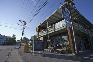
Waiting for Breakfast
I'm pretty close to the end. As of July 2011, I've only got two peaks left on my Northeast 111 list: Mount Abraham and North Brother - both in the state of Maine. Scenically, they are a toss-up: both have bare, open peaks with 360 degree views and lots of alpine, and both were reportedly uncrowded. We decided to go with Abraham for two reasons: one was that it is logistically easier to get to Abraham for us - a shorter drive. And the other was that I've really fallen for the food at the nearby White Wolf Cafe in Stratton, and I felt like having another couple of meals there (you'll notice a recurring theme about good food at the White Wolf as you read this report).

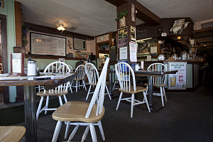
White Wolf Cafe Interior
Brian came along with us on this hike. Abraham is not a hard hike by the route we were going to use, and he was in the mood for something easy, seeing as he hadn't been on many hikes and outdoor outings for a while. We drove from Ottawa on a Friday evening, after work, and arrived in the Stratton area around 9:30pm, where we checked into a room we had booked at the White Wolf Inn. Needless to say, we availed ourselves of a dinner downstairs, then headed off to bed.
The next morning, we awoke relatively lazily. Our hike wasn't going to be that hard or long, and we wanted to enjoy breakfast at the cafe, which only opened at 7am.
Behind the scenes in Stratton
Packed up and ready, we headed off on a clear and sunny morning, heading south-east on highway 27 towards the Carabassett Valley. Our destination was the Mt Abraham firewarden's trail trailhead.
At the town of Kingfield, along highway 27, we turned west onto West Kingfield Road. There was a decent view of the summit of Abraham not long after starting out along this road. Some somewhat rough gravel road, a series of un-marked intersections (which we had to know how to navigate in advance - many thanks to Julie), and a couple of bridge crossings brought us to the firewarden's trail trailhead.
Note: if you want a detailed description of how to get to this trailhead,
click here.
Hwy 27 and West Kingfield Rd
With the small challenge of getting to the trailhead behind us, we got out and got ready to start our hike. Already it was quite warm, and the bugs were a bit pesky. It was good to get started on the trail and create a little personal space between us and the insects. At the trailhead, we noticed an extra sign stating that the old firewarden's cabin had burnt down, and that a new backcountry campsite was now in place.
If you wish to drive further
The trail is easy, wide, and not hard to follow. We immediately crossed small Norton Brook, noting the pretty green moss-covered boulders in it, then followed along its banks for a bit. The trail then traversed side-hill up a short slope, then began a quite long, very gradual ascent on a very nice path - dry, wide, and with very few roots or boulders.
Approaching Norton Crossing
About 1 mile in (1.6km) in from the trailhead, we encountered a section of trail re-route. I couldn't be sure of the reason, but I suspected that it was a re-route around a section of trail that was prone to wetness. This section of new trail is still quite spongey, and is about 1200 feet long. Very soon after the trail re-route joins the original route, the trail arrives at the upper forest road crossing (where you could drive to if you were so inclined, conditional on vehicle and road conditions).
Crossing upper forest road
The Firewarden's trail continued on the other side of the forest road, still with an excellent tread, no rough stuff, and through beautiful leafy, shady forest. A very easy walk in the forest so far!
Another mossy stream-crossing
At around the 2.4 mile mark (4km), we came to another section where we could see that the trail had been re-routed. Where it used to continue on the level, this new section angled left, traversing uphill. Dutifully we followed this, eventually arriving at a very freshly constructed backcountry campsite. In fact, I'd venture to say that it was not yet complete (although there was an outhouse).

courtesy Jinnes
Just a few hundred feet beyond the campsite, we re-intersected the original trail. The trail was no longer flat and easy here; instead, the grade was quite steep and the footing rougher, although still pretty decent. I had not seen the firewarden's cabin clearing, and figured that this last trail re-route must have bypassed it.