Immediately upon leaving Orbeton River, the A.T. makes a very steep bouldery ascent up out of the steep trench the river has carved. It was then a long and smooth stretch of gradually-ascending trail - very straight, with good footing, and through very pleasant forest. If we had not already done more than 20 kilometres (12 miles) of hiking and a bunch of elevation gain and loss, this would have been exceptionally easy. It was still easy now, just a little bit more tiring than usual.
Towards the end of the easy stretch of trail, the original group of four Thru-Hikers again caught up to us. They looked fairly tired too, and were also heading to the Spaulding Mountain Lean-to. We were glad that we'd brought along a tent rather than rely upon the availability of spots in the lean-to: It looked like it was going to be a busy night there!
Since the grade had only been very gradual up to this point, we still had a fair bit of elevation left to gain in order to reach the elevation level of the campsite. Sure enough, the trail soon started a steeper ascent, leading up to a minor bump known as Lone Mountain, which tops out at about 3,300 feet. We were mighty glad when this bit of climbing was over, because we were fairly pooped at this point; and we knew that from here on, it was a nice, easy gradual descent to the campsite.
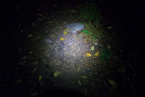
The A.T. runs along an easy forested ridgetop from the top of Lone Mountain to the Spaulding Mountain Lean-to. The trail has very good footing along this section, which allowed us to move quickly and with little effort. Dusk fell upon us along this stretch, and by the time we got to the junction with the side trail to Mt Abraham, it was getting quite dim. Even though we were now quite close to camp, we got out our headlamps in preparation for the deep dark that was soon to come.
A.T. junction at Side Trail
The side trail to Mt Abraham is a there-and-back 1.7 miles (each way) journey from the main line of the A.T. to the summit of Mt. Abraham. Back in the easy, comfortable surroundings of home, I had mused about including this peak -- another of the 4000-footers I need to do for my NE 111 -- in our journey. We certainly weren't going to be able to do it now, at this late hour, and given that we still had a pretty challenging day coming up even without adding this peak, we had pretty much mentally given up any thought of doing this side journey the next day. Mt Abraham would have to wait for another trip.

Night-time Trail View
Another kilometer or so of hiking by headlamp brought us to the Spaulding Mountain Lean-to. The Thru-hiker we had been talking to back at Orbeton River was just making his dinner, and the Lean-to behind him was indeed fairly full. We decided to head around back and find a smooth patch to pitch the tent, after which we set about filtering water and making some much-needed dinner. We were in our sleeping bags by about 9pm, resolved to get a much earlier start for day 2. As it turned out, day 1 had been pretty long and hard: 28 kilometres (17.4 miles) in total, 5,700 feet of elevation gain and over 4,000 of elevation loss.
Interactive Trackmap, Rangeley-Stratton Traverse Day 1
Day 1, elevation over distance
Day 1, elevation over time
Hike Data - Rangeley-Stratton day 1: Highway 4 to Spaulding Mtn Lean-to
Start Time:
8:22a.m.
End Time:
7:34p.m.
Duration:
11h11m
Distance:
27.98 km
(17.39 mi)
Average Speed:
2.5 km/hr
(1.6 mph)
Start Elevation:
1662ft
(507m)
*
Max Elevation:
4161ft
(1268m)
*
Min Elevation:
1564ft
(477m)
*
End Elevation:
3165ft
(965m)
*
* : +/- 75 feet
Total Elevation Gain:
5946ft
(1812m)
*
Total Elevation Loss:
4446ft
(1355m)
*
* : +/- 75 feet
Elevation Graph