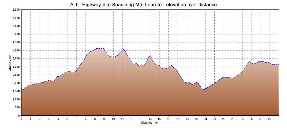
This is a GPS-derived elevation plot of the first day of our Rangely-Stratton Traverse along the A.T., graphed over distance.
This image is from the presentation "Traverse of the Rangeley-Stratton Section of the AT".
 Go to presentation where this image occurs.
Go to location in presentation where this image occurs.
Go to presentation where this image occurs.
Go to location in presentation where this image occurs.
Copyright 2001-2016 alavigne.net.