courtesy PTruong

courtesy PTruong
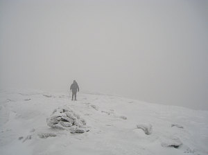
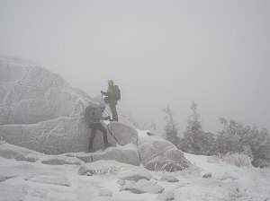
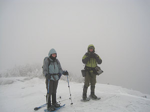
We were soon on the summit, and I congratulated Scott and Phuong on becoming 'winter 1ers', and Jenn on becoming a winter 42er. Jenn and I were now aligned: we both had the same four summits to finish for our winter 46: Marcy, Gray, Skylight and Haystack. Getting close!

courtesy PTruong
With a chilly breeze and no views, we didn't dally long at the summit, and headed back down, using the buttsliding technique to get down the little scrambly bits. Soon we were back in the stillness and relative warmth of the trees, and it was a simple and short trek down the trail back to the car.
Thanks for coming along, Phuong and Scott, and I hope you are inspired to come on future outings! I guarantee that at some point you'll get some fantastic views!
Interactive Trackmap & Photo Points - Cascade Mtn - Click map to expand
Start Time:
9:32a.m.
End Time:
12:28p.m.
Duration:
2h55m
Distance:
3.52 km
(2.19 mi)
Average Speed:
1.2 km/hr
(0.8 mph)
Start Elevation:
2180ft
(664m)
*
Max Elevation:
4140ft
(1262m)
*
Min Elevation:
2159ft
(658m)
*
End Elevation:
4135ft
(1260m)
*
* : +/- 75 feet
Total Elevation Gain:
1966ft
(599m)
*
Total Elevation Loss:
1ft
(0m)
*
* : +/- 75 feet
Start Time:
12:28p.m.
End Time:
2:15p.m.
Duration:
1h47m
Distance:
3.56 km
(2.21 mi)
Average Speed:
2.0 km/hr
(1.2 mph)
Start Elevation:
4129ft
(1258m)
*
Max Elevation:
4168ft
(1271m)
*
Min Elevation:
2104ft
(641m)
*
End Elevation:
2125ft
(648m)
*
* : +/- 75 feet
Total Elevation Gain:
1ft
(0m)
*
Total Elevation Loss:
2038ft
(621m)
*
* : +/- 75 feet
Cascade Mountain (combined)
Start Time:
9:32a.m.
End Time:
2:15p.m.
Duration:
4h42m
Distance:
7.09 km
(4.4 mi)
Average Speed:
1.5 km/hr
(0.9 mph)
Start Elevation:
2180ft
(664m)
*
Max Elevation:
4168ft
(1271m)
*
Min Elevation:
2104ft
(641m)
*
End Elevation:
2125ft
(648m)
*
* : +/- 75 feet
Total Elevation Gain:
1979ft
(603m)
*
Total Elevation Loss:
2027ft
(618m)
*
* : +/- 75 feet
Elevation Graph
