Fundy Footpath Day 6
Point Wolfe Campground to Alma - Friday, August 26
The clear and sunny evening did not last overnight - clouds returned and it was overcast when we woke up the following morning. Not having sun was not that big of a deal, in any case.
We used the convenience of the shared cooking building -- which was right next to our tents -- in order to have a very civilized breakfast and pack-up experience. Then, shortly before 8 a.m., we hiked down our campground loop, past the entrance kiosk, and back to the day parking area - where we had finished our hike the day before.
One important point of note here for anyone following along and looking for guidance. As soon as we entered Fundy National Park at Goose River the day before, all Fundy Footpath signage ended. No more big blue-green kilometre markers, no little roundels. At major intersections, there's no indication of which way the Fundy Footpath goes. We only knew, from looking at online guides and maps, that in order to continue along the Fundy Footpath eastbound from Point Wolfe, we needed to follow the Shiphaven trail, which has one end at the day parking area.
This Shiphaven trail section was one of these front-country sorts of trails - lots of built-up sections (wooden walkways and railings and decked overlooks and such). Now, at this early time, we had it all to ourselves. I imagine that during the day during peak periods there are lots of day-walkers along this bit.
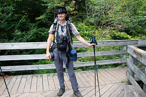
Staying on the Shiphaven-signed route (ignoring the turnoff to Point Wolfe Beach), we passed some nice lookouts down to the Point Wolfe River estuary and the Bay of Fundy. Eventually, via a series of stairs, the trail descended to a lookout along the Point Wolfe River that gave us a glimpse of the quaint Point Wolfe covered bridge. And... it was about at this moment that we felt the first pitter-patter of rain drops. Unfortunately.
courtesy JInnes
How much is that Hatko in the window?
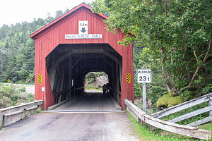
The Shiphaven-signed bit of the footpath soon dumped us out on the main park road right at one end of the Point Wolfe Bridge. There was no signage indicating where to go from here to continue on the Fundy Footpath, but we knew of course that it involved crossing the Point Wolfe River and the bridge was the logical choice. And also, the sprinkles had turned into a continuous shower and it would get us out of the rain.
courtesy JInnes
Point Wolfe river from bridge
On the far (eastern end) of the bridge, we stopped for a bit to see if perhaps this shower would pass. And also to consider where to go. Once again, on this far side of the bridge, there was no indication whatsoever of the where to go to get to the next segment of trail - fundy footpath or otherwise. It was just regular road infrastructure with nothing for hikers.
After hanging around for fifteen minutes or so (and with Gillian checking the weather radar on her phone), the rain started to abate and we decided to continue on. I was pretty sure that at some point down this road there would be a side trail that would allow us to continue on the footpath (and we were looking closely so we knew we had not missed anything).
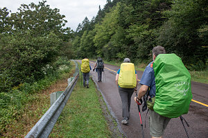
A quarter of a kilometre of hiker-inappropriate highway walking brought us to a spot with a picnic area on the left (looking east) and a trailhead on the right. This trailhead, fortunately, turned out to be what we were looking for - although once again, there was zero signage regarding the Fundy Footpath. It was simply marked "Coastal Trail" / "Trans Canada Trail"
courtesy JInnes
With yesterday's superhighway-like trail from Goose River to Point Wolfe, we were somehow expecting that this next stretch would be similar. But... it wasn't. Instead, the trail was a more traditional and rougher footpath - nothing horrible, just not the hiker-highway we had yesterday.
From the road, the trail immediately headed uphill, winding upwards for about 250 feet (75m) before topping out. It was enough to get the heartrate up and generate a bit of sweat. Also increasing the wet factor... the showers and sprinkles started up again.
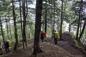
Once finished with the climb up from the Point Wolfe Road, the footpath turned east and we hiked through fairly nondescript forest. The tread itself was ok, but not great, and there were several sections that had a lot of hiker-caused erosion. On this wettish day, these areas were often mucky. In fact, it was along this stretch of trail - in Fundy National Park - that we encountered the most unpleasant trail conditions. Part of that is no doubt due to the fact that this trail gets a lot more foot traffic than the more remote parts of the footpath.
After a couple of kilometres of somewhat uninteresting forest hiking, the trail gradually descended and neared the coast, soon coming to a very nice westward-facing lookout. The little detached pinnacle known as Squaw's Cap is prominently visible from here.
Western view from Matthews Head
The footpath continued for another half-kilometre to another nice western-facing lookout, this time from near Matthew's Head (it's kind of the western lookout from atop Matthews Head itself). The trail then crosses over the top of Matthews Head (in forest) and arrives at a much nicer eastern lookout, this one almost down at sea level. This one was quite panoramic, and as a bonus sported a couple of official Parks Canada Adirondack-style chairs. The town of Alma can be seen off in the distance from this viewpoint, giving our little group a first look at the far-end destination of our six-day full traverse of the Fundy Footpath. Some lips were licked here; the plan at the hike's end was to hit one of the town's noteable seafood restaurants, located in this town, and already we could taste (in our minds) a delicious lunch.
Eastern view from Matthews Head
From Matthews Head, the trail became a little more challenging again; it climbed up via a set of loose switchbacks, to nearly 350 feet above sea level (100m), and then just as quickly descended back down to sea level. We had arrived at the Herring Cove area.
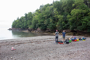
A trail junction offered us the opportunity to bypass a visit down to the beach at Herring Cove, but we didn't want to skip anything (plus we wanted a place to stop for a morning snack break). So, we took the optional trail down to the cove, which finished in a nice set of well-built stairs. We had clearly entered front-country territory: there was a class of kids on some sort of day-trip present with us as we took our break, and several other sets of people present as well.
courtesy JInnes
courtesy JInnes
courtesy JInnes
Snack break at Herring Cove
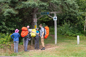
A different set of stairs led us up and away from Herring Cove Beach, soon depositing us at the nearby parking area (which is likely why there were so many people down at the beach). A sign and wooden archway off to the side marked the beginning of the very last segment of our Fundy Footpath journey (again, with zero signage that we were still on the footpath, but I digress).
We were now very, very close to completing our full traverse of the Fundy Footpath. And we were really looking forward to our completion celebration lunch. Between us and that, however, was a final segment of footpath, and that final segment had a final little sting in the tail. a fairly steep climb up and over an elongated rib of land (which I think might be called Devil's Hill), to a height of 500 feet, followed immediately by a descent back down to sea level and arrival at the main park headquarters complex near Alma.
courtesy JInnes
Continuing from Herring Cove
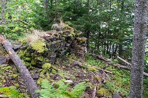
The trail itself was in good shape along this last segment, without much roughness or erosion or muckiness. After the fairly stiff climb, the bit of trail over the height of land wound past some interesting features in the forest: pits and deep ravines and rocky outcrops. Then, rounding a final rocky rib, we started a straight-line, easy and gradual descent down to the old decommissioned Devil's Half Acre park road, across that road, and then in a few moments to a trailhead on an active road near the Fundy National Park Saltwater Pool. I ran ahead and set up the tripod so I could capture the arrival moment. Success!
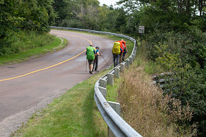
Despite the celebratory pictures and handshakes, we were not *quite* done. There is no place to park cars long-term near this trailhead, and (as you may recall) we had parked the cars at the Upper Salmon River trailhead parking area, which is adjacent to the main park headquarters. Which itself was still a bit of a walk away.
courtesy JInnes
A little more hiking required
So, off we went. Off to our left was the intersection with the Point Wolfe Road (continuation of the road we had briefly walked on back near the covered bridge on the start of our walk this morning). We walked over to this road and followed it east, up a slight hill, past the Fundy National Park amphitheatre on our left and an old attractive park building on our right. In order to save a bit of time, we chose to cut across the broad lawn to the south of Visitor center, making a beeline more directly to the Upper Salmon River trailhead parking lot, which is immediately to the west of the visitor center parking area. All of this, of course, is clearly documented in the track-map associated with our hike (in case you were doing planning and wanted to understand the relationship between trailhead, long-term parking, and the visitor center).
We arrived at our parked cars just around 1pm. A little sweaty and a lot grungy (from six days of hiking), but in good spirits, and with no one injured apart from the unpleasant foot blister here or there. Congratulations to all - six days and 63.6 kilometres (64.4 if you include the final walk all the way to the parking area with the cars). Not an especially fast pace, with an average daily distance of only ten and a bit kilometres, but of course that was by choice, since we deliberately chopped distance on a couple of days to avoid rainy weather. We could definitely have done it in the five originally-planned days, and, if we were feeling like pushing it, four days was not outside of the realm of possibility.
The following track-map shows the precise course of our six-day journey. Each day is drawn in a different color: dark red for the day 1, green for day 2, purple for day 3, yellow for day 4, blue for day 5, and orange for day 6. The occasional bright red bit of track denotes walking not specifically on the Fundy Footpath. Be sure to click on the map to see a full-size version that shows the major waypoints (denoted with green diamonds), and each picture's location (with red markers). The map type can also be changed, if for example you want to see the track rendered over a topographic or satellite map.
Interactive trackmap with photo points - The Fundy Footpath - click map to view
Day 6 - Point Wolfe to Alma - Hike Data
(Track color: )
Start Time:
7:55a.m.
End Time:
12:45p.m.
Duration:
4h50m
Distance:
10.32 km
(6.41 mi)
Average Speed:
2.1 km/hr
(1.3 mph)
Start Elevation:
175ft
(53m)
*
Max Elevation:
482ft
(147m)
*
Min Elevation:
-12ft
(-4m)
*
End Elevation:
20ft
(6m)
*
* : +/- 75 feet
Total Elevation Gain:
1071ft
(326m)
*
Total Elevation Loss:
1192ft
(363m)
*
* : +/- 75 feet
Elevation Graph
The following is a combined elevation profile rendering of all six days' journeying. If you compare it to the elevation profile in the Fundy Footpath Hiker's Guide Book, you'll see that it largely matches, with a few key exceptions. Two locations are shown completely incorrectly in the guide book version (Rose Brook and Goose River), and two other notable locations show as not being down at sea level, when they in fact are. I go over these mistakes in more detail in the "Errata" section on my
Thoughts-and-Observations page, which I invite you to read after you have finished reading this main report.
The Fundy Footpath - Full Backpack Data
Distance:
63.62 km
(39.53 mi)
Average Speed:
0.5 km/hr
(0.3 mph)
Time:
121h46m
Start Elevation:
33ft
(10m)
*
Max Elevation:
755ft
(230m)
*
Min Elevation:
-12ft
(-4m)
*
End Elevation:
20ft
(6m)
*
* : +/- 75 feet
Total Elevation Gain:
8108ft
(2471m)
*
Total Elevation Loss:
8093ft
(2467m)
*
* : +/- 75 feet
Elevation Graph
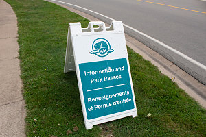
With our Fundy Footpath traverse complete, it was time to sign out and head for some celebratory lunch. I quickly popped into the visitor center and registered the fact that our group had finished. I guess a little part of me was expecting a minor bit of fanfare but the staff seemed busy with other visitors and noted our checkout in a perfunctory manner. We then hopped into the cars and headed east, out of the park and into the immediately neighbouring town of Alma. Alma is a quaint little seaside village that serves as a kind of support center (places to eat and stay, etc) for the park.
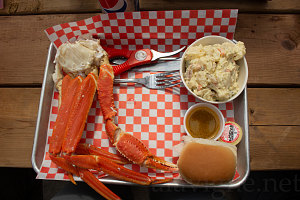
As is typical, Mr. Hatko had thoroughly scoped out the culinary delights and recommended spots in Alma. Our first stop was Kelly's Bake Shop, where we purchased the sticky buns that they seem to be quite famous for (at least in Southern New Brunswick - even my brother Carl in Fredericton had heard of them). Next, we (well, most of us) wanted a down-home Maritime seafood meal. Hatko had identified a few good spots, including the one we chose - the Alma Lobster Shop. Now, I'm not really a crustacean fan, so the thought (or the smell) of lobster is off-putting to me - but as is typical with most places, they also serve fish-type things and I had a very good order of fish and chips. and for dessert, we treated ourselves to our recently-purchased Kelly's Famous Sticky Buns.
courtesy JInnes

courtesy JInnes
Lunch at Alma Lobster Shop
courtesy JInnes
After completing our celebratory completion lunch, it was time to start thinking about the logistics of wrapping up our trip and heading back home. Brian is, like me, also from New Brunswick. He bid us goodbye, and headed off to visit with family. My brother Carl and his partner Line made things immeasurably easier for the rest of us by offering his house in Fredericton for the night, including (and I must stress this) serving a full and hearty lasagna dinner. Many, many thanks for that (Chris at multiple times commented on the excellent-ness of the meal, and Chris is a foodie.... so... that's a big compliment).
Thanks again, everyone, for a great trip. Apart from a few broken poles and ripped tent fabric, it all went quite well. I have compiled a number of thoughts about the Fundy Footpath, as well as a few basic tips and corrections that anyone doing research might find useful. Check that stuff out on
my footpath guide page.
Note: there is also a full-length video of our Footpath traverse, and it is available on the video page. If you just want a quick taste, have a look at this quick teaser video below!
2022 Fundy Footpath Backpack - Teaser