Day 4
May 18 - Escalante River North to Harris Wash
Another clear, calm and mild day greeted us on the fourth day of our now re-routed backpack. In my mind I had now morphed the title of this backpack from "The Escalante Mishmash" to "The Escalante Missmash" - in reference to the fact that we were now going to miss achieving our original goals. Still, we were keen for today's hike, as it would afford us an opportunity to visit a couple of fun and interesting sites.
Today's objective was to simply make our way north, following the course of the Escalante, until we reached the confluence with Harris Wash. We would find a good campsite at that point and then decide which route to take to make our way back to the Harris Wash trailhead -- our trip's starting point -- the following day.
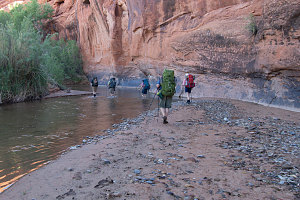
We departed from camp at a more normal (although still not super early) 7:45 a.m. A very nice herdpath led over dry ground at the base of a cliff wall for quite a distance, perhaps half a kilometre, before a bend in the river hard-up against the wall forced us to switch into our water shoes.
courtesy BConnell
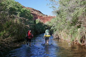
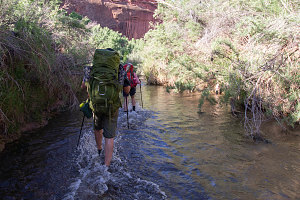
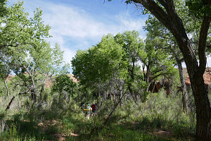
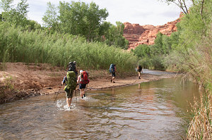
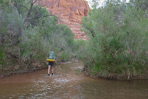
For the next few hours, we settled into what would become a familiar pattern: a bit of wading in the knee-deep water, searching the banks for an earthy groove that marked a herdpath exit, scrambling up that groove and onto a flat floodplain terrace, usually populated with a vibrant green forest of cottonwoods. The herdpath would cut across the terrace, and after a few hundred yards we'd once again encounter the next stretch of the river. And if we were lucky, there would be a continuation of the herdpath on the river's far bank and we would go down, straight across the river, and back up onto and across the next terrace.
courtesy JInnes
courtesy JInnes
courtesy BConnell
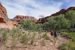
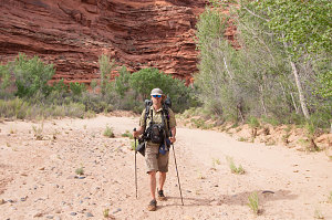
With a few kilometres of Escalante River travel now under our belt, the state of affairs in the Escalante corridor in 2022 was becoming apparent. Generally things are not too brushy, and there isn't an excessive amount of debris (like after the big november storm of 2006). Usually there was one fairly distinct herdpath across the floodplain terraces, and sometimes a few faint ones that dead-ended into brush. Obviously, we tried to make sure we picked the distinct herdpath, but every so often we chose poorly. Still, overall, travel up the Escalante was relatively trouble-free. The walks across the floodplain terraces were often quite pleasant - full of lush greenery and tall, stately trees. Often we'd cross clearings where the oche-red of the canyon walls presented themselves as a scenic backdrop.
courtesy JInnes
courtesy BConnell
Across the flats, without a path
Across the flats, with a path
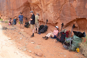
At 10 a.m. we were in the vicinity of Fence Canyon. Good Progress. There are a number of interesting attractions in this area and we were looking forward to visiting them. First, though, it was time for the day's first break, under a desert-varnished wall in a large open clearing on the Escalante Canyon's east side.
courtesy JInnes
courtesy JInnes
Constructed Cattle Trail?
There were two main attractions that I wanted to show the group today: one was an alcove known as The Golden Cathedral. It is located along an eastern side tributary known as Neon Canyon. The other was Ringtail Canyon, which sports a slot section that occurs very near its confluence with the Escalante and is therefore very accessible and quick to visit. Chris had never been in a really tight slot and he had expressed a keen interest in seeing one.
We continued north from our morning snack/rest break. I knew roughly where Neon and Ringtail Canyons' were, but, because I had not intended to come this way on this trip, I was guiding myself solely based from memories of past visits (unfortunately, the topographic map that I had with me did not label Neon Canyon nor Ringtail Canyon). In my mind's eye, we would encounter Neon Canyon first and then Ringtail.
The herdpaths became more distinct as we neared Neon, Ringtail and Fence Canyons. That made sense because most visitors to this section of the Escalante come directly down from the Egypt trailhead, through Fence, and to the Escalante. I knew that Neon was popular and therefore was expecting a fairly clear and well-beaten path to junction off to the right at some point soon. Sure enough, such a junction soon appeared, and I suggested to the group that this was likely Neon (and hence, the way to the Golden Cathedral).
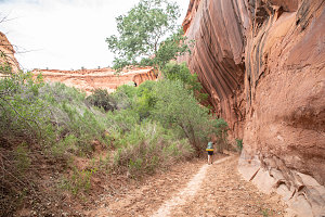
Entering Neon Canyon
We turned right and soon crossed the course of the Escalante River. Directly ahead of us, a side canyon entered. The path continued up the far bank and directly up this canyon. Definitely Neon.
The herdpath up Neon was clear and obvious. The canyon itself is quite beautiful and much narrower than the Escalante itself. It was also dry, with no pools or wet spots, at least at the moment.
Twenty-five minutes of mostly easy walking (there were a couple of boulder sections, but nothing hard) brought us to a sort of gateway between a huge chunk of fallen rock and the canyon wall. Beyond we caught our first glimpse of The Golden Cathedral.
Arriving Golden Cathedral
The Golden Cathedral is indeed an amazing place. Essentially it is a huge pouroff in the course of Neon Canyon. That in itself is impressive but what is even more impressive is how the falling water and groundwater erosion has carved out a beautiful hemisphere of overhanging bedrock. Even more impressive than that, the erosive force of flash floods has created two huge vertical tubes into the ceiling of this overhanging alcove. Essentially these were erosional potholes that kept getting deeper and deeper until they drilled completely through the alcove ceiling. The place is immense and full of echoes and the reflected light from the walls makes for a very orange-tinted light. Beautiful. We were grateful that we were able to experience it by ourselves and in complete silence, save for our own echoes.
The Golden Cathedral, and indeed Neon Canyon as a whole, is not simply a place to sightsee. It is also a very fun medium-difficulty canyoneering objective, one that has become fairly famous in canyoneering circles. A descent from upper Neon Canyon down through a series of narrows and water-filled potholes culminates with a long rappel through one of the big huge tubes over our heads. This means one is rappelling completely suspended in open air, for over eighty feet, straight down into the shallow pool at the bottom. Sounded pretty great, and I think in a future trip we should aim to descend this route. It'd be fantastic.
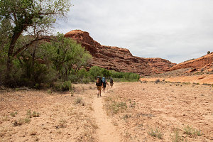
After spending time soaking in the ambiance of the Golden Cathedral, we retraced our steps back down lower Neon Canyon to its confluence with the Escalante. There we stopped for lunch at an excellent campsite tucked up in the huge branches of an old Cottonwood tree.
courtesy JInnes
We continued north on an excellent herdpath from the mouth of Neon Canyon. I was now on the lookout for Ringtail Canyon, eager to show Chris the cool triangular slot that I distinctly remembered from a 2007 trip.
I kept looking for an obvious side-canyon coming in from the right, but for the next little bit, there were none. I thought my memory might have been a bit off, and we kept on. Presently we did come to a side canyon, a quite prominent one, and with clear sign of foot traffic, too. I confidently asserted that this was Ringtail, and that soon we'd be exploring a cool bit of dark slot canyon.
We decided to drop our packs in a safe shady spot near the confluence, planning for a short little walk and wanting to feel a little bit lighter on our feet for a while.
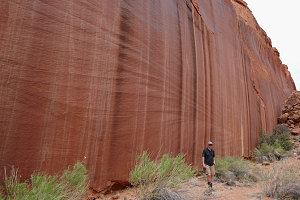
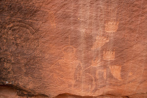
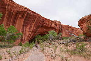
The canyon felt a little larger than I recalled it from 2007, but the stream of footprints indicated this was well-visited, and so where else could we be? (in my limited-thinking mind). Soon the footprints veered off towards the left-hand canyon wall, and we dutifully followed. We were brought to a beautifully smooth and desert varnished wall, and quickly it became apparent why the footprints led past this point: a very nice spread of ancient petroglyphs was carved into the lower edge of this wall. All kinds of images, from hands to animal claws to fancy head figures -- even what looked like an inflated neo-air camp mattress (those ancients knew even then that those were the best for camping).
courtesy BConnell
courtesy JInnes
Lower Choprock Petroglyphs
The footpath continued upcanyon. After another 20 minutes of walking, some doubt was starting to creep into my mind. I didn't recall the hike up to Ringtail taking this long. Plus, the canyon seemed way too wide. After all, this was supposed to tighten up into a nearly pitch-black slot.
Eventually a few in the group called up to say they would rather just turn around and wait at the confluence. Perhaps ten or fifteen minutes after that, we came to a large split in the canyon - which definitely didn't seem right. Chris, however, had had his goal-getting switch flipped, and he want to check a little farther up the right canyon, just to be sure. I dutifully followed while everyone else decided to head back to the confluence and wait.
courtesy BConnell
The Wild Choose Chase
Our walking speed picked up dramatically, and we power-walked up that right-hand canyon for quite a long time, hoping that at each bend, we'd come to the slotted-up section. In my right mind I would have long ago realized this couldn't possibly be Ringtail - we had come way too far already. Still we pressed on. Chris was half-running and soon disappeared into the distance when I heard a shout. What he'd found, though, was a dryfall blocking further progress. It looked a little like a nascent Golden Cathedral type of setup. Maybe in 3 million years it'll be the Golden Cathedral 2.
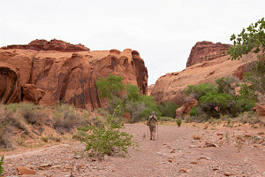
Blocked from further progress, we headed back down-canyon. At that junction, we decided to "just look around the corner" at what was in that other branch. Agreeing to that was a mistake, I learned, for Chris once again entered the goal-achieving zone, and soon we were half-running up this new tributary.
courtesy JInnes
Andrew chases Chris
This continued on for some time, and for a while we were actually proceeding at a running pace. I pointed out to Chris that if we were in the wrong canyon (which I knew by now we most assuredly were), we may very well be in one that continues for a very long time, quite possibly all the way into Circle Cliffs country. I think he finally started to concede that we weren't going to be seeing any slot canyons on this little side journey, and, after running off into the distance around a few more corners (where we kept in touch with some back-and-forth hollering), he returned with a somewhat resigned "I guess we can go back now".
So we turned back to rejoin the group, patiently waiting for us back at the Escalante River. We had to walk nearly two and a half kilometres to get back to the Escalante, and our little "few hundred yards" side exploration to find Ringtail had blossomed into a 6+ kilometre excursion. Later I would learn that I had mixed up the order of Neon and Ringtail, somehow thinking that the latter came after the former, when walking northbound. And much earlier in the day, we had cruised right past the entrance to Ringtail without even noticing it. What we had instead been spending a ton of energy running up and down was a much larger drainage called Choprock Canyon. And yes indeed, this is a way to get from the Escalante to the Circle Cliffs. We coulda been up there for hours or days if Chris hadn't turned around!
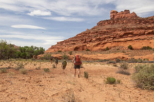
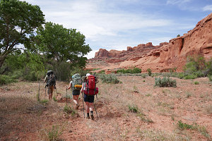
We had expended quite a bit of time and energy on our wild goose chase of Ringtail. It was time to continue our journey north along the Escalante, with the aim of reaching and camping at the mouth of Harris Wash. It wasn't too far away, but the afternoon was drawing on.
courtesy JInnes
courtesy BConnell
Sublime Escalante Scenery
courtesy JInnes
Fortunately, the herd paths and the terrain co-operated. There were plenty of nice open flats with a good path that cut across the major bends of the river, and we made good time. We encountered a couple of rather skittish cattle (which later we found out weren't cattle at all, but feral cows living in the Escalante), including one quite huge and dominant bull that gave us a long evil-eye before charging off into the bush, dust flying, like a big four-footed tank.
courtesy JInnes
Approaching Silver Falls Creek Confluence
By 6pm we were nearing the environs of the Harris Wash/Silver Falls Creek/Escalante confluence. It took us a little back-and-forth to find the actual Harris Wash-Escalante confluence, but when we did, we knew that we were only minutes from at least one good campsite - the one we stayed at back on a
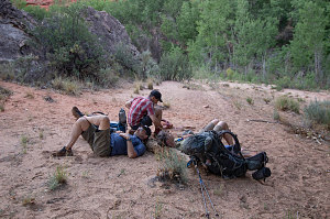
2011 trip with Jenn, Ewart, and Roy (Jenn's Dad). The campsite soon came into view, and, like every other campsite we had encountered so far on this trip, nicely unoccupied. We chilled a bit before setting up the tents and making our dinner.
courtesy BConnell
courtesy JInnes