Friday, September 18
Day 7 - Completion of Norman Creek 3-day backpack
Today we didn't have too much on the agenda. Basically, get back down to the trailhead, and the car, and then figure out what we were going to do next. Fortunately, from our Norman Creek campsite, the car was only about four kilometres away and all downhill, so we knew that it wouldn't take us long at all, giving us the majority of the day to arrange our final sprint -- whatever it might be -- until we had to fly back east.
Another example of impressive food storage
Departing at about 9:30 a.m. under fairly smoky skies (note how I don't give usual weather descriptions any more in this forest-fire influenced climate to which we were constantly subjected), we walked back across the lower bit of Norman Creek's beautiful open meadows, and back into the forest, soon beginning the single big descent that would bring us back to the car. Apart from the odd partridge/grouse, and one or two minor viewpoints, it was a heads-down, tromp-tromp-tromp sort of affair. The hike was short - about 80 minutes in total. The morning had grown warm and sunny but still, of course, quite smoky.
Arriving back at trailhead
Interactive trackmap with photo points - Norman Creek Descent - click map to view
Norman Creek Descent to Trailhead - Hike Data
Start Time:
9:27a.m.
End Time:
10:52a.m.
Duration:
1h24m
Distance:
4.34 km
(2.7 mi)
Average Speed:
3.1 km/hr
(1.9 mph)
Start Elevation:
6526ft
(1989m)
*
Max Elevation:
6526ft
(1989m)
*
Min Elevation:
4733ft
(1443m)
*
End Elevation:
4733ft
(1443m)
*
* : +/- 75 feet
Total Elevation Gain:
7ft
(2m)
*
Total Elevation Loss:
1786ft
(544m)
*
* : +/- 75 feet
Elevation Graph
It was Friday now, the second-last day of our trip. We felt like we were up for one more major outing, but also felt like it would be more palatable to package that into the morning of our final day (tomorrow) rather than trying to cram it into the end of today. We decided instead to turn the remainder of today into a bit of an intermission, taking our time to plan things out, and otherwise, not doing all that much.
First up, we wanted to nail down our accommodations for the night. We agreed that a final scramble somewhere in the general vicinity of Sunwapta Pass (basically right around where we were now, roughly in the vicinity of the boundary line between Banff and Jasper National Parks, was desired. I knew there were a number of easy outings here (which suited us), and it would mean we wouldn't have an excessively long drive back at the end of the day to Calgary (because we were shipping out back east the following day).
The nearby Wilcox Creek Campground along the Icefields Parkway seemed like the best choice for us. It was first-come/first-serve, meaning that at this early point in the day, we were likely to have no problems finding a spot. And it was close to any of the climbing objectives we were likely to choose, meaning we could get to the start of our climb nice and early in the morning, with the aim of finishing early afternoon and permitting a relaxed drive back to Calgary.

Wilcox Creek Campground
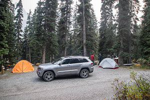
We drove north up the Icefields Parkway for a few tens of minutes, soon arriving at the Wilcox Creek Campground. As predicted, there were quite a few empty sites along the campground's many loops, and soon we were set up in a pleasant enough spot under big, tall, straight trees. The tenting area was a bit gravelly and kind of integrated with the parking but overall still more than sufficient. We lazily got things set up, then convened at the site's picnic table to plan out the final 24 to 36 hours of our trip.
One particular scramble caught my attention, for both its easy level of difficulty and for the fact that it was quite close to the campground: A summit known as Tangle Ridge, close to the Columbia Icefields area. The terrain was such that we could do a nice big loop (always preferable to there-and-back) and it was of medium length (maybe 15km). So long as we started early enough, we should theoretically have no problem finishing early and getting back to Calgary at a good time.
After figuring out our plan for the following day and having set up our accommodations for the night, we were "free" for the rest of the day. Since we had need for a little refresh of our hiking snacks, we decided to drive to the nearest grocery store. That, of course, meant going all the way back up to Jasper. Our back-and-forth along the Icefields parkway on this trip was turning into a regular commute!
After stocking up on snacks at The Grocery People in Jasper, we succumbed to the lure of served dining, and decided to seat ourselves at a table at the nearby Famoso Neapolitan Pizzeria. Eight meat and ricotta meatballs, ten famoso wings, a plate of rigatoni rose, and a few other plates later, we emerge for the hundred-kilometre drive back down to the Wilcox Creek campground. Gino gets a fire going and we do a bit of final organization so that we can get away as quickly as possible the next morning. Julian reveals that he has not been finding his combination of mat and sleeping bag to be warm enough for him, and opts to spend the night sleeping in the passenger seat of the Jeep.