Rimwalk to The Little Grand Canyon
Monday, April 15
A reasonably clear sky greeted the first "doing-stuff" day of our trip. The objective for today was pretty straightforward - an easy shake-out / intro hike.
This was a test of sorts for Evie, Chris and Gillian's five-year old daughter. There was some question as to whether or not she'd be up to hours and miles of hiking, and this was a good intro to see how she'd do.
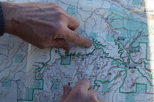
courtesy JInnes
Water Canyon to the Wedge
I had discovered that a multi-use path wound along the edge of a smaller tributary canyon near The Wedge. It was virtually completely level, and the tributary canyon it followed ended near The Wedge Overlook itself, hopefully giving us a great view of the Swell's "Little Grand Canyon". The path ran pretty much right past our campsite, meaning that we would be able to start walking directly from there. Our itinerary wasn't a loop or a there-and-back; rather, Chris and I ferried one of our vehicles to The Wedge overlook, and we would do this hike as a one-way.
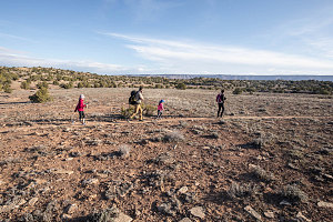
Right from Camp
We started off shortly after 8 a.m., with the kids immediately charging off at full run, each egging the other on. As a result, our overall pace started out quite briskly (we had to keep them somewhat in sight).
As I mentioned before, the path we were on traced the edge of a smaller tributary drainage (called Water Canyon). We had started at a point back near the beginning of the drainage, where it is nothing more than a gentle little depression in the otherwise flat, bush-studded plateau of The Wedge.
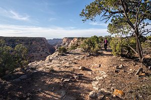
Starting to see canyon!
As the trail traced the edge of Water Canyon, especially when we were aligned next to the main axis of it, we got glimpses further downstream, towards a much more substantial chasm. It was nice doing it this way, starting off subtle and getting increasingly more scenic as we walked along.
In and out, in and out, in and out we hiked. When I said that this path follows the edge of Water Canyon, I meant it. It follows it pretty religiously - there are almost no shortcuts taken that deviate from the rule, meaning that the edge of even minor little sub-tributaries are followed almost religiously. Of course, following the tree-like dendritic pattern in this manner means a whole lot of extra distance. We would see the other side of a minor side-tributary, only a few hundred yards away across a slight dip, and we'd know that it would take quite a lot of walking to go the whole way around to the very head (of the side-tributary) and then back. But... it's very very flat, so that's the bargain.
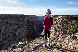
courtesy JInnes
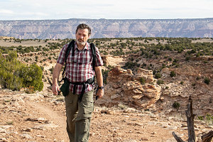
We eventually wound past boondocking campsite number eight, which was unoccupied (and very nice indeed). I should have looked at this one the night before - it would have been an even nicer place for us to have camped.
courtesy JInnes
Katie and Evie were doing quite well, not lagging behind at all and generally enjoying themselves. This augured well for the rest of the trip.
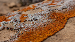
Time and distance were drawing on as the morning progressed. We were doing well, but we also didn't want this hike to end up being too long. We took the liberty in one or two spots to depart from the trail and shortcut across (once across a shallow tributary, and once across the flats of a long finger of flat land between two tributaries). And in the places where we were adjacent to Water Canyon, we beheld how it had transformed from a little hollow into a deep and impressive canyon, with big walls and depth.
courtesy JInnes
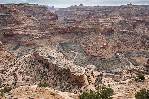
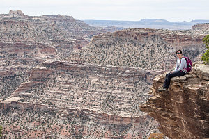
Our shortcuts quickly brought us to the first of the grand views, where Water Canyon emptied into the canyon of the San Rafael River. A broad panorama of tawny cliffs and towers presented itself. Far below (about a thousand feet below), the brown ribbon of the San Rafael River wound back and forth. This was the landscape of Utah's so-called "Little Grand Canyon". And it was indeed very nice. Not as colorful nor as deep as the Grand Canyon, but still very nice. And quiet and relatively unknown. High marks for that.
We encountered the first "other-mode" trail users about this time - a couple of cyclists headed in the opposite direction. We had seen no one else on the trail up to this point.
At the mouth of Water Canyon, the trail turned right and followed along the edge of the main canyon, heading west towards The Wedge Overlook itself. The grand panoramic views continued, although now it was just a slow evolution of the original vista we encountered. There were several groups of hikers and cyclists along this bit. No doubt they had started out from the overlook parking lot, which was now not far ahead.
Mesa Below
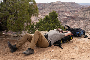
Our rim trail soon merged with a gravel access road. My GPS had indicated that we had exceeded ten kilometres of walking at this point, which had been the informal max distance we had wanted to cover on this first hike. Since we still had a ways to go to reach our shuttle vehicle, I offered to run ahead and bring it back to this point, to which everyone else readily agreed. I dropped my pack and ran the last kilometre or two to the Tahoe and trundled it back to pick everyone up.
courtesy JInnes
courtesy JInnes
This hike had definitely been a success. It was a nice way to limber up and it proved that our group could easily cover a fair bit of distance in a short period of time (assuming relatively easy terrain, of course). We now felt a lot more confident that the days on our upcoming Coyote Gulch backpack would be dispatched fairly easily.
Interactive trackmap with photo points - Wedge Rim Hike - click map to view
Water Canyon and The Wedge - Hike Data
Start Time:
8:18a.m.
End Time:
12:22p.m.
Duration:
4h4m
Distance:
10.12 km
(6.29 mi)
Average Speed:
2.5 km/hr
(1.5 mph)
Start Elevation:
5986ft
(1824m)
*
Max Elevation:
6241ft
(1902m)
*
Min Elevation:
5971ft
(1820m)
*
End Elevation:
6236ft
(1901m)
*
* : +/- 75 feet
Total Elevation Gain:
340ft
(104m)
*
Total Elevation Loss:
89ft
(27m)
*
* : +/- 75 feet
Elevation Graph