Upper Muley Twist
Capitol Reef NP - April 4
The weather conditions on our hike out from Halls Creek and our subsequent beautiful afternoon at Cedar Mesa had been perfect. I had hoped that the same weather would last for this next day, but as we had breakfast and prepped to leave, a high thin cloud deck glided in from the west. Although the termperature and wind were fine, I've never been fond of these high-cloud type days. I find it makes everything look bland.
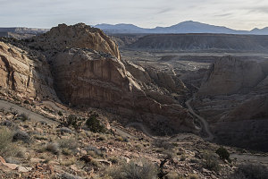
Burr Trail Switchbacks
The objective for today was a very cool hike - a hike along the very crest of the Waterpocket Fold and in an adjacent high canyon known as Upper Muley Twist. The general layout of the hike is a "lollipop" - a bit of there-and-back hiking connected to a loop. The hike would give us hundred-mile views up down along the Waterpocket Fold and much of the land to the east.
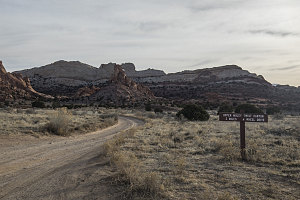
Turnoff to Upper Muley
The start of the Upper Muley Twist hike is along a 3 mile access road branching off from the Burr Trail (the Burr Trail is another backcountry byway that cuts east-west through Capitol Reef roughly halfway up its length). The first bit of this access road is passable to normal-clearance 2wd vehicles, but the final 2.5 miles is designated as high clearance. Our trusty little Kia actually had a front-rear differential lock, a short wheelbase, and pretty good ramp angles, and I surmised that it could make it.
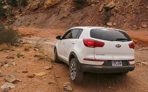
courtesy JInnes
It's a bit 4WD-ish
Turns out I was right - the little Kia could make it. The guidebooks say that a high-clearance 2WD can make it, but I'm not so sure. There are a few spots where if you don't have at least one front wheel and one rear wheel applying power, it would be hard to proceed. And we definitely had to do a bit of careful spotting in places to ensure that only the Kia's rubber touched the earth.
If you don't have a vehicle capable (or you don't want to drive along this type of road), the nominal length of the hike - 9 miles - gets stretched out to about 15.
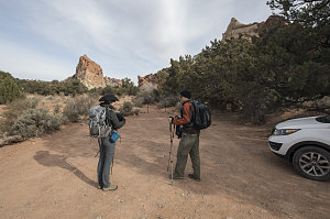
Upper Muley Twist Trailhead
No other cars were parked at the Upper Muley Twist / Strike Valley Overlook parking area at the end of the road. Nice - so far, we had the entire place to ourselves!
As I mentioned earlier, the first part of this hike is the "stick" part of the lollilop. And in this case, that stick is the bed of the Upper Muley Twist wash, which is typically dry, flat, and easy to walk up. We headed off at about 9:30 a.m.
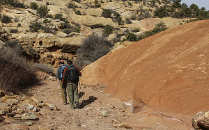
courtesy JInnes
Upper Muley Twist Trailhead
Here's an interesting factoid about this Upper Muley Twist hike: Brian and I had done it before. But way, way, wayyy back - in 1998 - before I had started recording my trip reports on this website. We were quite new to the desert southwest back then, and we were full of wonder at the variety, interesting geology and scenery on this hike. I had always meant to come back someday and hike it again, and finally, here we were - nearly 20 years to the day, as I recall (it had been late March of 1998, I think).
I find the canyon of Upper Muley Twist to be interesting from a topographic perspective. It sits fairly high up in elevation - at roughly 6000 feet - with the much larger and much lower valley of Strike Valley perhaps less than a mile to the east, for almost all of its length. It is, in effect, a little wrinkle in the high crest of the Waterpocket Fold. It follows the low point between the steeply tilted Navajo and Wingate sandstones (which we could clearly see on our right and left), such that it forms a viable drainage system -- and for quite a long stretch of the fold. It's almost like a natural aqueduct, perched up next to the very highest bit of the Waterpocket Fold.
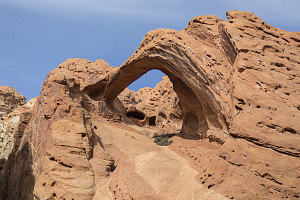
Saddle Arch
After less than one hour of easy wash-walking, we arrived at a point just below a very beautiful orange Wingate arch on our left. This was Saddle Arch, one of the named arches visible along this hike. Directly opposite this arch on the eastern slopes was a faded old sign that marked the branch point of the loop portion of the hike. Turning right would climb up to the crest of the fold. However, we wanted to do the canyon bottom part first, then climb up to the top of the fold and hike it back south. So, after a closeup look at Saddle Arch (very pretty, that arch), we continued north in the floor of Upper Muley Twist.
courtesy JInnes
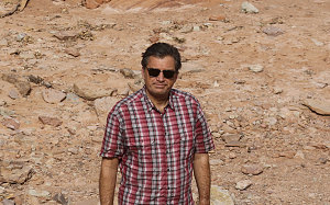
Herr Connellmann
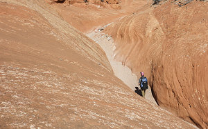
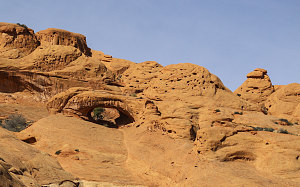
After Saddle Arch, Upper Muley Twist gets a bit more scenic. It narrows a bit, sometimes with some nice v-shaped orange slickrock walls, sometimes with some tilted strata. To the right - a constant presence of rounded cliffs of white Navajo Sandstone - to the left, a strange tilted landscape of orange knobs, eroded out of a solid mass of Wingate Sandstone. This sandstone is prone to forming arches, and there are several - big and small, high and low.
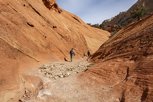
courtesy JInnes
courtesy JInnes
With a nice flat floor and only a few very minor obstacles to scramble over, the walk up Upper Muley twist was straightforward and quick, and in another hour, we saw some cairns marking a steep route right and up, out of the canyon. I was pretty sure that was the designated route, but first we chose to explore the wash a bit further, where it narrowed into an impressive bit of narrow slot. A 10-foot high dryfall blocked the way. A sloping moqui-stepped bypass a short way before climbed around it, but it was fairly clear that would only get us so far. without things getting technical. We returned back to the cairns marking the climb out of the wash bottom.
courtesy JInnes
Beginning of Slot Section
courtesy JInnes
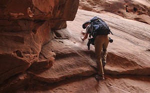
Following the cairns, we climbed steeply, on a sort-of footpath, up over some boulders, a bit of slickrock and past a few shrubs and trees. Soon we were fairly high above the floor of Upper Muley Twist. Brian stopped for a bit of blister care (some things have not changed in 20 years).
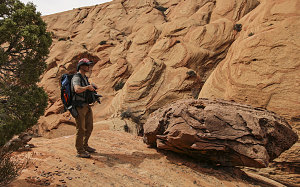
The now-cairned route began a traverse - above the narrow slot that Upper Muley Twist had become - but well below the top of the Wingate and Kayenta Sandstone layers. Being in the Wingate layer meant that the terrain was often smooth slickrock, and in a few places there are slightly airy traverses that must be made -- traverses where the slickrock slope below angles downward, all the way to the slot.
In other places the traversing route follows comfortable ledges, winding around and behind trees. There are one or two minor easy scrambles, too. If you are hiking along this stretch of route, keep an eye out for cairns. There's never one too far away and you should not be hiking for any length of time without seeing one.
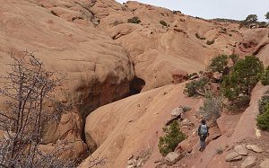
If we lifted our eyes from route-following activities, we beheld an amazing view over to the west side of Upper Muley Twist Canyon. There, a huge slope of strangely eroded Wingate Sandstone knobs dominated the field of view. The sense of the tilt of the Waterpocket Fold is very present when looking at this.
Another look at Tilted Knobs
courtesy BConnell
courtesy JInnes
Andrew, Upper Muley Twist
Staying above the narrows
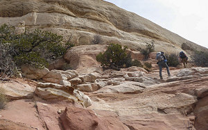
After about 30-40 minutes of the traversing trail, the route drops down into the now-again-wide-and-sandy wash of Upper Muley Twist, which had now risen up to roughly our level. After briefly climbing out of the wash on the far side to get around a dryfall, we arrived at another super-weathered sign marked "Ridge Route". One final crossing of the wash and we began a climb following a footpath (with cairns in places) that wound up towards the white Navajo Sandstone - a layer that was now not too far above us.
courtesy BConnell
Climbing to the White Stuff
Climbing to the White Stuff
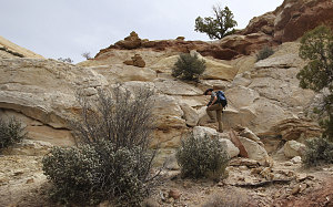
It was only about a 250-foot climb from the wash bottom to the crest of the fold. At the top, the landscape turns into classic Navajo Sandstone: smooth white rock, often covered with a square or parallel pattern of joints; little beehive-like hoodoos, and small bushes and trees dotted here and there. We were on the crest of the Waterpocket Fold here, and the flat white sandstone reached a highpoint and then started to fall away off to the east, where a huge sweep of Strike Valley and then land beyond presented itself to us.
courtesy JInnes