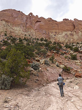
The guidebook makes mention of some sort of old constructed trail as one nears the head of this canyon, but once again I couldn't match up this description in the book to anything I could see in front of me, so we just stayed in the wash bottom all the way to the canyon's head. Once it dwindled to nothing, we simply scrambled up a steep slope to another ridgey pass, not unlike the one at the head of Egg Canyon, but less defined and less scenic.
courtesy BConnell
At the pass, the land beyond immediately dropped down to the east, into a deep basin. This basin connected to the larger, gentler basin through which we hiked ealier in the day. The Chinle pass where we had first truly gotten our bearings earlier in the hike (and hence we could see back to the completion of our loop) could also be seen.
A careful scramble down the steep and somewhat gravelly east side of the pass dropped us to an area of pink Chinle where -- once again -- we saw some good examples of petrified wood, although not as good as the ones in nearby Egg Canyon. We continued east, finding the easiest way around various obstacles, hiking down Chinle slopes of various colors, until we hit one of the old mining tracks from this morning. We turned left along the track until we completed the loop portion of our hike.
Return on old mining track
Intricately pocketed sandstone
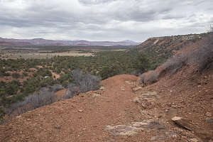
Car in sight
With all of the sightseeing, exploring, and routefinding difficulties behind us, it was an easy and short walk back along the old mining tracks to the car.
This was indeed a nice outing. It was quiet and scenic and the "exploration factor" was high (because it is unmarked and for the most part un-trailed. Also, the petrified wood deposits were first-class.
Interactive trackmap with photo points - Egg Canyon Loop - click map to view
Egg Canyon Loop - Hike Data
Start Time:
10:16a.m.
End Time:
4:52p.m.
Duration:
6h36m
Distance:
15.89 km
(9.87 mi)
Average Speed:
2.4 km/hr
(1.5 mph)
Start Elevation:
6319ft
(1926m)
*
Max Elevation:
6529ft
(1990m)
*
Min Elevation:
5898ft
(1798m)
*
End Elevation:
6317ft
(1925m)
*
* : +/- 75 feet
Total Elevation Gain:
1067ft
(325m)
*
Total Elevation Loss:
1068ft
(326m)
*
* : +/- 75 feet
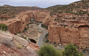
Elevation Graph
courtesy JInnes
Long Canyon
We had one more day of trip left (well, actually less than a full day, since we had to be back in Salt Lake City the next evening). We weren't 100% sure of what we'd do exactly. I had formed an idea to visit the remote area of extreme northern Capitol Reef National Park -- an area that had piqued my interest for many years but which I'd never gotten around to visiting (sound familiar?). I'd heard it was super beautiful, secluded and remote, but it never really fit properly into trip plans.
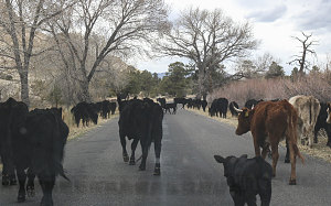
We could have simply gone back to our excellent at-large overnight campsite from the night before, but we figured that if we did want to visit extreme Northern Capitol Reef, it might be best to move our overnight spot to the north, closer to the area. So... we drove back west along the Burr Trail road to Boulder, then took highway 12 north to the Torrey / central Capitol Reef area.
courtesy JInnes
courtesy JInnes
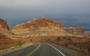
Beautiful Light near Fruita
The Torrey area (and the nearby Fruita area of Capitol Reef NP) is probably the busiest tourist spot in an otherwise fairly sleepy part of southern Utah. And, as it turned out, both the main campground in Fruita and pretty much all of the motels in nearby Torrey, well... they were basically full.
After searching in vain for a more civilized spot to camp (and after crashing an Indian-style Pizza place for a quick bite), we ended up finding an at-large spot not far off the highway just outside of Torrey. It worked as a hidden little place to set up and crash - we didn't choose it for the views or the amenities.