High Country Backpack
August 25 - Grand Teton NP
I let the others have a more leisurely morning. I had the task of obtaining our backcountry permit, and that would require a bit of driving, a bit of waiting, then a return drive. The lineup at the backcountry desk of the main visitor center was pretty slow, too, so it was 10 a.m. by the time I got back to the hostel.
Jenn had obtained our lift tickets while I had obtained the permit. We were packed and ready by about 11 a.m., which may seem late, but the fact that thousands of feet of climbing was going to be handled in twenty short minutes by a machine more than made up for it.
The main tram is capable of carrying one hundred passengers, and is quite new - built within the last ten years. It effortlessly whisked us up 4000+ feet to a sub-summit high up on the ridge of Rendezvous Mountain, at 10,450 feet.
The plan (for our backpack) was pretty straightforward. Hike west towards the crest of the Teton Range, finding a nice place to camp somewhere high in the drainage of the Middle Fork of Granite Creek. The total distance looked to be less than 8km (this time much more carefully verified by me than my careless Jenny Lake Loop estimate). And, it was overall a net loss in elevation, although the number of ups and downs along the way probably equated to about 800 feet of gain. Still, 8km and 800 feet of up was easy-peasy by our standards.
Starting with the tourists
On our summit along Rendezvous Ridge, we had a panoramic view of the lands of the park to our west. The three forks - south, middle, and north - of Granite Creek drained downwards before us, funnelling into Granite Canyon which carved its way just to the north of us down to Jackson Hole. Our view afforded a single glance of almost our entire 2-day hike, and I could point out to the others more or less the spot where we intended to camp, in the high alpine meadows nestled beneath the backbone of the park - the Teton Crest.
While regular tourists shivered in their summer clothes and crocs on the cool summit, we in our more appropriate hiking clothes shouldered our big packs and clomped downhill in our hiking boots, headed for the expanse of beautiful backcountry that we could see laid out before us.
For a few minutes, we walked along the paths of the ski resort, which were fairly busy with day hikers from the tram. Soon, however, we turned off onto the Rendezvous Mountain Trail and past the sign that marked the Grand Teton National Park boundary. From that point on we saw no one for the remainder of the distance to our camp. Swee-eeet.
courtesy PChen
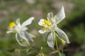
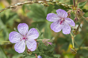
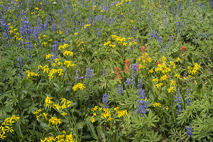
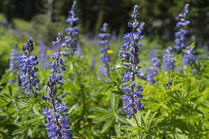
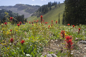
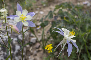
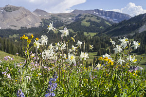
A beautiful little path led downhill through coniferous forest, properly graded and switchbacked throughout. We briefly crossed the bottom of a high alpine bowl (still with a large snowfield adjacent to the trail), and then slightly back up and across a ridge. It was here that we got our first taste of the wildflowers that were blooming in profusion at the roughly 9000-foot elevation level in the park. Columbines, geraniums, lupines, paintbrushes. Little did we know it was only a preview of what was to come.
courtesy JInnes
courtesy PChen
After our initial wildflower photo stop, we continued along the Rendezvous Mountain Trail, starting once again to descend - this time into the drainage of the forks of Granite Creek. We plunged back into shady conifer forest, easily and comfortably losing the final few hundred feet of descent to the bottom.
courtesy PChen
Down into the next valley
A sign marked our arrival at the edge of the Middle Fork Backcountry camping zone - our camping zone for this trip. Although we technically could have camped anywhere beyond this point, we wanted to make decent distance today to divide up the distance of our two-day backpack in a more even manner - and because a location in the high alpine at the upper end of the camping zone was probably much more scenic.
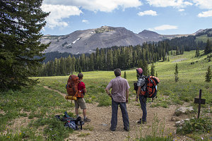
We bottomed out at the creek-bed of the South Fork of Granite Creek - which was entirely dry, so no water fillup here (we had brought enough for the day's needs, but we were relying on a flowing stream to tank up before our camp). Our route now cut more or less straight west, following a connector trail across mostly open subalpine meadows with occasional short stretches of forest. At the end of the connector trail we arrived at a junction with the Teton Crest trail - a 64 km (40 mile) long distance hiking route that follows the backbone of the park. Although this was not the most rugged part of the park, it was sufficiently mountainous, and it was also a wide-open, peaceful, relaxed, secluded place. A joy through which to stroll.
courtesy PChen
We turned north onto the Teton Crest trail. We'd be following it for a short distance, and in fact we'd probably be camping somewhere near it. We were now nearing the upper end of our camping zone, and soon we'd have to choose a spot - and find a place to get water.
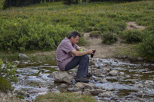
Fortunately, the latter soon was solved as we arrived at a crossing of the upper end of the Middle Fork Granite Creek, which was a beautiful little crystal-clear watercourse. We stopped to filter an amount of water that would do us for the evening and the next morning. While doing so, a fast-moving but very brief rainstorm passed over us. Not long after, warm sun returned.
courtesy JInnes
courtesy JInnes
courtesy JInnes
Just beyond the creek, we saw the signs for the camping zone's group campsite. We could have camped here (in fact so far it seemed like no one else at all was camping in this entire huge backcountry camping zone), and that would have afforded us a table, hard-sided food storage, an outhouse, etc. But, this group site was situated in a small bit of forest, and I was more in the mood for a scenic backcountry campsite, so I convinced the others to climb further along the trail, back up into an open alpine area.
courtesy JInnes
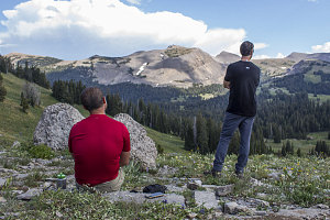
We soon re-crossed the 9000-foot mark (heading up now) and started across a much larger area of open alpine meadow. The scenery looking back east was now much more expansive, reaching all the way back to the (now-distant) Rendezvous Ridge ridgeline that we had stood on after getting off of the tram earlier today.
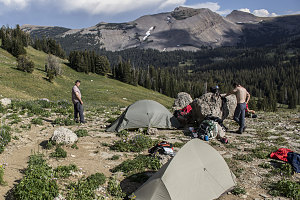
Ahead, a little knoll looked like it might provide a flat spot to camp on this otherwise large, sloping meadow. The knoll was slightly rocky but would work. I called for the others to take a break while I dropped my pack and headed further up the trail, looking for better alternatives. We were very close to the upper end of the camping zone, and the chances of finding a better camp location were slim. Nevertheless, I hiked another five minutes to the top boundary, and found nothing better. I returned back to the knoll and we agreed that this would be a suitable spot for our camp. More than suitable, I thought. What an excellent view!

courtesy PChen
courtesy PChen
courtesy JInnes