courtesy PChen
Meta-capture of an amazing thing
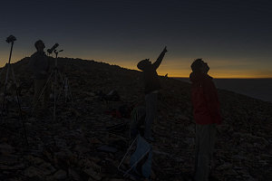
Totality was two minutes and twenty seconds for us here in the White Clouds. And in that short time, we were able to contemplate the bizarre and otherworldly - really, alien - spectacle above us. Streaming silvery corona - pink eruptions of solar prominences, huge larger-than planet-sized gouts of energy and plasma, so far away that they hung motionless, right around the edge of the moon. Realizing how incredible it was that the moon was precisely 400 times closer and 400 times smaller than the sun, providing us this precise and perfect occultation and allowing us to see the corona in full, spectacular fashion. We felt... like we were on another planet.
At the two minute mark, our eclipse timer beeped, and we knew we had twenty seconds to say our goodbyes to totality, capture the transition back to partial, and prepare to put our eclipse glasses back on. We could see the top-right side of the moon start to brighten a bit, and I got ready with my camera. I wanted to try and capture one of the beautiful and transient images of the moment that totality begins and ends.
I managed to luck out, and I captured one of these effects - the so-called "Diamond Ring" effect, where a tiny bit of photosphere shines brilliantly in one spot while the ring of the corona remains visible for a few moments longer. The flash of the photosphere forms the "diamond" part and the corona forms the "ring" part. Have a look at the photo and see what you think. I think the focus is off slightly, but not bad for a first-time totality photographer.

The Diamond Ring
The transition from totality back to a thin crescent of partiality was as breathtaking, if not more, than the descent into the darkness of totality. We returned from the underworld, back up into the land of the living, in just a few seconds. No wonder the ancient peoples of the world associated this sort of event with heaven, hell, punishment, and redemption.
A thin crescent of light, now facing up and to the right, marked the beginning of the long slide of the moon off of the sun's face. While it was something to capture and take note of, the real excitement had now passed. We again looked around at our surroundings, noting the weird light and the odd shadows.

courtesy PChen
We reflected on the experience as normal light gradually asserted itself over the landscape. We needed more time to process it, I think. It hade been so strange, so jarring to see our normal companion - the sun - transformed into that alien thing glowing in the sky. Had we imagined it?
Fortunately, it seemed at first glance as if our photographic efforts had been largely successful, and I was delighted with some of the initial thumbnails of the eclipse that I reviewed on my camera. We appeared to not have screwed it up!

courtesy PChen
Descending to Railroad Ridge
We waited until the moon had slid halfway off of the sun, and then decided to call it quits. All of the exciting stuff was over, and we had already experienced the first partial eclipse sequence. The second sequence would simply be the reverse. We had plenty of photographic evidence now, and to us it made more sense to try and get back to our camp, the car, and our next destination - at reasonable hours.
By the way, have a look at this embedded video below... it shows the progression of the eclipse from the view of some of the video and time lapses we gathered...
Eclipse Video Sequence - Click on video above to start
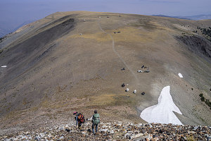
After packing up all of the camera gear, a short twenty minute walk / downclimb brought us back to our camp. Another short break to pack that up and we continued on down. We chose a different line down off of alpine terrain, taking advantage of some gentle and sparsely forested slopes to shortcut down to an old abandoned track, which in turn eventually joined us with the 4x4 forest road. From there, it was a rather boring, dusty and tedious descent back down to the Big Boulder Lakes trailhead. Our optimized descent route saved us about 2km (1.2 miles).

courtesy PChen
Eclipse Hike Day 1, Climb to Camp - Hike Data
Start Time:
9:31a.m.
End Time:
3:27p.m.
Duration:
5h55m
Distance:
9.99 km
(6.21 mi)
Average Speed:
1.7 km/hr
(1.0 mph)
Start Elevation:
7171ft
(2186m)
*
Max Elevation:
10403ft
(3171m)
*
Min Elevation:
7168ft
(2185m)
*
End Elevation:
10349ft
(3154m)
*
* : +/- 75 feet
Total Elevation Gain:
3214ft
(980m)
*
Total Elevation Loss:
10ft
(3m)
*
* : +/- 75 feet
Elevation Graph
Start Time:
7:19a.m.
End Time:
8:06a.m.
Duration:
0h47m
Distance:
1.13 km
(0.7 mi)
Average Speed:
1.4 km/hr
(0.9 mph)
Start Elevation:
10353ft
(3156m)
*
Max Elevation:
10833ft
(3302m)
*
Min Elevation:
10314ft
(3144m)
*
End Elevation:
10833ft
(3302m)
*
* : +/- 75 feet
Total Elevation Gain:
461ft
(141m)
*
Total Elevation Loss:
14ft
(4m)
*
* : +/- 75 feet
Elevation Graph
Start Time:
12:26p.m.
End Time:
12:49p.m.
Duration:
0h23m
Distance:
1.06 km
(0.66 mi)
Average Speed:
2.8 km/hr
(1.7 mph)
Start Elevation:
10733ft
(3271m)
*
Max Elevation:
10801ft
(3292m)
*
Min Elevation:
10339ft
(3151m)
*
End Elevation:
10368ft
(3160m)
*
* : +/- 75 feet
Total Elevation Gain:
13ft
(4m)
*
Total Elevation Loss:
424ft
(129m)
*
* : +/- 75 feet
Elevation Graph
Start Time:
2:04p.m.
End Time:
4:35p.m.
Duration:
2h31m
Distance:
8.05 km
(5.0 mi)
Average Speed:
3.2 km/hr
(2.0 mph)
Start Elevation:
10339ft
(3151m)
*
Max Elevation:
10342ft
(3152m)
*
Min Elevation:
7197ft
(2194m)
*
End Elevation:
7197ft
(2194m)
*
* : +/- 75 feet
Total Elevation Gain:
0ft
(0m)
*
Total Elevation Loss:
3101ft
(945m)
*
* : +/- 75 feet
Elevation Graph
The next order of business was finding a place for us to spend the night. With all of the stories of uber-expensive and uber-booked lodging anywhere within a hundred miles of the path of totality, we didn't even consider finding a place with a roof. We drove back out of the Idaho backcountry to a main highway, and started to make our way generally east and south. We kept our eyes open for campgrounds of any sort, but didn't find many in this part of the state, and those that were were jam-full up.
Several hours of driving saw us reach Idaho's central valley, near Craters of the Moon National Monument. The Monument's campground was totally full, of course, and so we began to look at finding some quiet little bit of BLM land where we could just camp at-large. After all, we had all of the necessary gear and still had plenty of water.

At-large in Idaho
BLM lands (Bureau of Land Management) are tracts of territory that are federally owned and upon which camping at-large is allowed. We had purchased an Idaho state recreation map, and at this point Brian was carefully scanning it to find the telltale shaded yellow areas that indicated this land. After a few false starts, we found a small little gravel road right off of the main highway near Craters of the Moon. The land immediately adjacent on that side of the highway was BLM land, and so all we had to do was drive as far as necessary to be out of sight and find a suitable spot.
The little gravel road soon dead-ended, so we simply set up right at the end of the road. Perfect. A classic case of improvisation and contingency management.

courtesy PChen