High Country Backpack, day 2
August 26 - Grand Teton NP
Another clear pre-dawn sky greeted us on the last full day of our Great American Solar Eclipse trip. We'd had a great run of excellent weather, with only a few morning and afternoon rain showes on two days. Perfect otherwise.
Our objective today was straightforward and not that difficult: pack up, hike to the top of the Middle-North Fork Granite Creek Divide (which was only about 100 feet of elevation and a few minutes of walking), then descend the entire length of Granite Creek and Canyon, starting from the top of the North Fork. It was an almost entirely descending route, and at a very moderate grade. Assuming the trail was in good shape, it would be a very easy 16-17km hike.
Pre-dawn, Grand Teton Backcountry
The sun came up, we had a final camp breakfast, and we packed up for our journey out. By 7:30 a.m. we were walking north, up very briefly and then starting down into the drainage of the North Fork of Granite Creek. Once again, we hiked down past that amazing(tm) display of colorful wildflowers. And this time, the early morning sun was shining on them, further accentuating the colors. Wowow! [many more pictures taken at this point... see following]
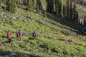
courtesy JInnes
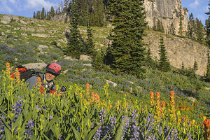
courtesy PChen
In the "thicket" of things
Eventually we tore ourselves away from the floral brilliance, and continued down the steep trail. We soon came to the bottom of the drainage and turned right at the junction with Granite Canyon trail (yesterday evening we had continued north on the Teton Crest trail to Marion Lake).
Now down in the valley bottom, the trail descended at a much more moderate grade. The trail's tread was excellent - not unexpected given what we'd seen so far in this park, but still appreciated. We alternated between stretches of shady forest and subalpine meadows - meadows that were again rich with all sorts of wildflowers.
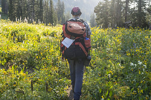
courtesy PChen
For a couple of hours, we descended the very easy, gentle Granite Canyon Trail. We crossed Granite Creek itself several times, at one point stopping to filter a few litres of cold fresh mountain water. There were many nice back country campsites along the way, of which only a very few were occupied. It seemed like the entire southern backcountry of Grand Teton NP was not very busy this late August of 2017. Slightly surprising, given the recent eclipse.
The temperatures rose but the trail grew more forested, shadier, as we descended. The waters of Granite Creek grew as tributary upon tributary emptied their contents into it, and near the bottom, it was a decently-sized rushing, cascading river. The valley narrowed into Granite Canyon proper, with high rocky walls on either side (but not particularly narrow). We noted the changes in vegetation as we descended, too. Some deciduous plants had crept into the forest mix, and the colorful wildflowers had disappeared from the meadows. Likely it was past blooming season at these lower, warmer elevations.
Finally, about four hours after setting out, we arrived at the mouth of Granite Canyon and the end of the Granite Canyon trail. Here we intersected with the Valley Trail, which we'd be taking right (south) to connect back to the ski resort.
It was much hotter down here in the main valley - almost a bit stifling. As we hiked south along the Valley Trail, it followed a course that gradually ascended some way up from the actual flat floor of the valley. Accustomed now to downhill hiking, this section of uphill soon had us sweaty and sticky.
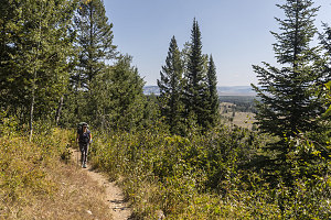
Valley Trail
A few kilometers of hot and somewhat uphill hiking brought us to the borders of the ski resort, where we had to navigate through a somewhat confusing set of multi-purpose trails, but eventually got ourselves onto the main trail that led down one of the bigger ski runs. We could now see the buildings of the ski resort in the distance, so there wasn't any mystery about where to go.
We all stopped next to the base of the tram we had taken up the day before, propping up our packs in the shade of a big tree. While I went and fetched the rental car, the others availed themselves of coffee and cold drinks at a little shop nearby.
And that, my friends, marked the end of our 2-day very scenic and rather relaxed backpack in Grand Teton National Park.
Interactive trackmap with photo points - Grand Teton NP Backpack - click map to view
Start Time:
11:32a.m.
End Time:
11:51a.m.
Duration:
0h18m
Distance:
3.65 km
(2.27 mi)
Average Speed:
12.2 km/hr
(7.6 mph)
Start Elevation:
6350ft
(1936m)
*
Max Elevation:
10328ft
(3148m)
*
Min Elevation:
6350ft
(1936m)
*
End Elevation:
10328ft
(3148m)
*
* : +/- 75 feet
Total Elevation Gain:
2343ft
(714m)
*
Total Elevation Loss:
0ft
(0m)
*
* : +/- 75 feet
Elevation Graph
Start Time:
11:51a.m.
End Time:
3:32p.m.
Duration:
3h40m
Distance:
8.06 km
(5.01 mi)
Average Speed:
2.2 km/hr
(1.4 mph)
Start Elevation:
10530ft
(3210m)
*
Max Elevation:
10530ft
(3210m)
*
Min Elevation:
8791ft
(2679m)
*
End Elevation:
9225ft
(2812m)
*
* : +/- 75 feet
Total Elevation Gain:
602ft
(183m)
*
Total Elevation Loss:
1879ft
(573m)
*
* : +/- 75 feet
Elevation Graph
Evening hike to Teton Crest
Start Time:
4:55p.m.
End Time:
7:09p.m.
Duration:
2h13m
Distance:
6.8 km
(4.23 mi)
Average Speed:
3.1 km/hr
(1.9 mph)
Start Elevation:
9242ft
(2817m)
*
Max Elevation:
9682ft
(2951m)
*
Min Elevation:
8935ft
(2723m)
*
End Elevation:
9233ft
(2814m)
*
* : +/- 75 feet
Total Elevation Gain:
1148ft
(350m)
*
Total Elevation Loss:
1172ft
(357m)
*
* : +/- 75 feet
Elevation Graph
Campsite back to Ski Village
Start Time:
7:26a.m.
End Time:
12:35p.m.
Duration:
5h8m
Distance:
16.27 km
(10.11 mi)
Average Speed:
3.2 km/hr
(2.0 mph)
Start Elevation:
9228ft
(2813m)
*
Max Elevation:
9317ft
(2840m)
*
Min Elevation:
6350ft
(1936m)
*
End Elevation:
6350ft
(1936m)
*
* : +/- 75 feet
Total Elevation Gain:
332ft
(101m)
*
Total Elevation Loss:
3237ft
(987m)
*
* : +/- 75 feet
Elevation Graph
We'd arrived back at Teton Village at a nice early hour - not long after noon. This was intentional, because we had a multi-hour drive back south to Salt Lake City, in preparation for our flight back home the next morning.
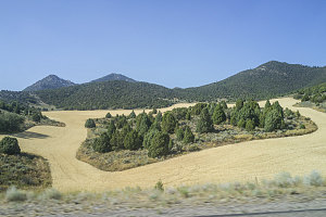
courtesy PChen
Back to SLC
The drive back south was quite scenic, passing though scenic river valleys and dry, hilly ranchlands (pretty much everywhere out west involves a scenic drive, it seems). We neared the Salt Lake City area before sundown and checked into our trusty Motel 6, where we did a final pack-up before heading out into the nearby downtown for a last dinner out and to wander around the center of the Mormon faith, observing the various cultural and religious sites.
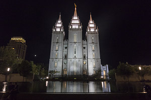
Salt Lake Temple
Early Sunday morning, we returned our rental car and boarded our flight back east. The end of a very successful trip, I'd venture to say. I was especially pleased with how well we managed with the actual eclipse - a far better attempt than that ill-prepared and ill-executed one
way, way back in 1994. May the one coming up in 2024 (again in the Adirondacks, curiously, and almost 30 years to the day from the May 1994 eclipse) be even better. I'm surely not going to miss it, in any case.
As always, I extend thanks for the great companionship and cooperation to Brian, Jenn and Pu. I'm glad to have people around that like doing this sort of thing as much as I do.