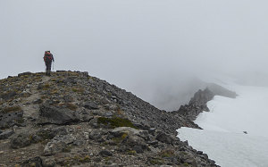
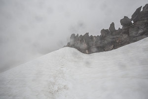
We were able to follow the nice ridgecrest path up to just before an elevation of 8000 feet. After this point, the ridgecrest itself became rough and craggy, and travel would now have to occur on the snowfields immediately to the right of the ridgeline. This would lead us up to the Gerdine glacier, where presumably we would then rope up for glacier travel. Of course, we really couldn't see where this was, since visibility was back down to perhaps a hundred yards.

courtesy BConnell
The end of bare ground
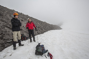
As we stepped back onto snow, it began to rain - rain mixed with a bit of slushy snow, in fact (Rosty called it 'snain'). Faced with another decrement to the quality of our experience, we stopped for a break to discuss our options. It was now nearing 4pm, and it had started to rain and sleet. We were still about a mile and a half (2.5km) away from the summit, and we also had a fairly respectable 2,500 feet of elevation yet to gain. Plus we'd soon have to mess with ropes, maybe some crampons, and we'd probably have no views at all. Not particularly compelling.

Voting time
So, what to do? There was relatively little wind; the weather wasn't particularly treacherous, so much as it was simply depressing and dreary. We had warm clothes, lots of food, headlamps, maps, compasses, and four functioning GPSs, three with tracks. And, we knew the route above was not overly technical. It wasn't like we were going to be unable to safely retrace our steps.
Still, after some debate, Arn and Brian voted for a turnaround. Rosty was still keen to go. I was kind of leaning with Arn and Brian, but wasn't fully ready to give up yet. All the effort to get here.....hmm.
Looking at it democratically, two votes for down against one vote and a half for up settled it. Down we'd go. But before turning around, Rosty wanted to burn off a bit more energy by kicking up the snow slope for a few more minutes, to which I agreed to accompany him. We quickly hiked up to the 8000-foot line, observed a world of snow and cloud and a bit of dark rock, then turned back. No Glacier Peak for us on this trip!

Rosty and Andrew's turnaround
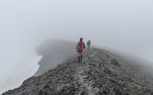
After returning to Brian and Arn, we got back onto the bare section of ridge. The little footpath allowing us to cruise downhill quite quickly, and soon the rain/sleet mix had turned back into straight rain. Now that our summit hopes were over, the dreary weather only further inspired us to quickly make the journey back to our camp, where we could have a quick hot meal and escape into the comfort of our sleeping bags.
Down we went along the ridgeline, up over the large snowfield, and down towards Glacier Gap. We decided that we wanted to avoid re-ascending the glacier fragment and its attendant requirement of putting on crampons, etc, so we chose a slightly alternate lower route around it. Although this more or less worked (and was perhaps marginally shorter), upon reflection afterwards I wondered if it had been the best choice. We ended up having to traverse across a large stretch of loose, rough, bouldery terrain. The sort of terrain that constantly requires a bit more effort, a bit more concentration, and a slower overall speed. Tedious and generally unpleasant. Oh, how I wished that this year hadn't had such a dearth of snowfall. I envisioned how awesome it would have been to cruise above all of it on a nice big, white, snowfield.

courtesy BConnell
My daydreams of extensive snowfields aside, eventually we wound our way across the boulder fields, around rushing meltwater streams, and across eroded gullies. Before us now was the gentle slope and mossy ground surrounding the little glacial lake beside which our tents were camped (but which we could not yet see, owing to the thick cloud). Rosty and Arn went on ahead to start the stove and dinner, while Brian and I retraced our steps a bit to retrieve his GPS, which he'd dropped at some point (fortunately, we were able to retrace our steps and found it within fifteen minutes).
Mosses and Lichens of home
Safely back at our camp shortly after 7pm, we had dinner. Even though it was still more than an hour before sunset, dense clouds and a light but constant rain reduced the world to a 100-yard circle of dark, wet grayness. We retreated to our tents and packed it in for the night.
Interactive trackmap with photo points - Glacier Peak South Route Day 2 - click map to view
Glacier Peak South Route Day 2 - Climb Data (failed to summit)
Start Time:
11:09a.m.
End Time:
7:06p.m.
Duration:
7h57m
Distance:
10.93 km
(6.79 mi)
Average Speed:
1.4 km/hr
(0.9 mph)
Start Elevation:
6418ft
(1956m)
*
Max Elevation:
7885ft
(2403m)
*
Min Elevation:
6414ft
(1955m)
*
End Elevation:
6431ft
(1960m)
*
* : +/- 75 feet
Total Elevation Gain:
2018ft
(615m)
*
Total Elevation Loss:
2010ft
(613m)
*
* : +/- 75 feet
Elevation Graph