courtesy BConnell
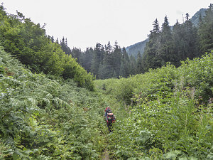
Crossing Avalanche Swath
From Red Creek, it was another mostly flat (some fairly mild ups and downs) 1.5 miles (3-ish km) to the Mackinaw Shelter. Mostly we were still travelling through forest, occasionally emerging out into the open when we crossed the brushy path of old avalanche scars.
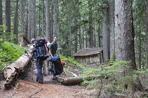
Mackinaw Shelter Stop
Based only on the description, I expected some sort of lean-to or even a cabin with doors and windows. The Mackinaw Shelter is neither and less than either of these: a rather dilapidated affair that is (or was) half lean-to, half shack. Its roof was partially collapsed, and several side panels were missing. The overall sense was 'rickety'. It would offer some shelter in bad weather, but the extensive tentsites around the shelter are probably more attractive these days.
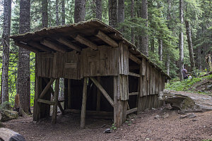
Mackinaw Shelter
Even though it was only 10 am (meaning we had traversed the 5 miles in about 3 hours - quite good), we decided to have what amounted to an early lunch. This was a good spot for a break - there was another nice backcountry outhouse here, and we also knew that the trail ahead was about to get harder, as we'd be starting the steep climb up to White Pass.
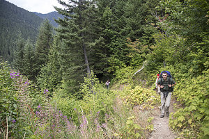
Starting climb
Nicely rested and with our bellies now containing a few more calories, we continued on from the Mackinaw Shelter. For a few minutes, the trail continued its nice gentle progression through deep, old-growth forest. The pitch then increased, still in forest, then out into the open, as we emerged into an open but brushy avalanche scar, and we began a long series of switchbacks.
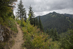
Increasing Valley Views
Despite the uphill, the going was still pretty good: the grade was engineered to be below what I'd consider truly steep, and the footing was good: rarely was there a spot where you had to lift yourself over a big step or rock. Back and forth went trail #649, climbing ever upward. The trail's path would alternately cross into a strip of dark forest, then back out into an avalanche scar, and then back into forest again. There was a nice sort of rhythm to it - light, dark, switchback, dark, light, switchback. Etc.
While the trail continued to be great, the weather didn't follow suit. Our earlier periods of warm sun had gone, and now that we had ascended a bit and could see out from the avalanche paths, we noticed that the tips of the nearby peaks were touching the bottom of the cloud deck. Furthermore, upon looking back west, we noticed a light-colored misty wall of cloud. I'd been on enough outdoor trips to know that that was precisely what rain at a distance looked like. Things were looking down just as we were getting up.
Sure enough, it started to rain shortly thereafter. Nothing heavy, just a light sprinkle, but it was disheartening nevertheless. Perhaps, we hoped, it would blow through and we'd be returned to the intermittent sun and cloud from before.
The trail, meanwhile, continued its steady but quite reasonable climb up the valley side. 3000 feet of elevation gain is a fair amount on any climb, but owing to the well-engineered trail, we surmounted it without nearly as much effort as one would expect while carrying a 50-lb pack.
By about the 5000-foot level, we arrived at the final switchback, and began a long, traversing gently-ascending rise towards White pass. We were now almost entirely in open alpine meadowland. Unfortunately, the clouds had descended further and we couldn't see much of anything except down to the valley bottom.
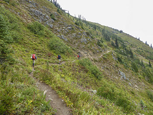
courtesy BConnell
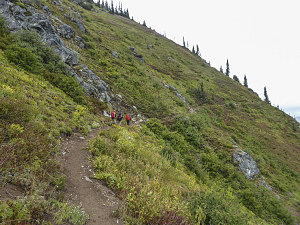
courtesy BConnell
The traverse along the final bit of trail 649 was quite easy, as the grade continued to lessen. Soon we arrived at a junction with another trail, this one quite famous - the PCT, or Pacific Crest Trail (The Pacific Crest Trail is a 2,650-mile odyssey of a track that extends from Mexico to Canada, following along some of western North America's best mountain scenery. If I was going to do a long distance trail, I'd probably choose this one).
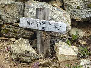
courtesy BConnell
About fifteen minutes and half a mile later, our sojourn along the PCT was over, as we arrived at White Pass. From here, we'd be angling off on another side trail on our way towards Glacier Peak. Thanks for the great hike, PCT!
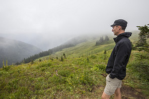
Another disapproving weather glare
Up here at White Pass, in the alpine on the crest of the ridgeline separating the major drainages in this area, we were positioned to take in great views in all directions. Unfortunately, it was not to be. Soon after reaching the PCT, we ascended into the cloud layer itself, and by the time we reached the pass, at roughly 6000 feet, all we saw in any direction was white. The pass was certainly living up to its name today, I guess. It wasn't really raining, per se - but it was excessively moist, misty, and damp. Pretty much what you'd expect when hanging around inside a cloud.
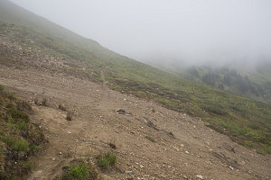
White Pass
We stopped at White Pass for a break, but apart from the necessity for a bit of food, there wasn't much reason to just sit around, so we continued on.
Our route from here not was not precisely clear to us, owing to the disorienting mist. We had consulted several different trip descriptions and had printed off some maps with some rough tracks drawn on them. Basically the idea was that we had to head northeast, contouring along at roughly our present elevation until we could find a suitable way over the ridgecrest above, which would allow us access to the high basins on the west side. From there, a bit of hiking in a generally northward direction would take us to a point below the start of the south ridge climb up Glacier Peak itself.
Although not marked on our topo maps, we encountered a marked trail - called the Foam Creek trail - that led in our desired direction. We began following it, and it seemed to do exactly what we wanted - contour along at a constant elevation below the ridgeline. The key would be to branch off left at the best point - something not all that easy to do with such low visibility.
The Foam Creek trail, although a tiny little footpath, was quite nice. Traversing in and out of innumerable little sideslope gullies, the trail cut mostly through soft meadow turf. The plump white forms of countless hoary marmots popped up and down throughout this section. Half the time they seemed to almost be looking for food handouts, and half the time they seemed to be shrilly warning of our approach (hm, or perhaps they were heralding our approach...).
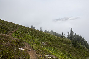
Mountaintop glimpse
Then, something wonderful happened: a rent in the clouds. Faintly at first, nothing more than a darker spot in the air above, we saw something. This grew into the recognizable shape of a craggy mountain ridge off in the distance - our first view of any such thing on the trip so far. Starved of any sort of views, this tiny sliver of scenery was electrifying. It grew larger, became more clear, even became surrounded by blue sky. Fantastic.
At first, excitedly, we thought it was part of Glacier Peak. After a few minutes, though, we oriented ourselves and realized that it was actually a neighbouring mountain to the south called Indian Head Peak. Still, it was beautiful, and a welcome sight after so much... blankness. Maybe, just maybe, our luck with the weather was turning?
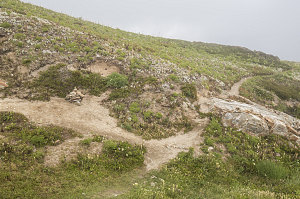
Climbing route turnoff
We soon came to a very obvious cairn along the side of the trail, and a clear footpath heading uphill to the left. This was very likely the signal to mark our turnoff from the Foam Creek trail and onto the climbing route leading to Glacier's south ridgeline. We turned left and headed up a packed gravel slope. Likely the ridgecrest was not far above.
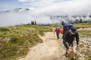
Actual sunshine
The mists around us continued to break up as we climbed the gravelly slope, and soon there was a lot of blue sky above us. Much of Indian Head Peak was now visible to the south, and real, honest-to-goodness sunshine beat down on us. Things were looking up!
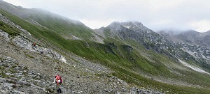
We soon reached the top of the gravelly slope - but, we were not at the ridgeline. Instead, the footpath we were following dipped down steeply again, but still on the eastern side of the ridgeline. Looking closely at our maps and at the path ahead, we could see that we were only at a high shoulder along the footpath's way to the ridgeline. Slightly annoyingly, we would now have to steeply descend into the head of an intermediate basin before making the actual climb up and over the east-west ridgeline. Sometimes the vagaries of topography results in these sorts of minor disappointments. Nothing to do but soldier on...
courtesy BConnell