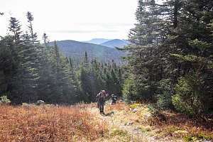
After an almost-scramble down from the 2nd summit of Montagne de Marbre, the grade lessens and we begin a fairly long walk down the border cut towards Mont Saddle. It is a bit strange to be walking directly along the border like this. Gives new meaning to the term "international travel". International foot travel, no less!
Chatting down the long slope
Soon we pass a hunting blind, perched in the trees of the forest on the Canadian side. And soon, another. It's worth mentioning at this point that there also an inordinate number of signs (again on the Quebec side) saying chasseur à l'affût (which can best be translated to english as "hunters around" or maybe "hunters afoot"). In fact, we've been seeing these signs, and blinds, and other indications of hunting, all day long. I have never been in any one location that has more hunting indications than this little slice of Quebec. Very weird.
courtesy JInnes
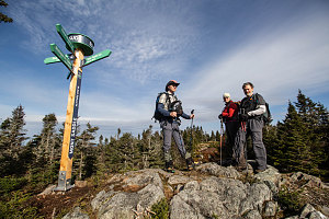
The walk along the border cut from Montagne de Marbe to Mont Saddle is easy and pleasant. The cut is sheltered from the wind and the November sun is warm today. It isn't long before we are steeply climbing the last few grassy metres to the summit of Mont Saddle, where another of these fancy new posts and directional arrow signs is planted. This summit is only open by virtue of the border cut, which again goes right over the summit. Another of the antique border markers is visible not far beyond, and we go over to give it a visit.
courtesy JInnes
Final pitch to Saddle summit
After visiting the old border monument, we return to the summit of Mont Saddle and find a nice spot in the sun and out of the cool wind to have our lunch. It is such a pleasant day today, made more so by the complete lack of other hiker traffic. We literally seem to have the whole area to ourselves.
By half-past noon, we are beginning to make our way back down Mont Saddle, back the way we came. We're heading back to the car now, and all of the day's climbing and summit-visiting is now over.
We hike partway back along the border cut between Mont Saddle and Montagne de Marbe, until we encounter the junction with trail SF5, which turns off the ridgecrest, away from the border cut, and heads [fairly] directly down towards the parking area.
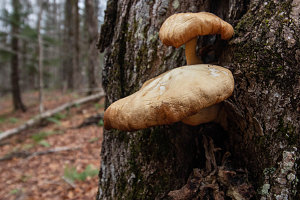
There's not too much to report about our hike down trail SF5. The grade is gentle, much gentler than the steep climb up Montagne de Marbre. The trail is littered deep with the fallen leaves of autumn, requiring care when stepping so as not to inadvertently twist your ankle on a hidden rock. Lower down on the trail, the trail buts up against a large network of blue tubes running from tree-to-tree. We are hiking along the edge of an extensive maple syrup farm, perhaps the largest one I've ever seen. I guess this isn't surprising since we are, after all, in pretty much the center of the world's maple syrup production here in eastern Quebec.
Hmm. what's this blue stuff?
courtesy JInnes
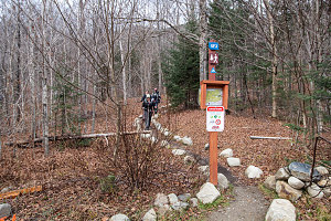
At the bottom end of trail SF5 we encounter the SF2-SF5 junction that I stupidly missed earlier in the morning, and I wistfully look up the SF2 trail, regretting the probably nice cliff-views we missed. But this is a very nice hiking route, and I wouldn't be too upset to come back here at some point and repeat this loop again, this time following the SF2 trail in its entirety.
courtesy JInnes
courtesy JInnes
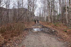
In a few more metres we are again following the old forest road, which we now realize we can follow directly back to the parking lot (on the way in, we stayed directly on trail SF2 more religiously). In a short twenty more minutes, the parking lot comes into sight, and with it, our car. Of note is the fact that we are still the only car in the parking lot. Most unusual, given how good the conditions are on this beautiful weekend day. But, I won't complain! Today's solitude has been great.
In summary, the sentiers frontaliers has turned out to have been an excellent discovery. We didn't even realize this trail network existed until this year, and the quality of the mountains and the trails here make it a well-worth it objective for anyone seeking some mountain hiking in eastern Canada. And when the northeastern US is denied, this makes for a very nice alternative. Many thanks to Caroline for discovering them (well, hearing about them from a friend) and spreading the word.
Interactive trackmap with photo points - Marbre and Saddle Loop - click map to view
Marbre and Saddle - Hike Data
Start Time:
7:48a.m.
End Time:
2:16p.m.
Duration:
6h27m
Distance:
14.1 km
(8.76 mi)
Average Speed:
2.2 km/hr
(1.4 mph)
Start Elevation:
1633ft
(498m)
*
Max Elevation:
3237ft
(987m)
*
Min Elevation:
1623ft
(495m)
*
End Elevation:
1625ft
(495m)
*
* : +/- 75 feet
Total Elevation Gain:
1967ft
(600m)
*
Total Elevation Loss:
1966ft
(599m)
*
* : +/- 75 feet
Elevation Graph
PS - this trip report is dedicated to my dad (now passed away), who was born on this day one hundred and one years ago.